Klesiv
| Klesiv Клесів | |||
|---|---|---|---|
| Urban-type settlement | |||
| |||
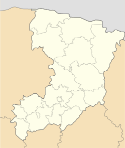 Klesiv Location of Klesiv in Ukraine  Klesiv Klesiv (Ukraine) | |||
| Coordinates: 51°19′03″N 26°53′41″E / 51.31750°N 26.89472°ECoordinates: 51°19′03″N 26°53′41″E / 51.31750°N 26.89472°E | |||
| Country |
| ||
| Oblast |
| ||
| Raion |
| ||
| Founded | 1902 | ||
| Town status | 1940 | ||
| Government | |||
| • Town Head | Viktor Buinyi | ||
| Area | |||
| • Total | 6.84 km2 (2.64 sq mi) | ||
| Elevation[1] | 157 m (515 ft) | ||
| Population (2001) | |||
| • Total | 4,624 | ||
| • Density | 680/km2 (1,800/sq mi) | ||
| Time zone | UTC+2 (EET) | ||
| • Summer (DST) | UTC+3 (EEST) | ||
| Postal code | 34550 | ||
| Area code | +380 3655 | ||
| Website | http://rada.gov.ua/ | ||


Klesiv (Ukrainian: Клесів; Polish: Klesów) is an urban-type settlement in Sarny Raion (district) of Rivne Oblast (province) in western Ukraine. Its population was 4,624 as of the 2001 Ukrainian Census.[2] Current population: 4,669 (2017 est.)[3]
Klesiv was first founded in the beginning of the 20th century as Klesów, then a part of the modern-day nation state of Poland. After the Soviet annexation of Western Ukraine, Klesiv acquired the status of an urban-type settlement in 1940.
Amber
There are placer deposits of amber near Klesiv.[4]
See also
- Stepan, the other urban-type settlement in Sarny Raion of Rivne Oblast
References
- ↑ "Klesiv (Rivne Oblast, Sarny Raion)". weather.in.ua. Retrieved 5 February 2012.
- ↑ "Klesiv, Rivne Oblast, Sarny Raion". Regions of Ukraine and their Structure (in Ukrainian). Verkhovna Rada of Ukraine. Retrieved 5 February 2012.
- ↑ "Чисельність наявного населення України (Actual population of Ukraine)" (in Ukrainian). State Statistics Service of Ukraine. Retrieved 26 August 2017.
- ↑ James Marson (June 3, 2016). "Lure of Amber Pits Ukraine's Illegal Miners Against State". The Wall Street Journal. Retrieved June 4, 2016.
| Raions | |||||
|---|---|---|---|---|---|
| Cities |
| ||||
| |||||
This article is issued from
Wikipedia.
The text is licensed under Creative Commons - Attribution - Sharealike.
Additional terms may apply for the media files.