Kleitor
| Kleitor Κλείτωρ | |
|---|---|
 Kleitor Location within the regional unit 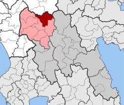 | |
| Coordinates: 37°45′N 22°05′E / 37.750°N 22.083°ECoordinates: 37°45′N 22°05′E / 37.750°N 22.083°E | |
| Country | Greece |
| Administrative region | Peloponnese |
| Regional unit | Arcadia |
| Municipality | Gortynia |
| • Municipal unit | 150.6 km2 (58.1 sq mi) |
| Population (2011)[1] | |
| • Municipal unit | 1,406 |
| • Municipal unit density | 9.3/km2 (24/sq mi) |
| Time zone | UTC+2 (EET) |
| • Summer (DST) | UTC+3 (EEST) |
| Vehicle registration | TP |
Kleitor (Greek: Κλείτωρ) is a former municipality in Arcadia, Peloponnese, Greece. Since the 2011 local government reform it is part of the municipality Gortynia, of which it is a municipal unit.[2] The municipal unit has an area of 150.582 km2.[3] Its population was 1,406 in 2011. The seat of the municipality was in Mygdalia.
History
Subdivisions
The municipal unit Kleitor is subdivided into the following communities (constituent villages in brackets):
- Agridi
- Drakovouni
- Kerpini (Kerpini, Ano Kalyvia, Kato Kalyvia)
- Mygdalia (Mygdalia, Palaiopyrgos)
- Pournaria (Pournaria, Mouria)
- Prasino (Prasino, Kalyvia Karnesi)
- Theoktisto
- Valtesiniko (Valtesiniko, Kourouveli, Olomades)
- Xirokarotaina
Population
| Year | Population |
|---|---|
| 1991 | 2,761 |
| 2001 | 2,584 |
| 2011 | 1,406 |
External links
References
- ↑ "Απογραφή Πληθυσμού - Κατοικιών 2011. ΜΟΝΙΜΟΣ Πληθυσμός" (in Greek). Hellenic Statistical Authority.
- ↑ Kallikratis law Greece Ministry of Interior (in Greek)
- ↑ "Population & housing census 2001 (incl. area and average elevation)" (PDF) (in Greek). National Statistical Service of Greece. Archived from the original (PDF) on 2015-09-21.
This article is issued from
Wikipedia.
The text is licensed under Creative Commons - Attribution - Sharealike.
Additional terms may apply for the media files.