Kisjakabfalva
| Kisjakabfalva | |
|---|---|
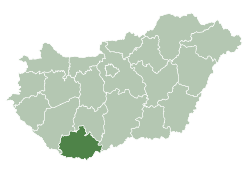
 Location of Baranya county in Hungary | |
 Kisjakabfalva Location of Kisjakabfalva | |
| Coordinates: 45°53′46″N 18°26′11″E / 45.89603°N 18.43625°ECoordinates: 45°53′46″N 18°26′11″E / 45.89603°N 18.43625°E | |
| Country |
|
| County | Baranya |
| Area | |
| • Total | 6.62 km2 (2.56 sq mi) |
| Population (2004) | |
| • Total | 157 |
| • Density | 23.71/km2 (61.4/sq mi) |
| Time zone | UTC+1 (CET) |
| • Summer (DST) | UTC+2 (CEST) |
| Postal code | 7773 |
| Area code(s) | 72 |
Kisjakabfalva (Croatian: Jakubovo;[1] German: Jackfall) is a village in Baranya county, Hungary.
References
- ↑ Živko Mandić (2005). "Hrvatska imena naseljenih mjesta u Madžarskoj (Croatian Names of Inhabited Places in Hungary)" (pdf). Folia Onomastica Croatica 14. (Note: English abstract on page 128.). p. 60. Retrieved 2017-04-01. (in Serbo-Croatian)
External links
- Street map (in Hungarian)

This article is issued from
Wikipedia.
The text is licensed under Creative Commons - Attribution - Sharealike.
Additional terms may apply for the media files.