Kings Highway (Australia)
| Kings Highway Australian Capital Territory–New South Wales | |
|---|---|
 | |
| General information | |
| Type | Highway |
| Length | 141 km (88 mi) |
| Opened | 1974 |
| Route number(s) |
|
| Former route number |
|
| Major junctions | |
| West end |
Fyshwick, Australian Capital Territory |
| for full list see major intersections | |
| East end |
Batemans Bay, New South Wales |
| Location(s) | |
| Major settlements | Bungendore, Braidwood, Nelligen |
| Highway system | |
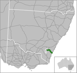
The Kings Highway is a State highway located within the Australian Capital Territory and New South Wales, Australia. The highway connects Canberra with Batemans Bay on the South Coast.
Route
West to east, it starts at the junction with the Monaro Highway on Canberra Avenue in the Australian Capital Territory, crosses over the border into New South Wales near Queanbeyan, passes through Queanbeyan itself, Carwoola, briefly crosses back into the Kowen district of ACT and then back into NSW heading south-east to Batemans Bay via Bungendore, Braidwood and Nelligen.
It is signed as route B52. NSW Roads and Maritime Services (RMS) has come to an informal agreement with councils along the route to signpost the entire route as Kings Highway, despite it having no single declared name along its route. The National Route 52 was established in 1974.[1]
The Kings Highway links Highway 1 (known as the Princes Highway) to Canberra, and provides access for residents of Canberra to the NSW South Coast and its beaches. The highway is often busy on weekends, especially during summer. The highway also experiences a high number of car crashes, on occasions averaging around one every three days, costing the local community around the highway several million dollars a year.[2]
The landscape is generally sheep country. The highway travels from the Southern Tablelands to the South Coast via Clyde Mountain.
Notable features and landmarks
A small rock cave at "Pooh Bear's Corner" can be found near the top of the Clyde Mountain Pass. This was the location of a munitions store during the Second World War, that could be detonated to stop passage from the coast to the national capital inland.[3] Dozens of soft toys are placed in the eucalyptus trees along the stretch of road that connects Queanbeyan and Bungendore.[4] These soft toys were placed there to mark the way to the ACT Nudist Club grounds, following repeated vandalism and thefts of signage.
In August 2017, Pooh Bear's Corner was set on fire causing substantial damage.
History
The road through the Clyde Mountain area was surveyed by Thomas Mitchell in 1855.[5]
A punt service across the Clyde River began at Nelligen in 1895 linking Batemans Bay to Braidwood. The service continued until 1964 when the Nelligen bridge was completed .[6]
In 2006 construction commenced on Headquarters Joint Operations Command in the Kowen district of the ACT between Bungendore and Queanbeyan. The facility opened in December 2008, and sections of the highway between the HQJOC turnoff and Queanbeyan have progressively been upgraded to cater for the increased traffic.[7]
Road usage
In 2003, approximately 3,000 vehicles a day were using the highway at Nelligen. From Braidwood (at the Shoalhaven River Bridge) there were about 4,200 cars travelling on the road. Out of Bungendore near Burbong, 5,600 cars were counted each day.[8]
Casualty crash rates on the Kings Highway are 85% higher than the NSW average and road fatalities are 8% higher. A 2005 NRMA Motoring and Services road survey found:[2][9]
- The rate of people hospitalised after crashes on the Kings Highway is well over the national average. 877 crashes were recorded on Kings Highway over a 10-year period, an average of about one crash every four days. Over this time there have been 24 fatal crashes, 355 crashes resulting in injury and 488 crashes resulting in property damage. The rate was worse than this in 2004, when there were 103 crashes resulting in six fatalities and 53 injuries.
- Crashes on the Kings Highway have cost A$42.65 million over the past three years – that’s equivalent to nearly A$39,000 every day.
- Safety: particular concerns over Clyde Mountain, and only 5% of road deemed to provide "safe" overtaking opportunities. Two blackspots (one in Eurobodalla and one in Palerang) and 16 blacklengths (nine in Eurobodalla, six in Palerang and one in Queanbeyan City) were identified. The 40 kilometres (25 mi) section of road over the Great Dividing Range – which includes Clyde Mountain – recorded the highest number of crashes, with 22% of all incidents occurring in this area.
- The most common type of crash – 18% of all incidents – was when a vehicle leaves the road to the left on a right hand bend and crashes into a stationary object. Head-on collisions made up one in 10 of all crashes. Crashes occurred most frequently on Sundays (20%) and least frequently on Tuesdays (9%). Recent drought conditions and an explosion in the kangaroo population in the area, has seen a marked increase in the number of crashes between vehicles and these macropods - particularly at night. This is evidenced by the increasing levels of 'road kill' carcasses on the sides of the Highway.
Major intersections
| State/Territory | District/LGA | Location | km[10] | mi | Destinations | Notes |
|---|---|---|---|---|---|---|
| Australian Capital Territory | Canberra Central – Jerrabomberra boundary | Fyshwick – Narrabundah – Symonston tripoint | 0.0 | 0.0 |
| Western terminus: continues as Canberra Avenue; only northbound exit from and southbound entrance to Monaro Highway |
| Fyshwick – Symonston boundary | 1.5 | 0.93 | Traffic lights | |||
| Jerrabomberra | | 4.3 | 2.7 | Norse Road – Oaks Estate | Eastbound exit and westbound entrance | |
| New South Wales | Queanbeyan | Crestwood – Queanbeyan West boundary | 6.0 | 3.7 | Lanyon Drive – Cooma | Roundabout |
| Queanbeyan East | 8.9 | 5.5 | Roundabout | |||
| Palerang | Carwoola | 11.7 | 7.3 | Captains Flat Road – Captains Flat | Roundabout | |
| Bungendore | 32.4 | 20.1 | Tarago Road north – Tarago, Goulburn | T junction: Eastbound traffic turns east, westbound traffic turns south | ||
| Manar | 53.8 | 33.4 | Braidwood Road – Tarago, Goulburn | |||
| Braidwood | 79.6 | 49.5 | Nerriga Road – Nerriga, Nowra | |||
| Eurobodalla | North Batemans Bay | 139 | 86 | Eastern terminus at roundabout | ||
Gallery

 Warri Bridge, which crosses the Shoalhaven River near Braidwood.
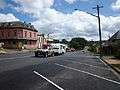 The Kings Highway at Braidwood.
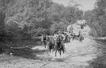 Horse teams carting goods from the ship at Nellingen to Braidwood, crossing Currajong Creek, about 1902.
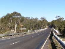
 Climbing Clyde Mountain from the coast to Braidwood.
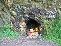 Pooh's Corner.
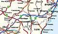 Kings Highway (formerly called Kings Way), National Route 52, links Canberrans to the coast.
See also
Route map:
| Wikimedia Commons has media related to Kings Highway, Australia. |
References
- ↑ "National Route 52". NSW National Routes. Ozroads.com.au. Retrieved 2008-01-14.
- 1 2 "Research highlights costly Kings Highway crashes". ABC News. Australia. 20 October 2005. Retrieved 19 May 2013.
- ↑ Dunn, Peter. "DEMOLITION OF OUR HARBOURS, AIRFIELDS, ROADS AND OTHER IMPORTANT INSTALLATIONS". www.ozatwar.com. Retrieved 20 May 2013.
- ↑ Harden, Fred (25 March 2004). "Bear Spotting". Retrieved 19 May 2013.
- ↑ Cumpston, J.H.L. (2007) [1954]. Thomas Mitchell: Surveyor General and Explorer. Project Gutenberg of Australia eBook. eBook No.: 0700531h.html.
The final evidence--lamentably too final--of his tendency to do everything himself was his personal presence, in his sixty-fourth year, at the survey of a road through that rugged Clyde Mountain region: work which might well have been entrusted to his surveyors. ... Having contracted a chill when supervising the survey of a road from Braidwood to Nelligen, he developed broncho-pneumonia and died at his home, "Carthona" at Darling Point on 5 October 1855, in his sixty-fourth year.
- ↑ "Brief history of Nelligen, Batemans Bay and the Clyde River on the Eurobodalla South Coast, NSW Australia". Clyde River Houseboats. Archived from the original on 15 December 2007. Retrieved 2008-01-14.
- ↑ "Inquiry into the Provision of Facilities for Headquarters Joint Operations Command, NSW (Chapter 3)" (PDF). Joint Standing Committee on Public Works. Parliament of Australia. 2004. Archived from the original (pdf) on 11 April 2008. Retrieved 2008-01-14.
- ↑ "Traffic Volume Data for Southern Region 2003: Annual Average Daily Traffic for MAIN ROAD NO.51 - BATEMANS BAY-QUEANBEYAN" (PDF). Traffic Management Branch. New South Wales Road Traffic Authority. 2004. pp. 14–15. Archived from the original (PDF) on 11 April 2008. Retrieved 5 February 2008.
- ↑ "Report on Southern NSW and ACT Roads" (PDF). NRMA Motoring and Services. Archived from the original (PDF) on 11 April 2008.
- ↑ Google (31 January 2016). "Kings Highway (Australia)" (Map). Google Maps. Google. Retrieved 31 January 2016.
| Controlled-access roads: | ||
|---|---|---|
| Limited-access roads: |
| |
| Major interchanges: | ||
*Partially limited-access ^Partially controlled-access roadway under construction | ||