Sawang Wirawong District
| Sawang Wirawong สว่างวีระวงศ์ | |
|---|---|
| District | |
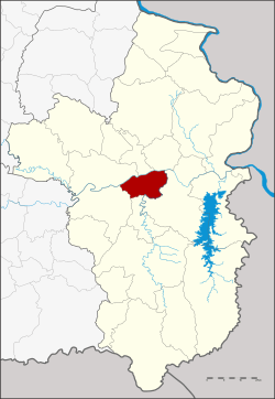 District location in Ubon Ratchathani Province | |
| Coordinates: 15°14′29″N 105°5′32″E / 15.24139°N 105.09222°ECoordinates: 15°14′29″N 105°5′32″E / 15.24139°N 105.09222°E | |
| Country | Thailand |
| Province | Ubon Ratchathani |
| Seat | Sawang |
| Area | |
| • Total | 163.0 km2 (62.9 sq mi) |
| Population (2005) | |
| • Total | 30,170 |
| • Density | 110.0/km2 (285/sq mi) |
| Time zone | UTC+7 (ICT) |
| Postal code | 34190 |
| Geocode | 3432 |
Sawang Wirawong (Thai: สว่างวีระวงศ์, pronounced [sā.wàːŋ wīː.rā.wōŋ]) is a district (amphoe) in the central part of Ubon Ratchathani Province, northeastern Thailand.
History
Sawang Wirawong was separated from Warin Chamrap District to create a minor district (king amphoe) on 1 April 1995.[1]
On 15 May 2007, all of the 81 minor districts were upgraded to full districts.[2] On 24 August the upgrade became official.[3]
Geography
Neighboring districts are (from the north clockwise) Don Mot Daeng, Tan Sum, Phibun Mangsahan, Na Yia, Warin Chamrap, and Mueang Ubon Ratchathani.
Administration
The district is divided into four sub-districts (tambons), which are further subdivided into 53 villages (mubans). There are no municipal (thesaban) areas, and four tambon administrative organizations (TAO).
| No. | Name | Thai name | Villages | Pop. | |
|---|---|---|---|---|---|
| 1. | Kaeng Dom | แก่งโดม | 11 | 5,300 | |
| 2. | Tha Chang | ท่าช้าง | 18 | 10,119 | |
| 3. | Bung Malaeng | บุ่งมะแลง | 12 | 6,978 | |
| 4. | Sawang | สว่าง | 12 | 7,773 |
References
- ↑ ประกาศกระทรวงมหาดไทย เรื่อง แบ่งเขตท้องที่อำเภอวารินชำราบ จังหวัดอุบลราชธานี ตั้งเป็นกิ่งอำเภอสว่างวีระวงศ์ (PDF). Royal Gazette (in Thai). 112 (Special 9 ง): 60. March 22, 1995.
- ↑ แถลงผลการประชุม ครม. ประจำวันที่ 15 พ.ค. 2550 (in Thai). Manager Online.
- ↑ พระราชกฤษฎีกาตั้งอำเภอฆ้องชัย...และอำเภอเหล่าเสือโก้ก พ.ศ. ๒๕๕๐ (PDF). Royal Gazette (in Thai). 124 (46 ก): 14–21. August 24, 2007.
External links