Kinabatangan River
| Kinabatangan River | |
|---|---|
 Kinabatangan River at the bridge near Batu Tulug. | |
 Kinabatangan River with source and tributaries (dark blue colour). | |
| Native name | Sungai Kinabatangan |
| Country | Sabah, Malaysia |
| Physical characteristics | |
| Main source | Mountains of southwest Sabah |
| River mouth | Sulu Sea |
| Length | 560 km (350 mi) |
The Kinabatangan River (Malay: Sungai Kinabatangan) is a river in Sabah, Malaysia. It is the second longest river in Malaysia,[1] with a length of 560 km (350 mi) from its headwaters in the mountains of southwest Sabah, to its outlet at the Sulu Sea, east of Sandakan.
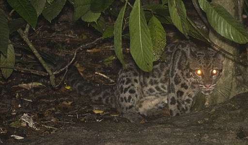
Kinabatangan is known for its remarkable wildlife and fascinating habitats such as limestone caves at Gomantong hill, dryland dipterocarp forests, riverine forest, freshwater swamp forest, oxbow lakes and salty mangrove swamps near the coast.
Ecology and status
The ecology of the upper reaches of the river has been severely disrupted by excessive logging and clearing of land for plantations. However, the original lowland forests and mangrove swamps near the coast have largely survived, provide sanctuary for a population of saltwater crocodiles (Crocodylus porosus), and contain some of Borneo's highest concentrations of wildlife. Of special note are Borneo's indigenous proboscis monkeys, Bornean orangutan and Asian elephants. The area is also known for its great variety of birdlife.
Each year, the lashing rains of the northeast monsoon cause the river to swell rapidly. Unable to disgorge into the sea quickly enough, the river frequently overflows its banks and spreads across the flat land of its lower reaches, creating a huge floodplain. The lower Kinabatangan teems with animal and plant life, making it the best area for viewing wildlife, not just in Sabah but all of Southeast Asia.
In 1997, 270 square kilometres (27,000 ha) of the lower Kinabatangan floodplain was declared a protected area, and in 2001 this designation was upgraded to that of "bird sanctuary", largely through the efforts of NGOs. Further efforts to have the area declared a "wildlife refuge" or even "national park" had been opposed by oil palm plantation owners seeking to expand their cultivated land.
Currently, most nature tourism is concentrated around Sukau, accessible by road and offering comfortable accommodation to visitors prepared to pay for well-managed tours. The most populated area and also the Central Administration for Kinabatangan is Kinabatangan Town, along the Sandakan-Lahad Datu highway and about 90 kilometres from Sandakan Town. The largest cave system in Sabah, Gomantong Caves, can be found in this region.
Wildlife
Since 1996 HUTAN, a French grassroots non-profit organisation founded and run by primotologist Dr. Isabelle Lackman and wildlife veterinarian Dr. Marc Ancrenaz, has been working to develop and implement solutions to conserve the orangutans in Sabah. In 1998, HUTAN together with the Sabah Wildlife Department established the Kinabatangan Orang-utan Conservation Project. A small conservation centre was built in the village of Sukau in the Kinabatangan wetlands.[2] Initially it conducted studies and an in-depth stakeholders' consultation process to identify the complex threats faced by the orangutans. Its findings were used by the Sabah Wildlife Department to develop and implement a sound and efficient orangutan conservation strategy, first for the Lower Kinabatangan region and later for Sabah.[3] It now has 40 staff from the Kinabatangan local community, working in collaboration with a network of Sabahan partners including government agencies, Non-Governmental-Organisations and research institutions as well as private stakeholders.
By August 2006, following media attention after a decapitated elephant's head was found floating down the river, the area was gazetted under the State's Wildlife Conservation Enactment of 1997 as the Kinabatangan Wildlife Sanctuary. It is now under the purview of the Sabah Wildlife Department.
History
For centuries, the rare treasures of Borneo's forests acted like a magnet for traders in search of edible bird's nests, rhinoceros horn, elephant ivory and hornbill casques for the emperor and the wealthy mandarins of China.
They also sought a hardwood resin, damar; flexible rattan vines; beeswax to make candles; fragrant woods and oil-rich illipe nuts.
Locals say the name Kinabatangan and sukau originated from some Chinese language of early Chinese explorers. Sukau is supposed to mean "rattan" in some Chinese language.
Access
One can fly from Kota Kinabalu to Sandakan on Malaysia Airlines, whilst those from Kuala Lumpur can take direct daily flights to Sandakan on AirAsia.
Alternatively, one can take an air-conditioned coach to Sandakan or Lahad Datu from Kota Kinabalu. One can also take a ferry to Sukau from the Sandakan harbour.
Bridgings
Currently the only bridge crossing the Kinabatangan River is located at Federal Route ![]()
A 350 m (1,150 ft) bridge linking Sukau with Litang and Tommanggong was planned, but cancelled in April 2017 after opposition from conservationists including David Attenborough due to potential adverse effect on the local pygmy elephant population.[4]
When to visit
The Kinabatangan region can be visited all year round, though it is often flooded during the wettest part of the year in December and January.
The main flowering and fruiting season, from April to October is generally fairly dry and a good time to spot many birds and animals.
During the northeast monsoon, from November to March, there are often heavy showers during the afternoons, particularly during December and January. During the rainy season, however, it is possible to negotiate many of the river channels leading into the oxbow lakes, where there is a greater concentration of wildlife.
Accommodation
In Sukau, many of the major tour operators maintain lodges. All lodges offer packages, which usually include transport, accommodation, food, river cruises, and guiding services. However, most of the money spent in these Lodges leaves the area. Visitors should also check locally run bed & breakfast and homestay accommodation. More information can be obtained on the Sabah Tourism Website.
Further up river at the villages of Bilit or Batu Putih you could opt to stay with the local Orang Sungai people in the Miso Walai homestay program part or a Sabah National Project . Nearby the villages there are beautiful series of oxbow lakes. They provide accommodation, food, jungle guides, boat trips, fishing and other activities. They also have recently built an eco-lodge in the jungle nearby one of the oxbow lakes – Tungog lake. The ecotourism program has been successful and helped clear the oxbow lake of weed, funded reforestation projects with partnership with LEAP and is providing a sustainable income for the communities.
See also
References
- ↑ The longest is the 563 km Rajang River.
- ↑ http://www.hutan.org.my/About_Us.html
- ↑ http://www.redapeencounters.com/kocp.htm
- ↑ "David Attenborough's 'Guardian headline' halts Borneo bridge". The Guardian. Retrieved 21 April 2017.
External links
| Bays | |
|---|---|
| Capes | |
| Rivers |
|
| Mountains & mountain ranges | |
| Peninsula |
|
| Waterfalls | |
| Valleys | |
| Caves | |
| Volcanic fields | |
| Islands |
|