Killara
| Killara Sydney, New South Wales | |||||||||||||||
|---|---|---|---|---|---|---|---|---|---|---|---|---|---|---|---|
_01.jpg) Residential home, Springdale Road, Killara | |||||||||||||||
| Population | 10,574 (2016 census)[1] | ||||||||||||||
| • Density | 2,171.3/km2 (5,624/sq mi) | ||||||||||||||
| Established | 1821 | ||||||||||||||
| Postcode(s) | 2071 | ||||||||||||||
| Area | 4.87 km2 (1.9 sq mi) | ||||||||||||||
| Location | 14 km (9 mi) north-west of Sydney CBD | ||||||||||||||
| LGA(s) | Ku-ring-gai Council | ||||||||||||||
| State electorate(s) | Davidson, Ku-ring-gai | ||||||||||||||
| Federal Division(s) | Bradfield | ||||||||||||||
| |||||||||||||||
Killara is a suburb on the Upper North Shore of Sydney in the state of New South Wales, Australia 14 kilometres (8.7 mi) north-west of the Sydney Central Business District in the local government area of Ku-ring-gai Council. East Killara is a separate suburb and West Killara is a locality within Killara.
History
Killara is an Aboriginal word meaning permanent or always there.[2] The name of the suburb was chosen when the railway line opened in 1899. James George Edwards was a representative of the people who requested a station be built here. The suburb was established as a 'Gentlemen's suburb', designed so that there would be no commercial ventures in the area. For this reason, the suburb has very few shops in the original development.[2]
Killara Post Office opened on 7 November 1904.[3]
Killara later became the home of the famous architect Harry Seidler, whose home—designed by him and his wife Penelope in the 1960s—can still be seen in Kalang Avenue. It is sometimes known as Killara House and sometimes as Harry and Penelope Seidler House. The couple moved into the house on Harry Seidler's birthday in 1967. The garden contains a sculpture by the Los Angeles sculptor Eric Orr. The house is heritage-listed.[4]
Heritage listings
Killara has a number of heritage-listed sites, including:
- 13 Kalang Avenue: Harry and Penelope Seidler House[5]
- 1 Werona Avenue: Woodlands, Killara[6]
Infrastructure and development
Killara railway station is on the North Shore, Northern & Western Line of the Sydney Trains network. The Pacific Highway is the main road through Killara. Churches in the suburb comprise St Martin's Anglican Church and Killara Uniting Church (formerly Killara Congregational Church) on Karranga Avenue.
The Swain Gardens were donated to Ku-ring-gai Council by Mr Swain, a Sydney bookseller, in the 1920s, and are today maintained by the council and volunteers. The gardens have been listed by the National Trust of Australia.
Schools
Killara is served by two top ranking public primary schools, Killara Public School and Beaumont Road Public School.[7] The suburb is also home to Killara High School, one of the highest performing non-selective government secondary school in the state of New South Wales.[8][9] A short-lived private school in Killara, Abbotsholme College, counted two future prime ministers among its pupils.[10][11]
_01.jpg)
_03.jpg)
Commercial
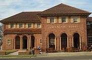
Commercial developments are located along the length of the Pacific Highway, including the Greengate Hotel. Residents often travel to nearby suburbs of Gordon, Macquarie Park and Chatswood for regular shopping.
Residential
The majority of residential properties are built in the Federation and Californian Bungalow styles, although the suburb includes many other styles.
The Harry and Penelope Seidler House at 13 Kalang Avenue was designed by Harry and Penelope Seidler. The 1960s-era modern-design home, constructed with reinforced masonry walls, concrete floors and roof, rubble-stone retaining walls and fireplace, won the Wilkinson Award in 1967.
At the 2016 census, 57.5% of occupied private dwellingd were separate houses and 40.5% were flat or apartments. The average household size was 2.9 people.[1]
.jpg)
.jpg)
_02.jpg)
_02.jpg)
.jpg)
.jpg)
.jpg)
_02.jpg)
.jpg)
Old_English_style_house_Killara-1.jpg)
Seidler_house_Kalang_Avenue-3.jpg)
Politics
For federal elections, Killara lies in the electorate of Bradfield, currently represented by Paul Fletcher. For state elections, Killara falls under the state electoral districts of Davidson and Ku-ring-gai. Kuring-gai is represented by Alister Henskens. The member for Davidson is Jonathan O'Dea. In terms of local government, Killara is part of the Ku-ring-gai municipal council.
Population and demographics
.jpg)
In the 2016 Australian census, the total population of Killara was 10,574 people; 47.5 percent were male and 52.5 percent were female. 53.7% of people were born in Australia. The most common countries of birth were China 11.5%, England 4.7%, Hong Kong 3.9%, South Korea 2.7% and New Zealand 1.8%. 61.1% of people only spoke English at home. Other languages spoken at home included Mandarin 13.9%, Cantonese 7.6%, Korean 3.2% and Japanese 1.0%. The most common responses for religion were No Religion 35.5%, Catholic 17.7% and Anglican 15.8%, Of persons aged 15 years and over, 59.1% were married, 28.2% never married, 5.8% widowed 5.2% divorced, and 1.6% separated.[1]
Killara is an affluent suburb. The median weekly personal income was A$951, compared with A$662 in Australia. The median weekly household income was A$2,534, compared with A$1,438 in Australia. The median weekly family income was A$2,918, compared with A$1,734 in Australia.[1]
Notable residents
- John Alexander OAM MP- Tennis champion and current Federal Member for Bennelong
- Carlyle Greenwell – Architect, philanthropist and designer of Killara Uniting Church and many, now heritage listed, houses.[12][13][14][15]
- Peter Jackson – boxer, British Commonwealth and Heavyweight champion.
- David Koch, an Australian financial analyst, television presenter and host of Sunrise on the Seven Network.
- Elle Macpherson, – grew up in Killara and also attended the local high school, Killara High School.
- Charles Scrivener – surveyor
- Penelope Seidler – architect
- Ethel Turner – author of Seven Little Australians lived on a large property now known as Kiamala Crescent.
- Jim Waley – a former presenter and newsreader for National Nine News.
- Robert Alan Crook - Electrical Engineer, owner of Alan Crook Electrical manufacturers, partner in Acelec and founder of Australian Rostrum
References
- 1 2 3 4 Australian Bureau of Statistics (27 June 2017). "Killara (State Suburb)". 2016 Census QuickStats. Retrieved 4 September 2017.

- 1 2 The Book of Sydney Suburbs, Compiled by Frances Pollon, Angus & Robertson Publishers, 1990, Published in Australia ISBN 0-207-14495-8, page 136
- ↑ Premier Postal History. "Post Office List". Premier Postal Auctions. Retrieved 16 June 2012.
- ↑ State Heritage Register
- ↑ "Harry and Penelope Seidler House, New South Wales State Heritage Register (NSW SHR) Number H01793". New South Wales State Heritage Register. Office of Environment and Heritage. Retrieved 18 May 2018.
- ↑ "Woodlands, New South Wales State Heritage Register (NSW SHR) Number H01762". New South Wales State Heritage Register. Office of Environment and Heritage. Retrieved 18 May 2018.
- ↑ "You live and learn".
- ↑ "Outstanding HSC Results for Killara High School Students".
- ↑ "Literacy push sends results through roof". The Sydney Morning Herald. 2010-12-16.
- ↑ Tom Frame (2005). The Life and Death of Harold Holt. Allen & Unwin. p. 4.
- ↑ Don Whitington (1972). Twelfth Man?. The Jacaranda Press. p. 144.
- ↑ http://www.heritage.nsw.gov.au/07_subnav_01_2.cfm?itemid=1880514
- ↑ http://www.heritage.nsw.gov.au/07_subnav_01_2.cfm?itemid=1880629
- ↑ http://www.heritage.nsw.gov.au/07_subnav_01_2.cfm?itemid=1880568
- ↑ http://www.heritage.nsw.gov.au/docs/heritagecouncil/shrminutes2006june.pdf
External links
| Wikimedia Commons has media related to Killara, New South Wales. |
- Zeny Edwards and Joan Rowland (2008). "Killara". Dictionary of Sydney. Retrieved 27 September 2015. [CC-By-SA]
- Ailsa McPherson (2012). "Marian Street Theatre, Community Theatre and Northside Theatre". Dictionary of Sydney. Dictionary of Sydney Trust. Retrieved 10 October 2015.
Coordinates: 33°46′07″S 151°09′48″E / 33.76864°S 151.16347°E