Roseville Chase, New South Wales
| Roseville Chase Sydney, New South Wales | |||||||||||||||
|---|---|---|---|---|---|---|---|---|---|---|---|---|---|---|---|
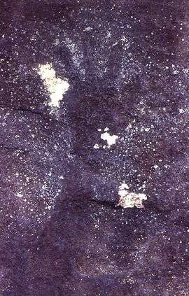 Aboriginal hand stencil near Chase Avenue | |||||||||||||||
| Population | 1,616 (2016 census)[1] | ||||||||||||||
| Postcode(s) | 2069 | ||||||||||||||
| Location | 11 km (7 mi) north-west of Sydney CBD | ||||||||||||||
| LGA(s) | Ku-ring-gai Council | ||||||||||||||
| State electorate(s) | Willoughby | ||||||||||||||
| Federal Division(s) | Bradfield, Warringah | ||||||||||||||
| |||||||||||||||
Roseville Chase is a suburb on the Upper North Shore of Sydney in the state of New South Wales, Australia 11 kilometres north-west of the Sydney central business district, in the local government areas of Ku-ring-gai Council. Roseville is a separate suburb to the west.[2]
Location
Located on Middle Harbour at its uppermost reaches, Roseville Chase is a secluded and bushy suburb. There are two main geographical and socio-economic subdivisions in Roseville Chase. The Chase Lowlands are centred on lower confines south of the mighty Roseville Bridge, while the Chase Heights are centred around the elegant Ormonde Rd, offering commanding views down to the harbour and beyond. These subdivisions are more well known as Upper Chase and Lower Chase. North of Warringah Road (Upper Chase), the residential development is lighter and is largely surrounded by bushland. The area is defined by the gully of Moores Creek to the west and north, plus Middle Harbour to the east. This part of Roseville Chase is home to the eminent Roseville Chase Oval, or as more commonly know by local residents "The RCO". Much of the surrounding bushland is contained within Garigal National Park.[3]
History
Captain Arthur Phillip's search for "good land, well watered" led to the discovery and colonisation of the rough shores of Roseville Chase, where Samuel Bates built a farm at Echo Point on the edge of what is now Middle Harbour.
The area was also inhabited by Aboriginal people, who left their mark in the form of hand stencils that can be seen in rock shelters in the area.
Later, the area was settled by Europeans like David Mathew and Richard Archbold, whose property eventually extended to Moores Creek and became the site of an orchard.[4]
During World War I the area was used as a training area for army engineers under the command of John (later Sir John) Madsen.
Many people lived in the Sydney bush during the Great Depression.[5] Remains of dwellings can be found in the bush at Roseville Chase, north of Chase Avenue.

Roseville Chase Post Office opened on 2 March 1953 and closed in 1994.[6]
Population
In the 2016 Census, there were 1,616 people in Roseville Chase, of whom 68.0% were Australia and 76.0% of whom spoke only English at home. The most common responses for religion were "No Religion" 31.6%, "Catholic" 24.8% and "Anglican" 21.2%.[1]
References
- 1 2 Australian Bureau of Statistics (27 June 2017). "Roseville Chase (State Suburb)". 2016 Census QuickStats. Retrieved 24 October 2017.

- ↑ Gregorys Sydney Street Directory, Gregorys Publishing Company, 2007
- ↑ Gregory's Sydney Street Directory, Gregory's Publishing Company, 2007
- ↑ Book of Sydney Suburbs, Frances Pollon, Angus and Robertson, 1990
- ↑ Sydney and Blue Mountains Bushwalks, Neil Paton, Kangaroo Press, 2004
- ↑ Premier Postal History. "Post Office List". Premier Postal Auctions. Retrieved 16 June 2012.
Coordinates: 33°46′54″S 151°11′46″E / 33.7818°S 151.1961°E
| Wikimedia Commons has media related to Roseville Chase, New South Wales. |