Kigamboni
| Kigamboni | |
|---|---|
| District | |
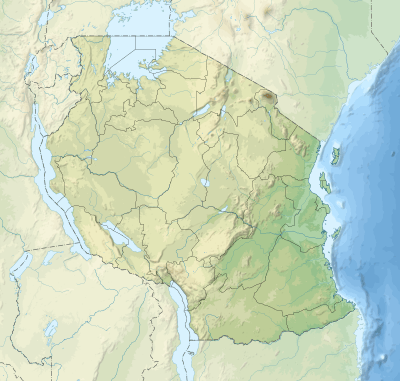 Kigamboni District Location of Kigamboni. 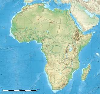 Kigamboni District Kigamboni District (Africa) | |
| Coordinates: 6°49′S 39°19′E / 6.817°S 39.317°ECoordinates: 6°49′S 39°19′E / 6.817°S 39.317°E | |
| Country | Tanzania |
| Zone | Coastal Indian Ocean |
| Time zone | UTC+3 (EAT) |
| Area code(s) | 022 |
| Website | City Website |
Kigamboni is a District south east of Dar es Salaam, Tanzania.
The Kigamboni District is divided into two administrative wards, Mbagala and Kigamboni.[1]
Kigamboni was an administrative ward in the Temeke District of Dar es Salaam. As of 2002, the ward had a total population of 36,701.[2]
Future development
Due to the expansion of economic activities, Dar es Salaam is expanding faster. In the coming few years, it is expected to expand even more and economic activities will increase. Especially, Kigamboni, the site area has a strong presence with large tracts of good, unexploited land.
According to various studies on the presence of unpolluted beaches, the redevelopment of Kigamboni will spearhead economic development and increase the national income. The big picture of the Kigamboni new city master plan is to provide sufficient infrastructure in order that the residents have a better quality of life and to build a core for developing new land demands of Dar es salaam, such as residential, commercial, trade and business, industrial, educational, and tourism facilities.
This report for the Kigamboni new city master plan is divided into eight sections.
The first section is the introduction, which provides the overall project description, including work scope and procedures. Section 2 provides physical, social and economic analysis of the site area and various case studies offering good examples of a new city master plan. The detailed plans in each field such as the Master plan, Infrastructure plan, Information, Communication, Telecommunication, Tourist resort development plan, and Architectural guidelines are introduced from Sections 3 to 7 in order. The last section is the implementation program, and it describes the development phase. A powerpoint presentation and PDF's of the plans can be found at this link.[3]
Economy
The Kigamboni shopping center is conveniantly located near the Kigamboni Ferry Terminal allowing travellers to browse and purchase items whilst they are preparing to alight or after disembarking from the ferry.
Infrastructure
Bridge
The Kigamboni Bridge from the west of Kigamboni to the east of Kurasini area.
Transport
Maritime Transport
Ferry
A ferry crossing from the south east of Kivukoni and the Dar es Salaam central business district to the north west of Kigamboni.
Notable landmarks
- TIPER, former refinery presently used as an oil terminal
- Kigamboni Naval Base
Gallery
 The mosque tower(used for calling out prayer call(adhan) through the public announcement speakers) of Masjid Annur Ferry within the ward.
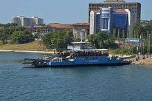 The MV Kigamboni
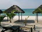 A beach in Kigamboni along the western shores of the Indian Ocean
References
- ↑ Hilda Mhagama (January 29, 2016). "Tanzania: Dar es Salaam Has Five Districts As Ubungo, Kigamboni Added to It". Tanzania Daily News.
- ↑ "2002 Population and Housing Census General Report". Government of Tanzania. Archived from the original on 2008-04-27. Retrieved 2008-08-21.
- ↑ "Kigamboni New City Plans". Government of Tanzania Ministry of Lands, Housing & Human Settlements Development. Archived from the original on 2012-02-25. Retrieved 2012-03-15.