Kiefersfelden
| Kiefersfelden | ||
|---|---|---|
 Church of the Holy Cross in Kiefersfelden with Kaiser Mountains in the background | ||
| ||
 Kiefersfelden Location of Kiefersfelden within Rosenheim district 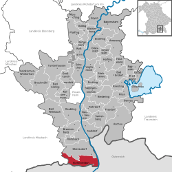 | ||
| Coordinates: 47°37′N 12°11′E / 47.617°N 12.183°ECoordinates: 47°37′N 12°11′E / 47.617°N 12.183°E | ||
| Country | Germany | |
| State | Bavaria | |
| Admin. region | Oberbayern | |
| District | Rosenheim | |
| Government | ||
| • Mayor | Hajo Gruber (UW) | |
| Area | ||
| • Total | 36.72 km2 (14.18 sq mi) | |
| Elevation | 490 m (1,610 ft) | |
| Population (2017-12-31)[1] | ||
| • Total | 6,825 | |
| • Density | 190/km2 (480/sq mi) | |
| Time zone | CET/CEST (UTC+1/+2) | |
| Postal codes | 83088 | |
| Dialling codes | 08033 | |
| Vehicle registration | RO | |
| Website | www.kiefersfelden.de | |

Kiefersfelden is a municipality with about 7000 inhabitants located in the district of Rosenheim in Bavaria in Germany on the border with Tyrol, Austria.
Geography
Geographical location
Kiefersfelden is located in the foothills of the Alps, in the Bavarian part of the Unterinntal, at an altitude of about 484 m (1,587.93 ft) ASL.
The local rivers are the Inn and the Kieferbach.
Nearby places
- Bayrischzell
- Ebbs in Tyrol
- Kufstein in Tyrol
- Oberaudorf
- Thiersee in Tyrol
References
- ↑ "Fortschreibung des Bevölkerungsstandes". Bayerisches Landesamt für Statistik und Datenverarbeitung (in German). September 2018.
This article is issued from
Wikipedia.
The text is licensed under Creative Commons - Attribution - Sharealike.
Additional terms may apply for the media files.