Khao Nom Sao
| Khao Nom Sao | |
|---|---|
 Khao Nom Sao Location in Thailand | |
| Highest point | |
| Elevation | 1,089 m (3,573 ft) |
| Listing |
List of mountains in Thailand Breast-shaped hills |
| Coordinates | 9°48′00″N 98°39′06″E / 9.80000°N 98.65167°ECoordinates: 9°48′00″N 98°39′06″E / 9.80000°N 98.65167°E |
| Geography | |
| Location | Ranong, Thailand |
| Parent range | Tenasserim Hills |
| Geology | |
| Mountain type | limestone/granite |
| Climbing | |
| Easiest route | drive |
Khao Nom Sao (เขานมสาว), "female breast mountain", is a land feature located in Ranong Province, Thailand.
Description
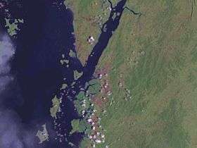
Khao Nom Sao is part of the mountain range on the center-right of the image.
Khao Nom Sao is the highest summit of a rugged mountain massif that stretches roughly from north to south in the Kra Isthmus. This mountain range represents an important catchment area for many rivers of the Ranong and Chumphon provinces, forming a natural border between both provinces.[1] Khao Daen and Khao Huai Siad, are other prominent peaks of the chain, which is part of the wider Tenasserim Hills.
This mountain is included in the Namtok Ngao National Park (อุทยานแห่งชาติน้ำตกหงาว) and there are hiking trails that allow to enjoy the surrounding scenery.
See also
References
External links
This article is issued from
Wikipedia.
The text is licensed under Creative Commons - Attribution - Sharealike.
Additional terms may apply for the media files.