Khanigau
| Khanigaun खानीगाउँ Mine Village | |
|---|---|
| Village development committee | |
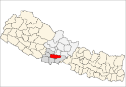
 Khanigaun Location in Nepal | |
| Coordinates: 27°55′N 83°33′E / 27.92°N 83.55°ECoordinates: 27°55′N 83°33′E / 27.92°N 83.55°E | |
| Country |
|
| Zone | Lumbini Zone |
| District | Palpa District |
| Population (1991) | |
| • Total | 2,221 |
| Time zone | UTC+5:45 (Nepal Time) |
Khanigaun is a village development committee in Palpa District in the Lumbini Zone of southern Nepal. At the time of the 1991 Nepal census it had a population of 2221.It is located on the bank of kaligandaki river on north.On the north-west side there is Ranimahal khown as Taj mahal of nepal..[1]
References
- ↑ "Nepal Census 2001". Nepal's Village Development Committees. Digital Himalaya. Archived from the original on 12 October 2008. Retrieved 12 December 2008.
This article is issued from
Wikipedia.
The text is licensed under Creative Commons - Attribution - Sharealike.
Additional terms may apply for the media files.