Bakamalang
| Bakamalang वाकामलाङ Wakamalan/Malang | |
|---|---|
| Village Development Committee | |
| Country |
|
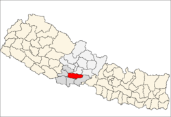
| Zone | Lumbini Zone |
| District | Palpa District |
| Population (1991) | |
| • Total | 2,861 |
| Time zone | UTC+5:45 (Nepal Time) |
Bakamalang is a village development committee (VDC) in Palpa District in the Lumbini Zone of southern Nepal. At the time of the 1991 Nepal census it had a population of 2861 people living in 472 individual households.[1]It is surrounded by Rakuwa in the North-East, Ruching in the South-East, Sahalkot in the South-West and Gadakot in the North-West. The North-East border of Bakamalang VDC resembles the Gandaki River.
References
- ↑ "Nepal Census 2001". Nepal's Village Development Committees. Digital Himalaya. Archived from the original on 12 October 2008. Retrieved 12 December 2008.
This article is issued from
Wikipedia.
The text is licensed under Creative Commons - Attribution - Sharealike.
Additional terms may apply for the media files.