Keene, North Dakota
| Keene, North Dakota | |
|---|---|
| Township | |
 Keene, North Dakota Location within the state of North Dakota | |
| Coordinates: 47°59′N 102°57′W / 47.983°N 102.950°WCoordinates: 47°59′N 102°57′W / 47.983°N 102.950°W | |
| Country | United States |
| State | North Dakota |
| County | McKenzie |
| Area | |
| • Total | 36.9 sq mi (95.5 km2) |
| • Land | 36.9 sq mi (95.5 km2) |
| • Water | 0.0 sq mi (0.0 km2) |
| Elevation | 2,444 ft (745 m) |
| Population (2000) | |
| • Total | 35 |
| • Density | 0.9/sq mi (0.4/km2) |
| Time zone | UTC-6 (Central (CST)) |
| • Summer (DST) | UTC-5 (CDT) |
| ZIP code | 58847 |
| Area code(s) | 701 |
| FIPS code | 38-41580[1] |
| GNIS feature ID | 1036969[2] |
Keene is an unincorporated community in McKenzie County, North Dakota in the United States. It has the ZIP code of 58847, which includes surrounding farmland. In this zip code area, the 2000 census found 258 people.[3] Keene is located at 47°58′N 102°56′W / 47.97°N 102.94°W.
Climate
This climatic region is typified by large seasonal temperature differences, with warm to hot (and often humid) summers and cold (sometimes severely cold) winters. According to the Köppen Climate Classification system, Keene has a humid continental climate, abbreviated "Dfb" on climate maps.[4]
References
- ↑ "American FactFinder". United States Census Bureau. Retrieved 2008-01-31.
- ↑ "US Board on Geographic Names". United States Geological Survey. 2007-10-25. Retrieved 2008-01-31.
- ↑ 2000 census results
- ↑ Climate Summary for Keene, North Dakota
Municipalities and communities of McKenzie County, North Dakota, United States | ||
|---|---|---|
| Cities | 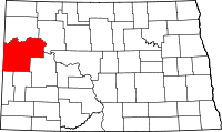 | |
| Townships |
| |
| CDPs | ||
| Unorganized territories |
| |
| Unincorporated communities |
| |
This article is issued from
Wikipedia.
The text is licensed under Creative Commons - Attribution - Sharealike.
Additional terms may apply for the media files.