Katrineholm Municipality
| Katrineholm Municipality Katrineholms kommun | ||
|---|---|---|
| Municipality | ||
| ||
 | ||
| Country | Sweden | |
| County | Södermanland County | |
| Seat | Katrineholm | |
| Area[1] | ||
| • Total | 1,189.54 km2 (459.28 sq mi) | |
| • Land | 1,020.19 km2 (393.90 sq mi) | |
| • Water | 169.35 km2 (65.39 sq mi) | |
| Area as of 1 January 2014. | ||
| Population (31 December 2017)[2] | ||
| • Total | 34,133 | |
| • Density | 29/km2 (74/sq mi) | |
| Time zone | UTC+1 (CET) | |
| • Summer (DST) | UTC+2 (CEST) | |
| ISO 3166 code | SE | |
| Province | Södermanland | |
| Municipal code | 0483 | |
| Website | www.katrineholm.se | |

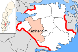
Katrineholm Municipality (Katrineholms kommun) is a municipality in Södermanland County in southeast Sweden. Its seat is located in the city of Katrineholm.
The present municipality was created in 1971, when the City of Katrineholm (instituted in 1917) was amalgamated with surrounding rural municipalities.
The thirty-first Swedish Prime Minister Göran Persson, while originally from the neighboring municipality of Vingåker, was once the municipal chairman (mayor) of Katrineholm.
Localities
Elections
Riksdag
These are the results of the Riksdag elections in Katrineholm Municipality since the 1972 municipal reform. The results of the Sweden Democrats were not published at a municipal level from between 1988 and 1998 by SCB because of the party's small size nationwide at the time.
| Year | Turnout | Votes | V | S | MP | C | L | KD | M | SD | ND |
|---|---|---|---|---|---|---|---|---|---|---|---|
| 1973[3] | 92.5 | 21,323 | 2.3 | 52.2 | 0.0 | 23.6 | 8.9 | 2.4 | 10.3 | 0.0 | 0.0 |
| 1976[4] | 93.0 | 22,037 | 2.0 | 51.1 | 0.0 | 24.2 | 9.2 | 1.8 | 11.4 | 0.0 | 0.0 |
| 1979[5] | 92.3 | 21,866 | 3.1 | 52.2 | 0.0 | 17.5 | 10.5 | 1.7 | 14.5 | 0.0 | 0.0 |
| 1982[6] | 92.8 | 22,002 | 3.4 | 54.7 | 1.7 | 15.2 | 5.6 | 2.3 | 16.9 | 0.0 | 0.0 |
| 1985[7] | 91.2 | 21,821 | 3.7 | 53.3 | 1.3 | 12.7 | 12.1 | 0.0 | 15.4 | 0.0 | 0.0 |
| 1988[8] | 87.8 | 20,798 | 4.2 | 52.8 | 5.0 | 11.4 | 11.3 | 2.3 | 12.7 | 0.0 | 0.0 |
| 1991[9] | 88.3 | 21,255 | 3.5 | 47.8 | 3.1 | 9.4 | 8.3 | 6.7 | 15.5 | 0.0 | 4.9 |
| 1994[10] | 88.1 | 21,455 | 4.7 | 54.2 | 5.9 | 7.6 | 6.4 | 3.3 | 16.5 | 0.0 | 0.5 |
| 1998[11] | 83.5 | 20,002 | 9.8 | 47.4 | 5.4 | 5.5 | 4.0 | 9.6 | 16.4 | 0.0 | 0.0 |
| 2002[12] | 81.2 | 19,543 | 5.5 | 52.6 | 5.0 | 5.9 | 9.8 | 7.7 | 10.9 | 1.2 | 0.0 |
| 2006[13] | 82.3 | 20,023 | 4.3 | 48.0 | 5.2 | 6.7 | 7.2 | 5.7 | 19.1 | 2.4 | 0.0 |
| 2010[14] | 84.7 | 20,708 | 4.6 | 38.4 | 7.6 | 6.3 | 6.8 | 4.3 | 25.0 | 6.3 | 0.0 |
| 2014[15] | 86.0 | 21,351 | 4.7 | 39.5 | 6.0 | 6.5 | 4.2 | 3.5 | 19.0 | 14.3 | 0.0 |
Blocs
This lists the relative strength of the socialist and centre-right blocs since 1973, but parties not elected to the Riksdag are inserted as "other", including the Sweden Democrats results from 1988 to 2006, but also the Christian Democrats pre-1991 and the Greens in 1982, 1985 and 1991. The sources are identical to the table above. The coalition or government mandate marked in bold formed the government after the election. New Democracy got elected in 1991 but are still listed as "other" due to the short lifespan of the party. "Elected" is the total number of percentage points from the municipality that went to parties who were elected to the Riksdag.
| Year | Turnout | Votes | Left | Right | SD | Other | Elected |
|---|---|---|---|---|---|---|---|
| 1973 | 92.5 | 21,323 | 54.5 | 42.8 | 0.0 | 2.7 | 97.3 |
| 1976 | 93.0 | 22,037 | 53.1 | 44.8 | 0.0 | 2.1 | 97.9 |
| 1979 | 92.3 | 21,866 | 55.3 | 42.5 | 0.0 | 2.2 | 97.8 |
| 1982 | 92.8 | 22,002 | 58.1 | 37.7 | 0.0 | 4.2 | 95.8 |
| 1985 | 91.2 | 21,821 | 57.0 | 40.2 | 0.0 | 2.8 | 97.2 |
| 1988 | 87.8 | 20,798 | 62.0 | 35.4 | 0.0 | 2.6 | 97.4 |
| 1991 | 88.3 | 21,255 | 51.3 | 39.9 | 0.0 | 8.8 | 96.1 |
| 1994 | 88.1 | 21,455 | 64.8 | 33.8 | 0.0 | 1.4 | 98.6 |
| 1998 | 83.5 | 20,002 | 62.6 | 35.5 | 0.0 | 1.9 | 98.1 |
| 2002 | 81.2 | 19,543 | 63.1 | 34.3 | 0.0 | 2.6 | 97.4 |
| 2006 | 82.3 | 20,023 | 57.5 | 38.7 | 0.0 | 3.8 | 96.2 |
| 2010 | 84.7 | 20,708 | 50.6 | 42.4 | 6.3 | 0.7 | 99.3 |
| 2014 | 86.0 | 21,351 | 50.2 | 33.2 | 14.3 | 2.3 | 97.7 |
References
- ↑ "Statistiska centralbyrån, Kommunarealer den 1 januari 2014" (Microsoft Excel) (in Swedish). Statistics Sweden. Retrieved 2014-04-18.
- ↑ "Folkmängd i riket, län och kommuner 31 december 2017" (in Swedish). Statistics Sweden. February 21, 2018. Retrieved February 21, 2018.
- ↑ "Riksdagsvalet 1973 (page 162)" (PDF) (in Swedish). SCB. Retrieved 13 August 2017.
- ↑ "Riksdagsvalet 1976 (page 157)" (PDF) (in Swedish). SCB. Retrieved 13 August 2017.
- ↑ "Riksdagsvalet 1979 (page 181)" (PDF) (in Swedish). SCB. Retrieved 13 August 2017.
- ↑ "Riksdagsvalet 1982 (page 182)" (PDF) (in Swedish). SCB. Retrieved 13 August 2017.
- ↑ "Riksdagsvalet 1985 (page 183)" (PDF) (in Swedish). SCB. Retrieved 13 August 2017.
- ↑ "Riksdagsvalet 1988 (page 164)" (PDF) (in Swedish). SCB. Retrieved 13 August 2017.
- ↑ "Riksdagsvalet 1991 (page 23)" (PDF) (in Swedish). SCB. Retrieved 13 August 2017.
- ↑ "Riksdagsvalet 1994 (page 37)" (PDF) (in Swedish). SCB. Retrieved 13 August 2017.
- ↑ "Riksdagsvalet 1998 (page 33)" (PDF) (in Swedish). SCB. Retrieved 13 August 2017.
- ↑ "Valresultat Riksdag Katrineholms kommun 2002" (in Swedish). Valmyndigheten. Retrieved 13 August 2017.
- ↑ "Valresultat Riksdag Katrineholms kommun 2006" (in Swedish). Valmyndigheten. Retrieved 13 August 2017.
- ↑ "Valresultat Riksdag Katrineholms kommun 2010" (in Swedish). Valmyndigheten. Retrieved 13 August 2017.
- ↑ "Valresultat Riksdag Katrineholms kommun 2014" (in Swedish). Valmyndigheten. Retrieved 13 August 2017.
External links
- Katrineholm Municipality - Official site