Kanzaki, Saga
| Kanzaki 神埼市 | |||
|---|---|---|---|
| City | |||
| |||
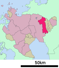 Location of Kanzaki in Saga Prefecture | |||
 Kanzaki Location in Japan | |||
| Coordinates: 33°19′N 130°22′E / 33.317°N 130.367°ECoordinates: 33°19′N 130°22′E / 33.317°N 130.367°E | |||
| Country | Japan | ||
| Region | Kyushu | ||
| Prefecture | Saga Prefecture | ||
| Government | |||
| • Mayor | Shigeyuki Matsumoto (from March 2005, including then Kanzaki Town) | ||
| Area | |||
| • Total | 125.01 km2 (48.27 sq mi) | ||
| Population (February 28, 2017) | |||
| • Total | 31,981 | ||
| • Density | 260/km2 (660/sq mi) | ||
| Symbols | |||
| • Tree | Maple | ||
| • Flower | Cherry Blossom | ||
| Time zone | UTC+9 (JST) | ||
| City hall address |
410 Kanzaki, Kanzaki-chō, Kanzaki-shi, Saga-ken 842-0001 | ||
| Website |
www | ||


Kanzaki (神埼市 Kanzaki-shi) is a city located in Saga Prefecture, Japan.


As of February 28, 2017, the city has an estimated population of 31,981 and a population density of 260 persons per km².[1] The total area is 125.01 km².
The modern city of Kanzaki was established on March 20, 2006, from the merger of the former town of Kanzaki, absorbing the town of Chiyoda, and the village of Sefuri (all from Kanzaki District). As a result of this merger there are no longer any villages in Saga Prefecture.
Geography

The northern part of the city is located in the middle of the Sefuri Mountains. As one goes south the elevation lowers. The southern part consists of the north bank of the Chikugo River and the Saga Plains, and the Jōbaru River runs through the middle portion of the city. The southeast border with Kurume in Fukuoka Prefecture is formed by the Chikugo River.
- Mountains: Mount Sefuri (1055 m), Mt. Doki (Mt. Hatten, 430 m)
- Rivers: Chikugo River, Jōbaru River, Tade River, Sanbonmatsu River
Adjoining municipalities
History
- April 1, 1889 — The modern municipal system is established. The current city region consists of eight villages (Chitose, Hasuike, Kanzaki, Niiyama, Saigō, Sakaino, Sefuri and Shirota).
- 1893 — The village of Kanzaki became a town.
- November 3, 1935 — The village of Hasuike became a town.
- March 31, 1955 — The villages of Saigō and Niiyama were merged into Kanzaki.
- April 1, 1955 — The villages of Chitose, Sakaino, Shirota, and parts of the town of Hasuike were merged to create the village of Chiyoda.
- April 1, 1965 — Chiyoda became a town.
- March 20, 2006 — The former town of Kanzaki absorbed the town of Chiyoda, and the village of Sefuri to create the city of Kanzaki.
Education
Universities
- Nishikyushu University (西九州大学)
Prefectural high schools
- Kanzaki High School (佐賀県立神埼高等学校)
- Kanzaki Seimei High School (佐賀県立神埼清明高等学校)
Municipal junior high schools
- Kanzaki Junior High School
- Chiyoda Junior High School
- Sefuri Junior High School
Municipal elementary schools
- Kanzaki Elementary School
- Saigō Elementary School
- Niiyama Elementary School
- Chiyoda Tōbu Elementary School
- Chiyoda Chūbu Elementary School
- Chiyoda Seibu Elementary School
- Sefuri Elementary School
Transportation
Air
The nearest airport is Saga Airport in Kawasoe, followed by Fukuoka Airport.
Rail
Road
- Expressways:
- Nagasaki Expressway: The closest interchange is the Higashi-Sefuri Interchange in Yoshinogari, Saga.
- National highways:
Notable places and festivals
- Kunen Hermitage
- Niiyama Shrine
- Kushida-gū
- Niiyama Park
- Hōshu-dera
- Yoshinogari Historical Park
- Naotori Castle ruins
- Home of Kojin Shimomura
- Jirōnomori Park
- Holiday Chiyoda (堀デーちよだ)
People from Kanzaki
References
External links
| Wikimedia Commons has media related to Kanzaki, Saga. |
- Kanzaki City official website (in Japanese)
| Special city | ||
|---|---|---|
| Cities | ||
| Districts | ||