Ōkawa, Fukuoka
| Ōkawa 大川市 | ||
|---|---|---|
| City | ||
| ||
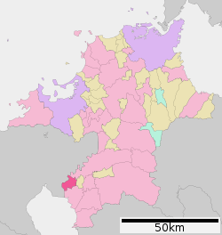 Location of Ōkawa in Fukuoka Prefecture | ||
 Ōkawa Location in Japan | ||
| Coordinates: 33°12′N 130°23′E / 33.200°N 130.383°ECoordinates: 33°12′N 130°23′E / 33.200°N 130.383°E | ||
| Country | Japan | |
| Region | Kyushu | |
| Prefecture | Fukuoka Prefecture | |
| Government | ||
| • Mayor | Koji Ueki (since July 2005) | |
| Area | ||
| • Total | 33.63 km2 (12.98 sq mi) | |
| Population (January 31, 2012) | ||
| • Total | 37,579 | |
| • Density | 1,117.42/km2 (2,894.1/sq mi) | |
| Symbols | ||
| • Tree | Princess tree | |
| • Flower | Canna lily | |
| Time zone | UTC+9 (JST) | |
| City hall address |
256-1 Ōaza Sakami, Ōkawa-shi, Fukuoka-ken 831-8601 | |
| Website |
www | |

Ōkawa (大川市 Ōkawa-shi) is a city located in Fukuoka Prefecture, Japan. The city was founded on April 1, 1954. The name means 'big river'.
As of January 31, 2012, the city has an estimated population of 37,579, with 13,102 households and a population density of 1,117.42 persons per km². The total area is 33.63 km².
Geography
Ōkawa is located in southern Fukuoka Prefecture next to the border with Saga Prefecture. The Chikugo River flows from northeast to southwest through the city, which is relatively flat. At the centre of Ōkawa, the Hanamune River flows into the Chikugo River as a tributary.
Neighboring municipalities
Sister cities
External links

- Ōkawa City official website (in Japanese)
| Wards of Fukuoka | ||
|---|---|---|
| Wards of Kitakyushu | ||
| Core city | ||
| Cities | ||
| Districts | ||
This article is issued from
Wikipedia.
The text is licensed under Creative Commons - Attribution - Sharealike.
Additional terms may apply for the media files.