Kalpaki
| Kalpaki Καλπάκι | |
|---|---|
 Kalpaki Location within the regional unit 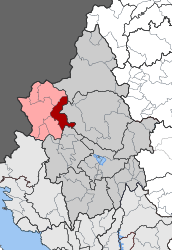 | |
| Coordinates: 39°53′N 20°37′E / 39.883°N 20.617°ECoordinates: 39°53′N 20°37′E / 39.883°N 20.617°E | |
| Country | Greece |
| Administrative region | Epirus |
| Regional unit | Ioannina |
| Municipality | Pogoni |
| • Municipal unit | 116.756 km2 (45.080 sq mi) |
| Population (2011)[1] | |
| • Municipal unit | 1,719 |
| • Municipal unit density | 15/km2 (38/sq mi) |
| Community[1] | |
| • Population | 625 (2011) |
| • Area (km2) | 13.189 |
| Time zone | UTC+2 (EET) |
| • Summer (DST) | UTC+3 (EEST) |
| Vehicle registration | ΙΝ |
Kalpaki (Greek: Καλπάκι) is a former municipality in the Ioannina regional unit, Epirus, Greece. Since the 2011 local government reform it is part of the municipality Pogoni, of which it is a municipal unit.[2] It is situated about 30 km (19 mi) northwest of Ioannina, and southwest of Konitsa. The municipal unit has an area of 116.756 km2, the community 13.189 km2.[3] Population 1,719 (2011).[1] The Greek National Road 20 connects Kalpaki with Ioannina and Konitsa. The GR-22 connects Kalpaki with Kakavia, the border crossing into southern Albania.
Subdivisions
The municipal unit Kalpaki is subdivided into the following communities (constituent villages in brackets):[1]
- Kalpaki (Kalpaki, Lioumpa)
- Ano Ravenia
- Chrysorrachi
- Doliana (Doliana, Agios Georgios Dolianon)
- Geroplatanos
- Kato Ravenia
- Mavrovouni
- Negrades
Population
| Year | Settlement population | Community population | Municipal unit population |
|---|---|---|---|
| 1981 | 586 | - | - |
| 1991 | 521 | - | 2,874 |
| 2001 | 558 | 754 | 2,324 |
| 2011 | 625 | 625 | 1,719 |
History
Kalpaki joined Greece after the Balkan Wars of 1913. The Battle of Elaia–Kalamas took place in the area in November 1940, during the Italian invasion of Greece.
See also
External links
References
- 1 2 3 4 "Απογραφή Πληθυσμού - Κατοικιών 2011. ΜΟΝΙΜΟΣ Πληθυσμός" (in Greek). Hellenic Statistical Authority.
- ↑ Kallikratis law Greece Ministry of Interior (in Greek)
- ↑ "Population & housing census 2001 (incl. area and average elevation)" (PDF) (in Greek). National Statistical Service of Greece. Archived from the original (PDF) on 2015-09-21.
Places adjacent to Kalpaki | |
|---|---|