Ano Pogoni
| Ano Pogoni Άνω Πωγώνι | |
|---|---|
 Ano Pogoni Location within the regional unit 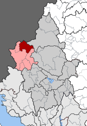 | |
| Coordinates: 40°1′N 20°34′E / 40.017°N 20.567°ECoordinates: 40°1′N 20°34′E / 40.017°N 20.567°E | |
| Country | Greece |
| Administrative region | Epirus |
| Regional unit | Ioannina |
| Municipality | Pogoni |
| • Municipal unit | 137.084 km2 (52.928 sq mi) |
| Elevation | 650 m (2,130 ft) |
| Population (2011)[1] | |
| • Municipal unit | 1,490 |
| • Municipal unit density | 11/km2 (28/sq mi) |
| Time zone | UTC+2 (EET) |
| • Summer (DST) | UTC+3 (EEST) |
| Postal code | 440 06 |
| Area code(s) | 26570 |
| Vehicle registration | ΙΝ |
Ano Pogoni (Greek: Άνω Πωγώνι) is a former municipality in the Ioannina regional unit, Epirus, Greece. Since the 2011 local government reform it is part of the municipality Pogoni, of which it is a municipal unit.[2] The municipal unit has an area of 137.084 km2.[3] Population 1,490 (2011). The seat of the municipality was in Kefalovryso.
Subdivisions
The municipal unit Ano Pogoni is subdivided into the following communities (constituent villages in brackets):
- Agios Kosmas
- Kakolakkos
- Kato Meropi
- Kefalovryso
- Meropi
- Oraiokastro
- Palaiopyrgos
- Roupsia
- Vasiliko
Population
| Year | Population |
|---|---|
| 1991 | 2,108 |
| 2001 | 1,663 |
| 2011 | 1,490 |
References
- ↑ "Απογραφή Πληθυσμού - Κατοικιών 2011. ΜΟΝΙΜΟΣ Πληθυσμός" (in Greek). Hellenic Statistical Authority.
- ↑ Kallikratis law Greece Ministry of Interior (in Greek)
- ↑ "Population & housing census 2001 (incl. area and average elevation)" (PDF) (in Greek). National Statistical Service of Greece. Archived from the original (PDF) on 2015-09-21.
This article is issued from
Wikipedia.
The text is licensed under Creative Commons - Attribution - Sharealike.
Additional terms may apply for the media files.