Kalamnuri
| Kalamnuri कळमनुरी | |
|---|---|
| city | |
 Kalamnuri Location in Maharashtra, India | |
| Coordinates: 19°40′N 77°20′E / 19.67°N 77.33°ECoordinates: 19°40′N 77°20′E / 19.67°N 77.33°E | |
| Country |
|
| State | Maharashtra |
| District | Hingoli |
| Government | |
| • Body | Municipal council |
| Elevation | 480 m (1,570 ft) |
| Population (2011[1]) | |
| • Total | 24,784 |
| Demonym(s) | Kalamnurikar |
| Languages | |
| • Official | Marathi |
| Time zone | UTC+5:30 (IST) |
| Vehicle registration | MH-38 |
Kalamnuri is a city and a municipal council in Hingoli district in the Indian state of Maharashtra.
Geography
Kalamnuri is located at 19°40′N 77°20′E / 19.67°N 77.33°E.[2] It has an average elevation of 480 metres (1574 feet).
Demography
- As per 2011 census, Kalamnuri city has population of 24,784 of which 12,952 were males while 11,832 were females.
- Average Sex Ratio of city was 914 which is lesser than Maharashtra state average of 929.
- Literacy rate of Kalamnuri city was 85.37 % compared to 82.95 % of Maharashtra. Male literacy rate was 90.34 % while female literacy rate was 80 %.
- Schedule Caste (SC) constitutes 6.29 % while Schedule Tribe (ST) were 5 % of total population.[1]
Government and Administration
- Kalamnuri Municipal Council has total administration over 4,350 houses to which it supplies basic amenities like water and sewerage. It is also authorized to build roads within Municipal Council limits and impose taxes on properties coming under its jurisdiction.[1]
- Kalamnuri comes under Kalamnuri assembly constituency for Assembly elections of Maharashtra. Current member of Assembly representing Kalamnuri is Santosh Tarfe of Indian National Congress who defeated Gajanan Ghuge of Shiv Sena in 2014 assembly elections of Maharashtra.[3]
- Kalamnuri comes under Hingoli parliamentary constituency for parliamentary elections of India. Current representative from this area to Parliament of India is Rajeev Satav of Indian National Congress who was also served as national President of Indian Youth Congress. He defeated Subhash Wankhede of Shiv Sena in 2014 Indian General Elections.[4]
See also
References
- 1 2 3 "Kalamnuri City Population Census 2011 - Maharashtra". Census2011.co.in. Retrieved 2015-08-30.
- ↑ Falling Rain Genomics, Inc - Kalamnuri
- ↑ "Kalamnuri (Maharashtra) Election Results 2014, Current and Previous MLA". Elections.in. 2015-02-17. Retrieved 2015-08-30.
- ↑ "Hingoli(Maharashtra) Lok Sabha Election Results 2014 with Sitting MP and Party Name". Elections.in. Retrieved 2015-08-30.
Hingoli district topics | ||
|---|---|---|
| Cities and towns | 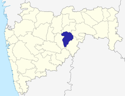 | |
| Lok Sabha constituencies | ||
| Vidhan Sabha constituencies | ||
This article is issued from
Wikipedia.
The text is licensed under Creative Commons - Attribution - Sharealike.
Additional terms may apply for the media files.