Kadakola
| Kadakola | |
|---|---|
| village | |
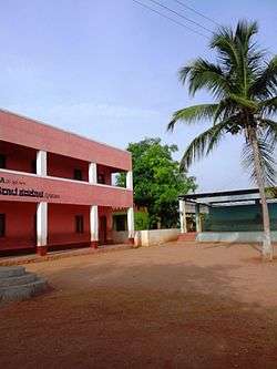 SGVK School | |
| Coordinates: 12°11′32″N 76°39′55″E / 12.19222°N 76.66528°ECoordinates: 12°11′32″N 76°39′55″E / 12.19222°N 76.66528°E | |
| Country |
|
| State | Karnataka |
| District | Mysore |
| Talukas | Mysore |
| Government | |
| • Body | Village Panchayat |
| Languages | |
| • Official | Kannada |
| Time zone | UTC+5:30 (IST) |
| ISO 3166 code | IN-KA |
| Vehicle registration | KA |
| Nearest city | Mysore |
Kadakola is a village in the southern state of Karnataka, India.[1][2] It is located in the Mysore taluk of Mysore district.
Demographics
As of 2001 India census, Kadakola had a population of 5327 with 2761 males and 2566 females.[1]
Schools
- S.G.V.K. Convent School
- Government Primary school
Post office
There is a post office at Kadakola and the pincode is 571311.[3]
Transportation
There is a small railway station at Kadakola where only slow trains to Mysore and Chamarajanagar stop. This railway station is part of Mysore-Chamarajanagar branch line. Buses are available to Mysore city which is 14.7 km away. The nearest airport is Mysuru airport at mandakalli which is 8 km away.
Villages and suburbs
Thandavapura ( 3 KM ) , Sinduvalli ( 3 KM ) , Someshwarapura ( 4 KM ) , Devalapura ( 6 KM ) , Hosahundi ( 7 KM ) are the nearby Villages. Other nearby villages are Kongara, Nanjaianahundi, Beeregowdana hundi and Kardimarayana hundi.
Image gallery
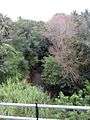 Yenne river, Kadakola
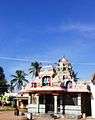 Kadakola temple
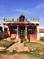 Small Devastahana
 Kadakola Railway Station
See also
References
- 1 2 Village code= 2825300 "Census of India : Villages with population 5000 & above". Archived from the original on 2008-02-11. Retrieved 2008-12-18.
|first1=missing|last1=in Authors list (help) - ↑ "Yahoomaps India :". Archived from the original on 2008-12-18. Retrieved 2008-12-18. Kadakola, Mysore, Karnataka
- ↑ http://www.mapsofindia.com/pincode/india/karnataka/mysore/kadakola.html
External links
- "Mysuru District Information". Mysore.nic.in. Retrieved 2016-05-01.