Jungo, Nevada
| Jungo, Nevada | |
|---|---|
| Ghost town | |
 Jungo  Jungo | |
| Coordinates: 40°55′00″N 118°22′55″W / 40.91667°N 118.38194°WCoordinates: 40°55′00″N 118°22′55″W / 40.91667°N 118.38194°W | |
| Elevation | 1,270 m (4,170 ft) |
Jungo[1] is a ghost town located on Humboldt County Route 55[2] (former Nevada State Route 49), between Winnemucca, Nevada and Sulphur, Nevada. At one time, Jungo boasted a hotel, store, filling station and blacksmith's shop, though no buildings remain.
The town of Jungo is named for Jungo Point, a survey peak located 11 miles away;[3][4] in 1888, Jungo Point was a stage stop on a mail route between Winnemucca and "Denio's".[5]

The post office at Jungo was in operation from January 1911 until May 1952.[6] Jungo was a station on the Feather River Route of the Western Pacific Railroad.[3]

George Austin lived in Jungo in 1915[7] and operated the hotel, filling station and general store at Jungo in the 1930s. In 1935, Austin purchased the Jumbo Mine,[8] located 36 miles away, from two prospectors for $10,000 ($178,000 today) with $500 due immediately. Mining engineer and former U.S. President Herbert Hoover visited Jungo in 1936 and advised Austin to retain ownership of Jumbo. Austin offered to pay Hoover for the advice and Hoover replied, "That kind of advice is free." Austin received many offers for the mine and stated that if he sold the mine for $1,000,000, then he would owe the $420,000 in taxes, but that the taxes don't apply if the gold is in the ground. Austin was also concerned about his sons becoming "loafers" if they were rich.[9][10]
In 1937, a group of Texas oilmen including H. L. Hunt placed an option to buy Jumbo Mine with a $250,000 ($4,256,000 today) down payment.[11][12]
The Jungo Hotel was in operation in 1955.[13]
In 2012, Recology received a permit to build a Municipal Solid Waste Disposal site at Jungo.[14][15]
References
- ↑ "Jungo (historical)". Geographic Names Information System. United States Geological Survey. 1980-12-12. Retrieved 2016-01-03.
- ↑ Nevada Road & Recreation Atlas (Map). 1:280000. Benchmark Maps. 2007. pp. 41–42. ISBN 0-929591-95-X.
- 1 2 Carlson, Helen S. (1974-01-01). Nevada Place Names: A Geographical Dictionary. University of Nevada Press. p. 147. ISBN 978-0-87417-094-8. Retrieved 2016-01-03.
- ↑ Origin of Place Names: Nevada (PDF). Reno: Federal Writers' Project, W. P. A. 1941. Retrieved 2016-01-03.
- ↑ "Beevities - Local and General Intelligence". Reno Evening Gazette. 1888-07-19. p. 3. Retrieved 2016-01-03.

- ↑ "Jungo Post Office (historical)". Geographic Names Information System. United States Geological Survey. 1991-09-01. Retrieved 2016-01-03.
- ↑ US patent 1185044
- ↑ "Jumbo Mine". Geographic Names Information System. United States Geological Survey. 1980-12-12. Retrieved 2016-01-09.
- ↑ "Jungo's Jumbo". Time Magazine. 1936-08-31. pp. 43–44. Retrieved 2016-01-09. Includes picture of Mr. George Austin and his wife.
- ↑ "Jumbo Gold Mine-Jungo Nevada-Summer Geo. Austin And Family - 1936". LIFE Photo Collection. Retrieved 2016-01-09. 136 photos of Jungo and Jumbo.
- ↑ "Jumbo Optioned". Time Magazine. 1937-06-07. pp. 68, 70. Retrieved 2016-01-09.
- ↑ "Jumbo Discoverers Strike New Vein". Reading Eagle, Reading, Pennsylvania. 1937-07-26. Retrieved 2016-01-09.
- ↑ Robert Trego (1955-10-23). "Black Rock Desert Roads Lead to Humboldt County". Nevada State Journal. p. 10. Retrieved 2016-01-09.
- ↑ "Jungo Disposal Site". Archived from the original on 2016-01-10. Retrieved 2016-01-09.
- ↑ "Jungo Landfill". Nevada Division of Environmental Protection. Retrieved 2016-01-09.
Municipalities and communities of Humboldt County, Nevada, United States | ||
|---|---|---|
| City | 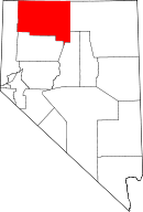 | |
| CDPs | ||
| Unincorporated communities | ||
| Ghost towns | ||
| Indian Reservations | ||
| Footnotes | ‡This populated place also has portions in an adjacent county or counties | |