Trego Hot Springs
| Trego Hot Springs | |
| Trego, Hot Springs, Kyles Hot Springs, Butte Spring, and Butte Hot Spring | |
| Ghost town | |
| Name origin: Named after nearby Mount Trego[1] | |
| Country | United States |
|---|---|
| State | Nevada |
| County | Pershing |
| Elevation | 3,914 ft (1,193 m) [2] |
| Coordinates | 40°45′53″N 119°08′38″W / 40.76472°N 119.14389°WCoordinates: 40°45′53″N 119°08′38″W / 40.76472°N 119.14389°W [2] |
| Founded | early 1900s |
| Timezone | Pacific (PST) (UTC-8) |
| - summer (DST) | PDT (UTC-7) |
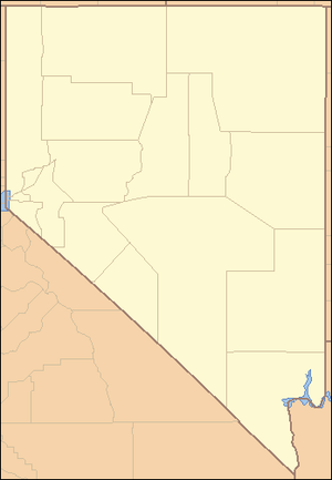 Location of Trego in Nevada | |

Trego Hot Springs is located in the Black Rock Desert at the location of Trego, Nevada, a former station on the Western Pacific Railroad. The name "Trego" dates from the 1910s, just after the railroad was built. Previously, the springs had names like Hot Springs, Kyles Hot Springs (1864), Butte Spring, and Butte Hot Spring.[2]
Today, Trego is known for its hot springs, which is a long ditch with a soft mud bottom. The springs are at the north end, near the railroad tracks, and the water flows south. Garside reports that the springs have a temperature of 187F.[3] Unlike nearby Frog Springs at the Garrett Ranch, Trego is on public land.
History
The area near the springs were seasonally occupied from 4000 B.P. and 1000 B.P.[4]
Fairfield states that in 1856, Ladue Vary and Fred Hines discovered the springs that were later named Trego Hot Springs when they took a short cut from Granite Creek (now known as Granite Ranch) across the Black Rock Desert playa towards Rabbit Hole Spring. When they arrived at the Humboldt River, the met a wagon train on the Nobles Emigrant Trail. Vary and Hines told the emigrants about the springs, the emigrants took the shortcut and the Nobles trail was adjusted accordingly.[5] "Hot Spr" appears on the 1857 map "Map of the Western Division of the Fort Kearney South Pass and Honey Lake Road" at that location.[6]
The 400 foot long trench was initially hand dug by a group led by Frederick W. Lander in 1860.[7]
Amesbury reports two 1861 entries from the diary of Edith Lockhart:
"August 18: Pleasant day. Started at noon and went 18 miles to Rabbit Hole Springs, rested a couple of hours and went 18 more miles by the next day to Hot Springs."
"Aug. 19. A warm day - got into camp at 10 oclock in this morning, laid over till evening - when we went 12 miles to Granite Creek or Wells."
The area was named Trego around the time the railroad came through in the early 1900s. Carlson states that Trego was named after nearby Mount Trego, which is formally known as Old Razorback Mountain.[1] The name Mount Trego only appears on the Pershing County Assessors Map.[8] The earliest citation for Trego from an original source is from an April 29, 1912 newspaper article that states that "Borax" in the water was the cause of a train engine boiler explosion that killed three people.[9]
In 1994, Desert Siteworks was held at Trego.[10] Desert Siteworks was a series of art events led by William Binzen, assisted by Judy West and John Law from 1993 to 1996. Desert Siteworks sometimes coincided with Burning Man, and many of the principles developed at Desert Siteworks (such as Leave-No-Trace) were adopted by Burning Man.
References
- 1 2 Carlson, Helen S. (1974). Nevada Place Names: A Geographical Dictionary. University of Nevada Press. p. 165. ISBN 9780874170948. Retrieved 15 June 2014.
- 1 2 3 "Trego Hot Springs". Geographic Names Information System. United States Geological Survey. Retrieved 2014-06-15.
- ↑ Garside, J. L.; Schilling, J. H. (1979). "Thermal Waters of Nevada" (PDF). Nevada Bureau of Mines and Geology Bulletin. Reno (91): 163. Retrieved 15 June 2014.
- ↑ Smith, Regina C.; McGuckian Jones, Peggy; Roney, John R.; Pedrick, Kathyrn E. (1984). "Prehistory and history of the Winnemucca District" (PDF). Winnemucca: Bureau of Land Management. Retrieved 15 June 2014.
- ↑ Fairfield, Asa Merrill (1916). Fairfield's Pioneer History of Lassen County, California. H. S. Crocker. p. 35. Archived from the original on 2008-06-30. Retrieved 2014-06-15.
- ↑ Map of the Western Division of the Fort Kearney South Pass and Honey Lake Road (Map). Retrieved 15 June 2014.
- ↑ Amesbury, Robert (1967). Nobles' Emigrant Trail. p. 37.
- ↑ Pershing County Assessors Book 2, Page 10 (1973_ shows "Mt. Trego" (Map) (1973 ed.). Pershing County Assessors Office. Retrieved 15 June 2014.
- ↑ "Water was the cause of the explosion". Reno Evening Gazette,. Reno. 29 April 1912. p. 2. Retrieved 21 December 2015.

- ↑ (Doherty, Brian (July 2006). This Is Burning Man. Benbella Books. ISBN 978-1-932100-86-0. Retrieved 2014-06-13. )