Jung, Victoria
| Jung Victoria | |||||||||
|---|---|---|---|---|---|---|---|---|---|
 Jung | |||||||||
| Coordinates | 36°37′43″S 142°20′09″E / 36.6285313°S 142.3357039°ECoordinates: 36°37′43″S 142°20′09″E / 36.6285313°S 142.3357039°E | ||||||||
| Population | 241 (2016 census)[1] | ||||||||
| Established | 1877 | ||||||||
| Postcode(s) | 3401 | ||||||||
| Elevation | 144[2] m (472 ft) | ||||||||
| Location | |||||||||
| LGA(s) | Rural City of Horsham | ||||||||
| State electorate(s) | Lowan | ||||||||
| Federal Division(s) | Mallee | ||||||||
| |||||||||
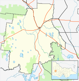
Jung is a locality in the northern Wimmera region, north-west Victoria. It is 316 km north-west of Melbourne and 18 km north-east of Horsham.[3]
The name is derived from the Parish Jung Jung, which comes from an Aboriginal expression of uncertain meaning. It was previously known as Taylor’s Creek, Green Hills and Jerro. Originally Jung was a settlement on the Yarriambiack Creek, 3 km north of its present location, until 1879 when it moved towards the newly built railway station on the line between Stawell and Horsham.[4]
In 2012 Jung's status was downgraded from a town to a gazetted locality.[5][6]
References
- ↑ Australian Bureau of Statistics (27 June 2017). "Jung (state suburb)". 2016 Census QuickStats. Retrieved 29 June 2017.

- ↑ http://weather.mla.com.au/climate-history/vic/jung
- ↑ http://www.victorianplaces.com.au/jung
- ↑ http://www.victorianplaces.com.au/jung
- ↑ http://www.mailtimes.com.au/story/1212080/celebrating-the-wimmeras-small-communities-jung/
- ↑ http://www.mailtimes.com.au/story/1209848/wimmera-leaders-criticise-small-town-changes/
This article is issued from
Wikipedia.
The text is licensed under Creative Commons - Attribution - Sharealike.
Additional terms may apply for the media files.