Jonesboro, Maine
| Jonesboro, Maine | |
|---|---|
| Town | |
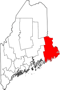
 Jonesboro, Maine Location within the state of Maine | |
| Coordinates: 44°39′48″N 67°35′43″W / 44.66333°N 67.59528°W | |
| Country | United States |
| State | Maine |
| County | Washington |
| Area[1] | |
| • Total | 38.36 sq mi (99.35 km2) |
| • Land | 36.58 sq mi (94.74 km2) |
| • Water | 1.78 sq mi (4.61 km2) |
| Elevation | 105 ft (32 m) |
| Population (2010)[2] | |
| • Total | 583 |
| • Estimate (2012[3]) | 584 |
| • Density | 15.9/sq mi (6.1/km2) |
| Time zone | UTC-5 (Eastern (EST)) |
| • Summer (DST) | UTC-4 (EDT) |
| ZIP code | 04648 |
| Area code(s) | 207 |
| FIPS code | 23-35905 |
| GNIS feature ID | 0582536 |
Jonesboro is a town in Washington County, Maine, United States. The town was named for John Coffin Jones, a landholder.[4][5] The population was 583 at the 2010 census.[6]
Geography
According to the United States Census Bureau, the town has a total area of 38.36 square miles (99.35 km2), of which, 36.58 square miles (94.74 km2) of it is land and 1.78 square miles (4.61 km2) is water.[1]
Climate
This climatic region is typified by large seasonal temperature differences, with warm to hot (and often humid) summers and cold (sometimes severely cold) winters. According to the Köppen Climate Classification system, Jonesboro has a humid continental climate, abbreviated "Dfb" on climate maps.[7]
Demographics
| Historical population | |||
|---|---|---|---|
| Census | Pop. | %± | |
| 1810 | 553 | — | |
| 1820 | 675 | 22.1% | |
| 1830 | 810 | 20.0% | |
| 1840 | 392 | −51.6% | |
| 1850 | 466 | 18.9% | |
| 1860 | 518 | 11.2% | |
| 1870 | 522 | 0.8% | |
| 1880 | 555 | 6.3% | |
| 1890 | 624 | 12.4% | |
| 1900 | 606 | −2.9% | |
| 1910 | 519 | −14.4% | |
| 1920 | 461 | −11.2% | |
| 1930 | 468 | 1.5% | |
| 1940 | 479 | 2.4% | |
| 1950 | 459 | −4.2% | |
| 1960 | 428 | −6.8% | |
| 1970 | 448 | 4.7% | |
| 1980 | 553 | 23.4% | |
| 1990 | 585 | 5.8% | |
| 2000 | 594 | 1.5% | |
| 2010 | 583 | −1.9% | |
| Est. 2014 | 576 | [8] | −1.2% |
| U.S. Decennial Census[9] | |||
2010 census
As of the census[2] of 2010, there were 583 people, 256 households, and 151 families residing in the town. The population density was 15.9 inhabitants per square mile (6.1/km2). There were 332 housing units at an average density of 9.1 per square mile (3.5/km2). The racial makeup of the town was 96.7% White, 0.2% African American, 0.5% Native American, 0.3% Asian, 0.5% from other races, and 1.7% from two or more races. Hispanic or Latino of any race were 0.9% of the population.
There were 256 households of which 25.8% had children under the age of 18 living with them, 47.3% were married couples living together, 8.6% had a female householder with no husband present, 3.1% had a male householder with no wife present, and 41.0% were non-families. 32.4% of all households were made up of individuals and 14.8% had someone living alone who was 65 years of age or older. The average household size was 2.28 and the average family size was 2.89.
The median age in the town was 45.2 years. 21.6% of residents were under the age of 18; 5.5% were between the ages of 18 and 24; 22.7% were from 25 to 44; 34.1% were from 45 to 64; and 16.1% were 65 years of age or older. The gender makeup of the town was 50.6% male and 49.4% female.
2000 census
As of the census[10] of 2000, there were 594 people, 257 households, and 172 families residing in the town. The population density was 16.2 people per square mile (6.3/km²). There were 325 housing units at an average density of 8.9 per square mile (3.4/km²). The racial makeup of the town was 99.33% White, 0.17% African American, and 0.51% from two or more races. Hispanic or Latino of any race were 0.51% of the population.
There were 257 households out of which 29.2% had children under the age of 18 living with them, 57.6% were married couples living together, 5.8% had a female householder with no husband present, and 32.7% were non-families. 29.2% of all households were made up of individuals and 14.8% had someone living alone who was 65 years of age or older. The average household size was 2.31 and the average family size was 2.82.
In the town, the population was spread out with 24.6% under the age of 18, 5.1% from 18 to 24, 27.8% from 25 to 44, 25.3% from 45 to 64, and 17.3% who were 65 years of age or older. The median age was 41 years. For every 100 females, there were 99.3 males. For every 100 females age 18 and over, there were 95.6 males.
The median income for a household in the town was $27,639, and the median income for a family was $36,458. Males had a median income of $31,389 versus $20,956 for females. The per capita income for the town was $14,418. About 9.6% of families and 16.1% of the population were below the poverty line, including 17.6% of those under age 18 and 12.0% of those age 65 or over.
Education
Area schools include Jonesboro Elementary School, Rose M. Gaffney Elementary School, Washington Academy, and Machias Memorial High School. [11]
Notable people
- Nathaniel Farnsworth, politician
- Tom Selleck, actor, film producer
References
- 1 2 "US Gazetteer files 2010". United States Census Bureau. Retrieved 2012-12-16.
- 1 2 "American FactFinder". United States Census Bureau. Retrieved 2012-12-16.
- ↑ "Population Estimates". United States Census Bureau. Archived from the original on 2013-06-17. Retrieved 2013-07-06.
- ↑ Gannett, Henry (1905). The Origin of Certain Place Names in the United States. Govt. Print. Off. p. 170.
- ↑ "Profile for Jonesboro, Maine". ePodunk. Retrieved 2010-05-08.
- ↑ "Profile of General Population and Housing Characteristics: 2010 Demographic Profile Data (DP-1): Jonesboro town, Washington County, Maine". U.S. Census Bureau, American Factfinder. Retrieved July 20, 2012.
- ↑ Climate Summary for Jonesboro, Maine
- ↑ "Annual Estimates of the Resident Population for Incorporated Places: April 1, 2010 to July 1, 2014". Archived from the original on May 23, 2015. Retrieved June 4, 2015.
- ↑ "Census of Population and Housing". Census.gov. Archived from the original on May 12, 2015. Retrieved June 4, 2015.
- ↑ "American FactFinder". United States Census Bureau. Retrieved 2008-01-31.
- ↑ "Jonesboro Elementary School". Jonesboro Elementary School. Retrieved 2012-10-06.
External links
- Varney, George J. (1886). "Gazetteer of the state of Maine. Jonesborough". Boston: Russell.
Coordinates: 44°39′45″N 67°34′21″W / 44.66250°N 67.57250°W