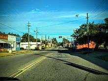
Johnsonville, South Carolina
| Johnsonville, South Carolina | |
|---|---|
| City | |
| Motto(s): "Outpost to the Coast"[1] | |
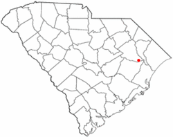 Location of Johnsonville in South Carolina | |
| Coordinates: 33°49′4″N 79°26′54″W / 33.81778°N 79.44833°WCoordinates: 33°49′4″N 79°26′54″W / 33.81778°N 79.44833°W | |
| Country | United States |
| State | South Carolina |
| County | Florence |
| Area | |
| • Total | 1.6 sq mi (5.40 km2) |
| • Land | 1.6 sq mi (5.33 km2) |
| • Water | 0.0 sq mi (0.07 km2) |
| Elevation | 92 ft (28 m) |
| Population (2010) | |
| • Total | 1,480 |
| • Density | 719/sq mi (277.6/km2) |
| Time zone | UTC-5 (EST) |
| • Summer (DST) | UTC-4 (EDT) |
| ZIP code | 29555 |
| Area code(s) | 843 |
| FIPS code | 45-37105[2] |
| GNIS feature ID | 1223621[3] |
| Website |
www |
Johnsonville is a city in Florence County, South Carolina, United States. The population was 1,480 at the 2010 census.[4] It is part of the Florence Metropolitan Statistical Area.
The city was founded in 1913 west of the spot of the former Witherspoon's Ferry on the Pee Dee River, where General Francis Marion received his commission for the Revolutionary War. Edward "Dwight" Carraway, Jr., a resident of Johnsonville from early childhood to the early 1980s, holds the record of South Carolina's youngest person ever elected to public office (1976–present). He was elected Alderman in June, 1976. Also, he was a classmate of Joseph Stevens "Steve" Dukes who has served as Mayor of Johnsonville since 2004.
The city is home to the Johnsonville Heritage Festival, which began in 2011 to celebrate the area's ties to the American Revolution.
History and Witherspoon's Ferry
In use during the American Revolution, Witherspoon's Ferry was the site where Francis Marion accepted command of the Williamsburg Militia in 1780. Ownership of the ferry lands passed from Robert to John Witherspoon in 1787. In 1802, John bequeathed the land to Aimwell Presbyterian Church.
Witherspoon's Ferry was a strategic ferry in the northeastern area of Williamsburg County, vested in John Witherspoon in 1801 and remaining in his charge until his death in 1815. According to the terms of John Witherspoon's will, the ferry was then vested in J. D. Witherspoon, executor, for a term of 14 years, "in trust for and having the sole benefit of the incorporated Presbyterian Church at Aimwell on the Pee Dee River."
In 1819, former South Carolina Governor David R. Williams, son-in-law of John Witherspoon, obtained these ferry lands. William J. Johnson, born 1787, succeeded J. D. Witherspoon at the ferry after purchasing the plantation in 1825 from the Witherspoon estate. The 1850 census of Williamsburg County shows William Johnson, a man of considerable wealth for his time and place, living just below where the American Legion stands in Johnsonville today.
Johnson's Ferry was a stagecoach horse changeover and meal break station. As the stagecoach passed east over the Lynches River on the ferry, a Johnson slave in charge of the ferry mules announced the number of passengers with a blast from a fox horn: one blast for each passenger, thus informing Mrs. Johnson of the number of places that should be set for dinner.
The stagecoach stopped at the Johnsons' house. All the mail for the surrounding communities was left in Capt. Johnson's care. This provided an excellent reason for him to request a post office be granted. In 1843 a post office, named "Johnsonville", was established near the ferry.
The city of Johnsonville was incorporated in 1913.[5]
Geography
Johnsonville is located in southeastern Florence County at 33°49′4″N 79°26′54″W / 33.81778°N 79.44833°W (33.817802, -79.448288).[6] The center of town is 1.5 miles (2.4 km) south of the crossing of the Lynches River by South Carolina Highways 41 and 51. The combined highways lead north 4 miles (6 km) to U.S. Route 378 at Kingsburg and south 5 miles (8 km) to Hemingway.
South Carolina Highway 341 passes through the center of town as Broadway Street, leading west 20 miles (32 km) to Lake City. Florence, the county seat, is 35 miles (56 km) to the northwest, while Myrtle Beach is 45 miles (72 km) to the east.
According to the United States Census Bureau, the city has a total area of 2.1 square miles (5.4 km2), of which 0.03 square miles (0.07 km2), or 1.36%, is water.[4]
The city of Johnsonville is located only a few miles from The Johnsonville Impact Crater, a circular geophysical feature that has been interpreted by some scientists as an impact crater, situated at the junction of Lynches River and the Pee Dee River in South Carolina. Snows Island, at that point, is believed to be the upthrust of the center after the impact. This eight-mile-wide crater is not well defined at the surface and was discovered by magnetic anomalies and supported by the study of well drilling cores. Supposed impact breccia was found in these cores.
Demographics
| Historical population | |||
|---|---|---|---|
| Census | Pop. | %± | |
| 1920 | 271 | — | |
| 1930 | 325 | 19.9% | |
| 1940 | 464 | 42.8% | |
| 1950 | 616 | 32.8% | |
| 1960 | 882 | 43.2% | |
| 1970 | 1,267 | 43.7% | |
| 1980 | 1,421 | 12.2% | |
| 1990 | 1,415 | −0.4% | |
| 2000 | 1,418 | 0.2% | |
| 2010 | 1,480 | 4.4% | |
| Est. 2016 | 1,504 | [7] | 1.6% |
| U.S. Decennial Census[8] | |||
As of the census[2] of 2000, there were 1,418 people, 532 households, and 413 families residing in the city. The population density was 897.6 people per square mile (346.5/km²). There were 602 housing units at an average density of 381.1 per square mile (147.1/km²). The racial makeup of the city was 75.74% White, 22.78% Black, 0.21% Native American, 0.14% Asian, 0.56% from other races, and 0.56% from two or more races. Hispanic or Latino of any race were 1.06% of the population.
There were 532 households out of which 35.7% had children under the age of 18 living with them, 52.8% were married couples living together, 18.6% had a female householder with no husband present, and 22.2% were non-families. 19.9% of all households were made up of individuals and 9.2% had someone living alone who was 65 years of age or older. The average household size was 2.65 and the average family size was 3.03.
In the city, the population was spread out with 26.4% under the age of 18, 8.9% from 18 to 24, 26.5% from 25 to 44, 25.8% from 45 to 64, and 12.3% who were 65 years of age or older. The median age was 37 years. For every 100 females, there were 88.1 males. For every 100 females age 18 and over, there were 82.7 males.
The median income for a household in the city was $34,274, and the median income for a family was $38,690. Males had a median income of $30,109 versus $19,500 for females. The per capita income for the city was $15,539. About 13.3% of families and 16.6% of the population were below the poverty line, including 21.5% of those under age 18 and 18.1% of those age 65 or over.
Notable people
- Jim Maxwell, NFL linebacker
- Odell Venters, South Carolina House of Representatives, 1961-1968, 1971-1977
- General John Henry Woodberry, Brigadier General; United States Army; Chief Ordinance Officer Southwest; Pacific Area SOS; World War II, 1944-1945
References
- ↑ Official city website
- 1 2 "American FactFinder". United States Census Bureau. Retrieved 2008-01-31.
- ↑ "US Board on Geographic Names". United States Geological Survey. 2007-10-25. Retrieved 2008-01-31.
- 1 2 "Geographic Identifiers: 2010 Demographic Profile Data (G001): Johnsonville city, South Carolina". U.S. Census Bureau, American Factfinder. Retrieved August 15, 2016.
- ↑ http://www.johnsonvilleschistory.org
- ↑ "US Gazetteer files: 2010, 2000, and 1990". United States Census Bureau. 2011-02-12. Retrieved 2011-04-23.
- ↑ "Population and Housing Unit Estimates". Retrieved June 9, 2017.
- ↑ "Census of Population and Housing". Census.gov. Archived from the original on May 12, 2015. Retrieved June 4, 2015.
External links
Municipalities and communities of Florence County, South Carolina, United States | ||
|---|---|---|
| Cities | 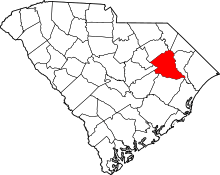 | |
| Towns | ||
| Unincorporated communities | ||