Jhihben National Forest Recreation Area
Coordinates: 22°41′32.9″N 120°59′23.0″E / 22.692472°N 120.989722°E
| Jhihben National Forest Recreation Area Chinese: 知本國家森林遊樂區 | |
|---|---|
 | |
| Geography | |
| Location | Beinan, Taitung County, Taiwan |
| Elevation | 125-650 meters |
| Area | 110 hectares |

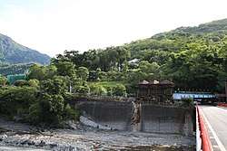
Visitor Center
Jhihben National Forest Recreation Area (Chinese: 知本國家森林遊樂區; pinyin: Zhīběn Guójiā Sēnlín Yóulè Qū) is a forest in Beinan Township, Taitung County, Taiwan.[1]
Geography
The forest spans around 110 hectares in area with an elevation of 125 to 650 meters above sea level. It has the mean annual temperature of around 22°C.
Features
- Forest Bath Trail
- Hero Hill Trail
- Ficus Shade Trail
Transportation
The forest is accessible by bus from Taitung City.[2]
See also
References
- ↑ "Jhihben National Forest Recreation Area". Recreation.forest.gov.tw. Archived from the original on 2014-06-07. Retrieved 2014-05-15.
- ↑ "Jhihben National Forest Recreation Area". Recreation.forest.gov.tw. Archived from the original on 2014-05-17. Retrieved 2014-05-15.
External links
| Wikimedia Commons has media related to Jhihben National Forest Recreation Area. |
- 知本國家森林遊樂區 (in Chinese)
This article is issued from
Wikipedia.
The text is licensed under Creative Commons - Attribution - Sharealike.
Additional terms may apply for the media files.