Jackson (village), Wisconsin
| Jackson | |
|---|---|
| Village | |
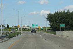 Sign for Jackson on WIS 60 | |
 Location of Jackson in Washington County, Wisconsin. | |
 Jackson Location within the state of Wisconsin | |
| Coordinates: 43°19′23″N 88°10′17″W / 43.32306°N 88.17139°WCoordinates: 43°19′23″N 88°10′17″W / 43.32306°N 88.17139°W | |
| Country | United States |
| State | Wisconsin |
| County | Washington |
| Government | |
| • Type | Village Board of Trustees |
| • Village Board President | Mike Schwab [1] |
| Area[2] | |
| • Total | 3.07 sq mi (7.95 km2) |
| • Land | 3.05 sq mi (7.90 km2) |
| • Water | 0.02 sq mi (0.05 km2) |
| Population (2010)[3] | |
| • Total | 6,753 |
| • Estimate (2016)[4] | 6,933 |
| • Density | 2,214.1/sq mi (854.9/km2) |
| Time zone | UTC-6 (Central (CST)) |
| • Summer (DST) | UTC-5 (CDT) |
| Area code(s) | 262 |
| FIPS code | 55-37675 |
| GNIS feature ID | 1583443 |
| Website | Official website |
Jackson is a village in Washington County, Wisconsin, United States. The population was 6,753 at the 2010 census. The village is adjacent to the Town of Jackson.
History
A post office called Jackson has been in operation since 1870.[5] The village was named for Andrew Jackson, seventh president of the United States.[6]
Jackson holds a traditional community wide rummage sale every year. The event is held the first Saturday after Mother's Day.[7]
On July 17, 2012, a petroleum product pipeline spilled an estimated 54,600 gallons of gasoline in the Town of Jackson. 37 private wells contaminated by the spill were ordered abandoned by the Wisconsin Department of Natural Resources. The West Shore Pipe Line Company, which owned the pipeline, paid the costs to extend water services from the Village of Jackson to a large part of the Town of Jackson.[8]
Geography
Jackson is located at 43°19′23″N 88°10′16″W / 43.32306°N 88.17111°W (43.323188, -88.171273).[9]
According to the United States Census Bureau, the village has a total area of 3.07 square miles (7.95 km2), of which, 3.05 square miles (7.90 km2) of it is land and 0.02 square miles (0.05 km2) is water.[2]
Demographics
| Historical population | |||
|---|---|---|---|
| Census | Pop. | %± | |
| 1970 | 561 | — | |
| 1980 | 1,817 | 223.9% | |
| 1990 | 2,486 | 36.8% | |
| 2000 | 4,938 | 98.6% | |
| 2010 | 6,753 | 36.8% | |
| Est. 2017 | 7,107 | [4] | 5.2% |
| U.S. Decennial Census[10] | |||
2010 census
As of the census[3] of 2010, there were 6,753 people, 2,870 households, and 1,866 families residing in the village. The population density was 2,214.1 inhabitants per square mile (854.9/km2). There were 3,061 housing units at an average density of 1,003.6 per square mile (387.5/km2). The racial makeup of the village was 96.9% White, 0.5% African American, 0.2% Native American, 0.7% Asian, 0.1% Pacific Islander, 0.6% from other races, and 1.1% from two or more races. Hispanic or Latino of any race were 2.2% of the population.
There were 2,870 households of which 31.5% had children under the age of 18 living with them, 53.4% were married couples living together, 8.0% had a female householder with no husband present, 3.6% had a male householder with no wife present, and 35.0% were non-families. 29.0% of all households were made up of individuals and 9.5% had someone living alone who was 65 years of age or older. The average household size was 2.35 and the average family size was 2.92.
The median age in the village was 39 years. 24.3% of residents were under the age of 18; 5.6% were between the ages of 18 and 24; 30.7% were from 25 to 44; 26.9% were from 45 to 64; and 12.4% were 65 years of age or older. The gender makeup of the village was 48.7% male and 51.3% female.
2000 census
As of the census[11] of 2000, there were 4,938 people, 1,949 households, and 1,393 families residing in the village. The population density was 1,959.5 people per square mile (756.6/km²). There were 2,011 housing units at an average density of 798.0/sq mi (308.1/km²). The racial makeup of the village was 98.52% White, 0.08% Black or African American, 0.24% Native American, 0.20% Asian, 0.32% from other races, and 0.63% from two or more races. 1.24% of the population were Hispanic or Latino of any race.
There were 1,949 households out of which 36.7% had children under the age of 18 living with them, 60.4% were married couples living together, 8.2% had a female householder with no husband present, and 28.5% were non-families. 22.9% of all households were made up of individuals and 7.8% had someone living alone who was 65 years of age or older. The average household size was 2.53 and the average family size was 3.00.
In the village, the population was spread out with 27.4% under the age of 18, 6.2% from 18 to 24, 38.9% from 25 to 44, 18.1% from 45 to 64, and 9.5% who were 65 years of age or older. The median age was 33 years. For every 100 females, there were 99.4 males. For every 100 females age 18 and over, there were 95.6 males.
The median income for a household in the village was $53,990, and the median income for a family was $60,991. Males had a median income of $41,632 versus $26,319 for females. The per capita income for the village was $23,450. About 3.3% of families and 4.5% of the population were below the poverty line, including 6.7% of those under age 18 and 3.3% of those age 65 or over.
References
- ↑ "Village Board, Commissions & Committees". Village of Jackson, Wisconsin.
- 1 2 "US Gazetteer files 2010". United States Census Bureau. Archived from the original on January 24, 2012. Retrieved 2012-11-18.
- 1 2 "American FactFinder". United States Census Bureau. Retrieved 2012-11-18.
- 1 2 "Population and Housing Unit Estimates". Retrieved June 9, 2017.
- ↑ "Washington County". Jim Forte Postal History. Retrieved March 19, 2015.
- ↑ Chicago and North Western Railway Company (1908). A History of the Origin of the Place Names Connected with the Chicago & North Western and Chicago, St. Paul, Minneapolis & Omaha Railways. p. 87.
- ↑ "Jackson Village-Wide Rummage Sale". Village of Jackson Wisconsin. Retrieved 16 May 2015.
- ↑ Behm, Don (October 31, 2014). "More water problems hit Town of Jackson residents Friday". Milwaukee Journal Sentinel. Retrieved May 16, 2015.
- ↑ "US Gazetteer files: 2010, 2000, and 1990". United States Census Bureau. 2011-02-12. Retrieved 2011-04-23.
- ↑ "Census of Population and Housing". Census.gov. Retrieved June 4, 2016.
- ↑ "American FactFinder". United States Census Bureau. Archived from the original on September 11, 2013. Retrieved 2008-01-31.
External links
Municipalities and communities of Washington County, Wisconsin, United States | ||
|---|---|---|
| Cities | 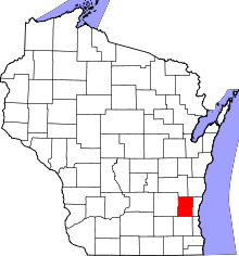 | |
| Villages | ||
| Towns | ||
| CDP | ||
| Unincorporated communities |
| |
| Footnotes | ‡This populated place also has portions in an adjacent county or counties | |