Jach'a Khuchi
| Jach'a Khuchi | |
|---|---|
 Jach'a Khuchi Location within Bolivia | |
| Highest point | |
| Elevation | 4,464 m (14,646 ft) [1] |
| Coordinates | 17°56′11″S 66°27′57″W / 17.93639°S 66.46583°WCoordinates: 17°56′11″S 66°27′57″W / 17.93639°S 66.46583°W |
| Geography | |
| Location |
Bolivia, Cochabamba Department |
| Parent range | Andes |
Jach'a Khuchi (Aymara jach'a big, khuchi pig,[2] "big pig", also spelled Jachcha Kochi) is a 4,464-metre-high (14,646 ft) mountain in the Bolivian Andes. It is located in the Cochabamba Department, in the east of the Bolívar Province. Jach'a Khuchi lies northwest of Sirk'i.[1][3]
References
- 1 2 Bolivia 1:100,000 Tarata 3635, Map prepared and published by the Defense Mapping Agency, Hydrographic/Topographic Center, Bethesda, MD
- ↑ Radio San Gabriel, "Instituto Radiofonico de Promoción Aymara" (IRPA) 1993, Republicado por Instituto de las Lenguas y Literaturas Andinas-Amazónicas (ILLLA-A) 2011, Transcripción del Vocabulario de la Lengua Aymara, P. Ludovico Bertonio 1612 (Spanish-Aymara-Aymara-Spanish dictionary)
- ↑ "Bolívar". INE, Bolivia. Archived from the original on September 11, 2014. Retrieved March 30, 2016.
Capital: Cochabamba | ||
| Provinces | 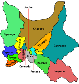 | |
| Municipalities (and seats) |
| |
This article is issued from
Wikipedia.
The text is licensed under Creative Commons - Attribution - Sharealike.
Additional terms may apply for the media files.