Izumiōtsu
| Izumiōtsu 泉大津市 | |||
|---|---|---|---|
| City | |||
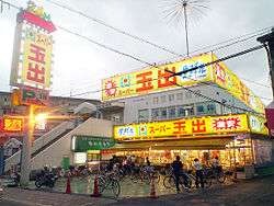 Supermarket in Izumiōtsu | |||
| |||
 Location of Izumiōtsu in Osaka Prefecture | |||
 Izumiōtsu Location in Japan | |||
| Coordinates: 34°30′N 135°24′E / 34.500°N 135.400°ECoordinates: 34°30′N 135°24′E / 34.500°N 135.400°E | |||
| Country | Japan | ||
| Region | Kansai | ||
| Prefecture | Osaka Prefecture | ||
| Area | |||
| • Total | 13.36 km2 (5.16 sq mi) | ||
| Population (March 1, 2017) | |||
| • Total | 75,398 | ||
| • Density | 5,600/km2 (15,000/sq mi) | ||
| Symbols | |||
| • Tree | Cinnamomum | ||
| • Flower | Rhododendron | ||
| Time zone | UTC+9 (JST) | ||
| City hall address |
9-12 Shinonome, Izumiotsu-shi, Osaka-fu 595-8686 | ||
| Website | http://www.city.izumiotsu.lg.jp/ | ||


Izumiōtsu (泉大津市 Izumiōtsu-shi) is a city in Osaka Prefecture, Japan, founded on April 1, 1942.
Demographics
As of March 1, 2017, the city has an estimated population of 75,398, with 33,748 households and a population density of 5,600 persons per km².[1] The total area is 13.36 km².[2]
Transport
Rail
Izumiōtsu is served by the following three railway stations on the Nankai Main Line.
National highways
Education
- Osaka Prefectural Izumiohtsu High School[3]
- Izumiōtsu Ozu Junior High School
- Izumiōtsu Seifu Junior High School
- Izumiōtsu Toyo Junior High School
The city previously had a North Korean school, Senshu Korean Elementary School (泉州朝鮮初級学校).[4]
Sister cities
References
- ↑ "Official website of Izumiotsu city" (in Japanese). Japan: Izumiōtsu City. Retrieved 8 April 2017.
- ↑ 泉大津市統計書(平成24年度) [Izumiōtsu City Statistics - Geography/Climate (Fiscal 2012)] (pdf) (in Japanese). Japan: Izumiōtsu City. 2013. p. 5. Retrieved 4 March 2014.
- ↑ Izumiohtsu High School official website Retrieved 2013-01-08 (in Japanese)
- ↑ "ウリハッキョ一覧" (). Chongryon. November 6, 2005. Retrieved on October 15, 2015.
External links
| Wikimedia Commons has media related to Izumiotsu, Osaka. |
- Official website (in Japanese)
| Wards of Osaka | ||
|---|---|---|
| Wards of Sakai | ||
| Core cities | ||
| Special cities | ||
| Cities | ||
| Districts | ||
This article is issued from
Wikipedia.
The text is licensed under Creative Commons - Attribution - Sharealike.
Additional terms may apply for the media files.