Ivel, Kentucky
| Ivel, Kentucky | |
|---|---|
| Unincorporated community | |
 Ivel Location within the state of Kentucky  Ivel Ivel (the US) | |
| Coordinates: 37°35′28″N 82°40′6″W / 37.59111°N 82.66833°WCoordinates: 37°35′28″N 82°40′6″W / 37.59111°N 82.66833°W | |
| Country | United States |
| State | Kentucky |
| County | Floyd |
| Elevation | 643 ft (196 m) |
| Time zone | UTC-5 (Eastern (EST)) |
| • Summer (DST) | UTC-4 (EDT) |
| ZIP codes | 41642 |
| GNIS feature ID | 508321[1] |
Ivel is an unincorporated community and coal town in Floyd County, Kentucky, United States.
A post office was established in the community in 1905. The town takes its name from the Ivy Creek.[2]
References
- ↑ U.S. Geological Survey Geographic Names Information System: Ivel, Kentucky
- ↑ Rennick, Robert M. (1987). Kentucky Place Names. University Press of Kentucky. p. 151. Retrieved 2013-07-26.
Municipalities and communities of Floyd County, Kentucky, United States | ||
|---|---|---|
| Cities | 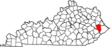 | |
| CDPs | ||
| Other unincorporated communities |
| |
| Footnotes | ‡This populated place also has portions in an adjacent county or counties. | |
This article is issued from
Wikipedia.
The text is licensed under Creative Commons - Attribution - Sharealike.
Additional terms may apply for the media files.