Ivanovice na Hané
| Ivanovice na Hané | |||
| Town | |||
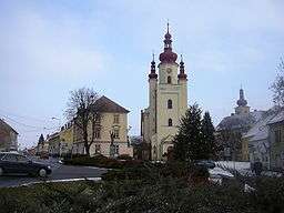 Palacký Square an the Church of Saint Andrew | |||
|
|||
| Country | Czech Republic | ||
|---|---|---|---|
| Region | South Moravian | ||
| District | Vyškov | ||
| Commune | Vyškov | ||
| Municipality | Ivanovice na Hané | ||
| Elevation | 214 m (702 ft) | ||
| Coordinates | 49°18′19.51″N 17°5′36.35″E / 49.3054194°N 17.0934306°ECoordinates: 49°18′19.51″N 17°5′36.35″E / 49.3054194°N 17.0934306°E | ||
| Area | 21.46 km2 (8.29 sq mi) | ||
| Population | 2,905 (1.12012) | ||
| Density | 135/km2 (350/sq mi) | ||
| First mentioned | 1183 | ||
| Mayor | Vlastislav Drobílek | ||
| Timezone | CET (UTC+1) | ||
| - summer (DST) | CEST (UTC+2) | ||
| Postal code | 683 23 | ||
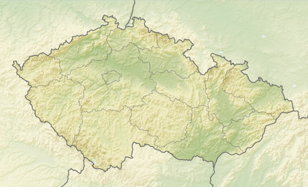 Location in the Czech Republic | |||
| Wikimedia Commons: Ivanovice na Hané | |||
| Statistics: statnisprava.cz | |||
| Website: www.ivanovicenahane.cz | |||


Ivanovice na Hané (German: Eiwanowitz in der Hanna) is a town in the Czech Republic.
People
- Gustav Karpeles (1848 - 1909), Jewish writer
- Andreas Nemetz (1799 - 1846), Moravian composer
- Bedřich Antonín Wiedermann (1883–1951), organist, composer
External links

- Municipal website
This article is issued from
Wikipedia.
The text is licensed under Creative Commons - Attribution - Sharealike.
Additional terms may apply for the media files.