Ivanov Beach
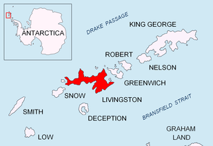

Ivanov Beach (Bulgarian: Иванов бряг, ‘Ivanov Bryag’ \i-va-'nov 'bryag\) is the predominantly ice-free beach extending 5 km (3.1 mi) in southwest-northeast direction on the southeast coast of Barclay Bay in western Livingston Island, South Shetland Islands in Antarctica. It is bounded by Nedelya Point and Byers Peninsula to the southwest, Rotch Dome to the southeast, and Rowe Point to the northeast. The beach features Bilyar Point 1.7 km (1.1 mi) northeast of Nedelya Point, and a minor point 1.1 km (0.68 mi) southwest of Rowe Point. Its ice-free area is ca. 144 hectares (360 acres).[1] The vicinity was visited by early 19th century sealers.
The feature is named for Lyubomir Ivanov, topographic surveyor in Antarctica during the 1994/95 and subsequent seasons, author of Antarctic topographic maps, and founding chairman of the Antarctic Place-names Commission of Bulgaria.
Location
Ivanov Beach is centred at 62°36′22″S 60°56′14″W / 62.60611°S 60.93722°WCoordinates: 62°36′22″S 60°56′14″W / 62.60611°S 60.93722°W. British mapping in 1822 and 1968, Spanish in 1991 and 1992, and Bulgarian in 2005, 2009 and 2017.
Protection status
The beach was incorporated in the Antarctic Specially Protected Area ASPA 126 Byers Peninsula in 2016, and was designated as a restricted zone of scientific importance to Antarctic microbiology with greater restriction placed on access with the aim of preventing microbial or other contamination by human activity.[2]
Maps
- Chart of South Shetland including Coronation Island, &c. from the exploration of the sloop Dove in the years 1821 and 1822 by George Powell Commander of the same. Scale ca. 1:200000. London: Laurie, 1822
- South Shetland Islands. Scale 1:200000 topographic map. DOS 610 Sheet W 62 60. Tolworth, UK, 1968
- Islas Livingston y Decepción. Mapa topográfico a escala 1:100000. Madrid: Servicio Geográfico del Ejército, 1991
- Península Byers, Isla Livingston. Mapa topográfico a escala 1:25000. Madrid: Servicio Geográfico del Ejército, 1992
- L.L. Ivanov et al., Antarctica: Livingston Island, South Shetland Islands (from English Strait to Morton Strait, with illustrations and ice-cover distribution), 1:100000 scale topographic map, Antarctic Place-names Commission of Bulgaria, Sofia, 2005
- L.L. Ivanov. Antarctica: Livingston Island and Greenwich, Robert, Snow and Smith Islands. Scale 1:120000 topographic map. Troyan: Manfred Wörner Foundation, 2010. ISBN 978-954-92032-9-5 (First edition 2009. ISBN 978-954-92032-6-4)
- South Shetland Islands: Livingston Island, Byers Peninsula. Scale 1:50000 satellite map. UK Antarctic Place-names Committee, 2010
- L.L. Ivanov. Antarctica: Livingston Island and Smith Island. Scale 1:100000 topographic map. Manfred Wörner Foundation, 2017. ISBN 978-619-90008-3-0
- Antarctic Digital Database (ADD). Scale 1:250000 topographic map of Antarctica. Scientific Committee on Antarctic Research (SCAR). Since 1993, regularly updated
Notes
- ↑ L.L. Ivanov. Antarctica: Livingston Island and Greenwich, Robert, Snow and Smith Islands. Scale 1:120000 topographic map. Troyan: Manfred Wörner Foundation, 2009
- ↑ Management Plan for Antarctic Specially Protected Area No. 126 Byers Peninsula. Measure 4 (2016), ATCM XXXIX Final Report. Santiago, 2016
References
- Ivanov Beach. SCAR Composite Gazetteer of Antarctica
- Ivanov Beach. GeoNames Database
- Bulgarian Antarctic Gazetteer. Antarctic Place-names Commission. (details in Bulgarian, basic data in English)
This article includes information from the Antarctic Place-names Commission of Bulgaria which is used with permission.