Ithome (Thessaly)
Coordinates: 39°24′57″N 21°47′56″E / 39.41583°N 21.79889°E
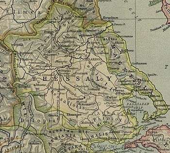
Ithome (Ancient Greek: Ἰθώμη) was a town of Histiaeotis in ancient Thessaly, described by Homer as the "rocky Ithome",[1] is placed by Strabo within a quadrangle formed by the four cities, Tricca, Metropolis, Pelinnaeum, and Gomphi.[2] It occupied the site of the castle which stands on the summit above the modern village of Fanari (in the modern municipality of Ithomi, which reflects the ancient name).[3][4] Visiting the place in the nineteenth century, William Martin Leake observed, near the north-western face of the castle, some remains of a very ancient Hellenic wall, consisting of a few large masses of stone, roughly hewn on the outside, but accurately joined to one another without cement.[5]
The town's original name was Thome (Θώμη).[6] Other names borne by the town were Thoumaion (Θούμαιον),[4] Thamai (Θαμαι),[4] and Thamiai (Θαμιαι).[3]
References
- ↑ Ἰθώμη κλωμακόεσσα, Homer. Iliad. 2.729.
- ↑ Strabo. Geographica. ix. p.437. Page numbers refer to those of Isaac Casaubon's edition.
- 1 2 Richard Talbert, ed. (2000). Barrington Atlas of the Greek and Roman World. Princeton University Press. p. 55, and directory notes accompanying.
- 1 2 3 Lund University. Digital Atlas of the Roman Empire.
- ↑ Leake, Northern Greece, vol, iv. p. 510.
- ↑ Reece, Steve (2009). Homer's winged words: the evolution of early Greek epic diction in the light of oral theory. Leiden; Boston: Brill. pp. 180–185.
![]()