Indonesia–Papua New Guinea relations
 | |
Indonesia |
Papua New Guinea |
|---|---|
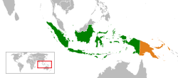
Indonesia – Papua New Guinea relations are foreign relations between Indonesia and Papua New Guinea, two bordering countries north of Australia.
Western New Guinea (which consists of two Indonesian provinces: Papua and West Papua) and Papua New Guinea share a 820-kilometre (510 mi) border that has raised tensions and ongoing diplomatic issues over many decades.[1]
Indonesia is represented in Papua New Guinea with an embassy in Port Moresby and a consulate in Vanimo.
Country comparison
| Population | 255,461,700[2] | 7,059,653[3] |
| Area | 1,904,569 km2 (735,358 sq mi) | 462,840 km2 (178,703 sq mi ) |
| Population Density | 124.66/km2 (322.87/sq mi) | 15/km2 (34.62/sq mi) |
| Time zones | 3 | 1 |
| Capital | Jakarta | Port Moresby |
| Largest city | Jakarta – 11,374,022 (30,326,103 Metro) | Port Moresby – 364,125 |
| Government | Unitary presidential constitutional republic | Unitary parliamentary constitutional monarchy |
| Official language | Indonesian | Hiri Motu, Tok Pisin, Papua New Guinean Sign Language, English |
| Main religions | 87.2% Islam, 6.9% Protestantism, 2.9% Catholicism, 1.6% Hinduism, 0.72% Buddhism, 0.05% Confucianism, 0.5% other | 60.9% Protestantism, 27% Catholicism, 8.9% other Christians, 0.3% Bahá'í Faith, 3.3% indigenous beliefs and other |
| Ethnic groups | 40.22% Javanese, 15.5% Sundanese, 3.58% Batak, 3.03% Madurese, 2.88% Betawi, 2.73% Minangkabau, 2.69% Bugis, 2.27% Malay, 27.1% other | Melanesians, Papuans, Negritos, Micronesians, Polynesians, Wopkaimin |
| GDP (per capita) | $11,135 | $2,834 |
| GDP (nominal) | $895.577 billion | $15.973 billion |
History
Dutch colonial and Indonesian government actions over the populations in Papua have caused an extensive and ongoing border issue which has a lengthy and enduring presence of refugees moving between Papua and Papua New Guinea.[4]
Leo Suryadinata writes that after "a number of border conflicts, Indonesia eventually signed a border treaty with Papua New Guinea in 1979";[5] however, issues continued while Indonesia pursued Papuans well after this date, and still continue to harass various population groups in the highlands of Papua adjacent to the border with Papua New Guinea.[6] The border is a straight line, drawn without considering the geological features, except for a slight indentation to the west at the Fly River, created in 1893 to allow for better British policing of the area.[7]
Sean Dorney of the Australian Broadcasting Corporation in his book Papua New Guinea — people, Politics and History since 1975 has the quote from a statements by the Indonesian Embassy in Port Moresby in 1978 in relation to the pursuit of Papuan rebels:
Indonesia wants PNG to grow strong and be a good neighbour. Therefore if there is a dream that we want to invade Papua New Guinea, we would do it now when Papua New Guinea is still weak, rather than to wait (for) Papua New Guinea to become strong[8]
Refugees
Due to conflict adjacent to the border between the two countries, refugees have crossed the border regularly.[9][10]
The main issue of refugees is from conflict between Indonesian national security forces, and various groups of dissaffected groups in West Papua seeking refuge in the Papua New Guinea territory.[11]
The subsequent diplomatic issues that have arisen, usually is the refugee flows and border transgressions by Indonesian forces.
Its (PNG) proximity and cultural ties to the Indonesian province of Papua means there is potential for a mass influx of West Papuan refugees. Given the continuing political instability and the security situation in Papua, regular revision of PNG's contingency plans and training of GoPNG officials is considered important.[12]
Treaty
Talks about the border moved to the signing on 27 October 1986, of the Treaty of Mutual Respect, Cooperation, and Friendship
The treaty was, in effect, a bilateral nonaggression pact in which the two sides agreed to "avoid, reduce and contain disputes or conflicts between their nations and settle any differences that may arise only by peaceful means"[13][14]
See also
References
- ↑ http://countrystudies.us/indonesia/100.htm
- ↑ CBS Estimate May 2015 - http://www.bps.go.id/linkTabelStatis/view/id/1274
- ↑ Estimate 2011 - "Archived copy". Archived from the original on 28 June 2013. Retrieved 25 June 2013.
- ↑ Chauvel, Richard Refuge, displacement and dispossession: responses to Indonesian rule and conflict in Papua RSC Working Paper No. 42 Dynamics of Conflict and Displacement in Papua, Indonesia A collection of papers developed in conjunction with a one-day workshop held on 26 October 2006 at St. Antony’s College, Oxford Edited by Eva-Lotta E. Hedman September 2007.
- ↑ Leo Suryadinata, Indonesia's foreign policy under Suharto: aspiring to international leadership (Times Academic Press, 1996), 97.
- ↑ Heidbuchel, Esther (2007) The West Papua conflict in Indonesia: actors, issues and approaches Johannes Herrmann Verlag ISBN 3-937983-10-4, ISBN 978-3-937983-10-3 page 67
- ↑ Who Bit My Border?
- ↑ As quoted in Heidbuchel page 67, and original page 265.
- ↑ http://www.reliefweb.int/rw/rwb.nsf/db900sid/AMMF-78QF4W?OpenDocument
- ↑ Glazebrook, Diana. 2004. "'If I stay here there is nothing yet if I return I do not know whether I will be safe': West Papuan refugee responses to Papua New Guinea Asylum Policy 1998-2003", Journal of Refugee Studies 17(2): 205–221.
- ↑ Kirsch, Stuart. 1996. "Refugees and Representation: Politics, Critical Discourse, and Ethnography along the New Guinea Border", in Michael Morgan and Susan Leggett (eds.) "Mainstream(s) and Margins: Cultural Politics in the 1990s", 222–236. Contributions in Political Science, Number 367. Westport, Ct: Greenwood Press.
- ↑ UNHCR, Country Operations Plan, Papua New Guinea, Planning Year 2006.
- ↑ http://countrystudies.us/indonesia/100.htm
- ↑
- "http://epress.anu.edu.au/sspng/mobile_devices/ch14.html ‘Mutual Respect, Friendship and Cooperation’? The Papua New Guinea-Indonesia Border and its Effect on Relations Between Papua New Guinea and Indonesia"
Further reading
- Beverley Blaskett, "Papua New Guinea-Indonesia Relations: A New Perspective on the Border Conflict," PhD thesis, Australian National University, February 1989.
External links
|  | |||||||||||||||||||||||||||||||
|
| ||||||||||||||||||||||||||||||||