Indian Springs Pass
| Indian Springs Pass | |
| Water divide | |
| Country | United States |
|---|---|
| State | Nevada |
| District | Clark County |
| Borders on | Pahrump Valley-S Spring Mountains-SSE Indian Springs Valley-N (south)-Pintwater Range-ENE Three Lakes Valley-NE (origin)-Las Vegas Valley-ESE |
| City | Indian Springs, NV |
| Coordinates | 36°34′23″N 115°40′31″W / 36.57306°N 115.67528°WCoordinates: 36°34′23″N 115°40′31″W / 36.57306°N 115.67528°W |
| Length | 0.2 mi (0 km), E-W |
 Indian Springs Pass in Nevada | |
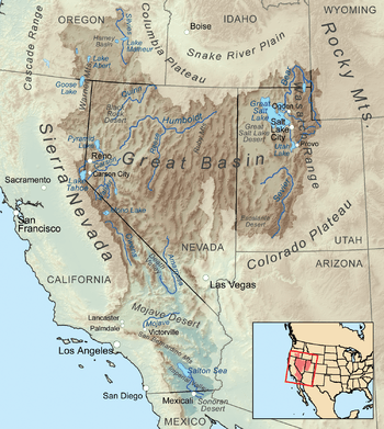
Indian Springs Pass, is a mountain pass 40-mi (64 km)[1] northwest of Las Vegas in northwest Clark County, Nevada.
The pass is in a region of converging landforms of various watersheds, valleys, and mountain ranges; specifically it lies on the north perimeter of the Ivanpah-Pahrump Watershed-(Pahrump Valley). The endorheic Indian Springs Valley[2] watershed lies due north, and the endorheic Three Lakes Valley is adjacent east.
Description of water divide regions
The following landforms converge at the Indian Springs Pass region:
- 1–(north)-Pahrump Valley-Spring Mountains, extends due south, (Pahrump Valley, of west watershed)
- 2–Spring Mountains-SE
- 3–Indian Springs Valley & Watershed, (endorheic)-N
- 4–south playas, south Three Lakes Valley (Nevada)-E & SE
The south playas of Three Lakes Valley, are on the northwest, up-basin perimeter of the Las Vegas Valley.
See also
References
Great Basin watersheds | ||
|---|---|---|
|  | |
This article is issued from
Wikipedia.
The text is licensed under Creative Commons - Attribution - Sharealike.
Additional terms may apply for the media files.