Ihľany
| Ihľany | |
| Municipality | |
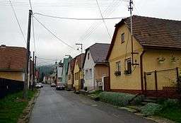 Street in Ihľany | |
| Country | Slovakia |
|---|---|
| Region | Prešov |
| District | Kežmarok |
| Elevation | 684 m (2,244 ft) |
| Coordinates | 49°11′00″N 20°32′15″E / 49.18333°N 20.53750°ECoordinates: 49°11′00″N 20°32′15″E / 49.18333°N 20.53750°E |
| Area | 9.587128 km2 (3.70 sq mi) |
| Population | 1,432 (2010) |
| Density | 149/km2 (386/sq mi) |
| Timezone | CET (UTC+1) |
| - summer (DST) | CEST (UTC+2) |
| Postal code | 059 94 |
| Area code | 052 |
 Location in Slovakia | |
| Statistics: | |
| Website: http://www.ihlany.sk | |
Ihľany is a village and municipality in Kežmarok District in the Prešov Region of north Slovakia.[1]
History
In historical records the village was first mentioned in 1307.
Geography
The municipality lies at an altitude of 706 metres and covers an area of 9.587 km². It has a population of about 1380 people.
See also
References
- ↑ "Statistical Office of the Slovak Republic" (PDF). Výsledky SODB 2011. Štatistický úrad SR. Archived from the original (PDF) on 2013-10-12. Retrieved 9 August 2012.
Genealogical resources
The records for genealogical research are available at the state archive "Statny Archiv in Levoca,Slovakia"
External links
- https://web.archive.org/web/20080111223415/http://www.statistics.sk/mosmis/eng/run.html
- http://www.ihlany.sk
- Surnames of living people in Ihlany
This article is issued from
Wikipedia.
The text is licensed under Creative Commons - Attribution - Sharealike.
Additional terms may apply for the media files.