Holumnica
| Holumnica | |
| Municipality | |
| Country | Slovakia |
|---|---|
| Region | Prešov |
| District | Kežmarok |
| Elevation | 594 m (1,949 ft) |
| Coordinates | 49°14′00″N 20°21′30″E / 49.23333°N 20.35833°ECoordinates: 49°14′00″N 20°21′30″E / 49.23333°N 20.35833°E |
| Area | 8.943600 km2 (3 sq mi) |
| Population | 872 (2010-12-31) |
| Density | 97/km2 (251/sq mi) |
| Timezone | CET (UTC+1) |
| - summer (DST) | CEST (UTC+2) |
| Postal code | 059 94 |
| Phone prefix | 421-53 |
| Car plate | KK |
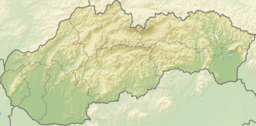 Location in Slovakia | |
| Website: http://obecholumnica.sk | |
Holumnica is a village and municipality in Kežmarok District in the Prešov Region of north Slovakia.[1]
History
In historical records the village was first mentioned in 1293.
Geography
The municipality lies at an altitude of 593 metres and covers an area of 8.944 km². It has a population of about 870 people.
Economy and infrastructure
In Holumnica is elementary school, kindergarten, public library, football pitch, post, medical service, foodstuff store and cable TV network. Cultural sightseeings are remnants of the castle, manor house, classical evangelical and gothic Roman Catholic churches.
See also
References
- ↑ "Statistical Office of the Slovak Republic" (PDF). Výsledky SODB 2011. Štatistický úrad SR. Archived from the original (PDF) on 2013-10-12. Retrieved 9 August 2012.
Genealogical resources
The records for genealogical research are available at the state archive "Statny Archiv in Levoca, Slovakia"
- Roman Catholic church records (births/marriages/deaths): 1768-1896 (parish A)
- Greek Catholic church records (births/marriages/deaths): 1877-1925 (parish B)
- Lutheran church records (births/marriages/deaths): 1785-1906 (parish A)
External links
This article is issued from
Wikipedia.
The text is licensed under Creative Commons - Attribution - Sharealike.
Additional terms may apply for the media files.