Lendak
| Lendak | |
| Village | |
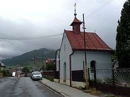 Chapel in Lendak, view on the village | |
| Country | Slovakia |
|---|---|
| Region | Prešov |
| District | Kežmarok |
| Elevation | 744 m (2,441 ft) |
| Coordinates | 49°14′39″N 20°21′20″E / 49.24417°N 20.35556°ECoordinates: 49°14′39″N 20°21′20″E / 49.24417°N 20.35556°E |
| Area | 19.658304 km2 (7.6 sq mi) |
| Population | 4,989 (2010) |
| Density | 254/km2 (658/sq mi) |
| First mentioned | 1288 |
| Timezone | CET (UTC+1) |
| - summer (DST) | CEST (UTC+2) |
| Postal code | 059 07 |
| Area code | 052 |
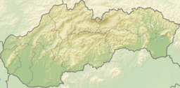 Location in Slovakia | |
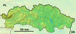 Location in the Prešov Region | |
| Statistics: | |
| Website: http://lendak.sk | |
Lendak is a village and municipality in Kežmarok District in the Prešov Region of north Slovakia.
Geography
The municipality lies at an altitude of 749 metres and covers an area of 19.658 km². It has a population of about 5200 people.
History
In historical records the village was first mentioned in 1288.
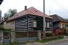
Typical folk architecture in Lendak
External links
This article is issued from
Wikipedia.
The text is licensed under Creative Commons - Attribution - Sharealike.
Additional terms may apply for the media files.