Horntown, Oklahoma
| Horntown, Oklahoma | |
|---|---|
| Town | |
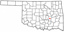 Location of Horntown, Oklahoma | |
| Coordinates: 35°5′2″N 96°14′59″W / 35.08389°N 96.24972°WCoordinates: 35°5′2″N 96°14′59″W / 35.08389°N 96.24972°W | |
| Country | United States |
| State | Oklahoma |
| County | Hughes |
| Area | |
| • Total | 4.00 sq mi (10.37 km2) |
| • Land | 3.95 sq mi (10.23 km2) |
| • Water | 0.05 sq mi (0.14 km2) |
| Elevation | 843 ft (257 m) |
| Population (2010) | |
| • Total | 97 |
| • Density | 25/sq mi (9.5/km2) |
| Time zone | UTC-6 (Central (CST)) |
| • Summer (DST) | UTC-5 (CDT) |
| FIPS code | 40-36090[1] |
| GNIS feature ID | 1093929[2] |
Horntown is a town in Hughes County, Oklahoma, United States. The population was 97 at the 2010 census,[3] up from 61 at the 2000 census.
Geography
Horntown is located in central Hughes County at 35°5′2″N 96°14′59″W / 35.08389°N 96.24972°W (35.084025, -96.249711).[4] The lightly populated town is centered on the intersection of U.S. Routes 75 and 270. US 75 leads north 10 miles (16 km) to Wetumka, while US 270 leads west 8 miles (13 km) to Holdenville, the Hughes county seat. The two highways join in Horntown and lead south 8 miles (13 km) to Calvin.
According to the United States Census Bureau, Horntown has a total area of 4.0 square miles (10.4 km2), of which 0.04 square miles (0.1 km2), or 1.33%, are water.[3] The town drains north via Grief Creek and Graves Creek to Wewoka Creek, a tributary of the North Canadian River.
Demographics
| Historical population | |||
|---|---|---|---|
| Census | Pop. | %± | |
| 2000 | 61 | — | |
| 2010 | 97 | 59.0% | |
| Est. 2015 | 94 | [5] | −3.1% |
| U.S. Decennial Census[6] | |||
As of the census[1] of 2000, there were 61 people, 27 households, and 21 families residing in the town. The population density was 15.2 people per square mile (5.9/km²). There were 30 housing units at an average density of 7.5 per square mile (2.9/km²). The racial makeup of the town was 88.52% White and 11.48% Native American.
There were 27 households out of which 25.9% had children under the age of 18 living with them, 70.4% were married couples living together, 3.7% had a female householder with no husband present, and 22.2% were non-families. 18.5% of all households were made up of individuals and 7.4% had someone living alone who was 65 years of age or older. The average household size was 2.26 and the average family size was 2.57.
In the town, the population was spread out with 14.8% under the age of 18, 8.2% from 18 to 24, 27.9% from 25 to 44, 36.1% from 45 to 64, and 13.1% who were 65 years of age or older. The median age was 44 years. For every 100 females, there were 90.6 males. For every 100 females age 18 and over, there were 100.0 males.
The median income for a household in the town was $36,250, and the median income for a family was $54,583. Males had a median income of $29,167 versus $22,500 for females. The per capita income for the town was $16,802. There were no families and 6.9% of the population living below the poverty line, including no under eighteens and none of those over 64.
References
- 1 2 "American FactFinder". United States Census Bureau. Retrieved 2008-01-31.
- ↑ "US Board on Geographic Names". United States Geological Survey. 2007-10-25. Retrieved 2008-01-31.
- 1 2 "Geographic Identifiers: 2010 Census Summary File 1 (G001): Horntown town, Oklahoma". American Factfinder. U.S. Census Bureau. Retrieved January 17, 2018.
- ↑ "US Gazetteer files: 2010, 2000, and 1990". United States Census Bureau. 2011-02-12. Retrieved 2011-04-23.
- ↑ "Annual Estimates of the Resident Population for Incorporated Places: April 1, 2010 to July 1, 2015". Archived from the original on June 2, 2016. Retrieved July 2, 2016.
- ↑ "Census of Population and Housing". Census.gov. Archived from the original on May 12, 2015. Retrieved June 4, 2015.
External links
Municipalities and communities of Hughes County, Oklahoma, United States | ||
|---|---|---|
| Cities | 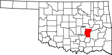 | |
| Towns | ||
| Footnotes | ‡This populated place also has portions in an adjacent county or counties | |