Gerty, Oklahoma
| Gerty, Oklahoma | |
|---|---|
| Town | |
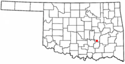 Location of Gerty, Oklahoma | |
| Coordinates: 34°50′10″N 96°17′24″W / 34.83611°N 96.29000°WCoordinates: 34°50′10″N 96°17′24″W / 34.83611°N 96.29000°W | |
| Country | United States |
| State | Oklahoma |
| County | Hughes |
| Area | |
| • Total | 0.24 sq mi (0.63 km2) |
| • Land | 0.24 sq mi (0.63 km2) |
| • Water | 0.0 sq mi (0.0 km2) |
| Elevation | 843 ft (257 m) |
| Population (2010) | |
| • Total | 118 |
| • Density | 484/sq mi (186.9/km2) |
| Time zone | UTC-6 (Central (CST)) |
| • Summer (DST) | UTC-5 (CDT) |
| FIPS code | 40-29150[1] |
| GNIS feature ID | 1093171[2] |
Gerty is a town in Hughes County, Oklahoma, United States. The population was 118 at the 2010 census.[3]
Geography
Gerty is located in southern Hughes County at 34°50′10″N 96°17′24″W / 34.83611°N 96.29000°W (34.836064, -96.289900).[4] It is 2 miles (3 km) west of U.S. Route 75 and 12 miles (19 km) south of Calvin.
According to the United States Census Bureau, the town of Gerty has a total area of 0.2 square miles (0.6 km2), all of it land.[3] The town drains south to Panther Creek, a tributary of Muddy Boggy Creek and part of the Red River watershed.
Demographics
| Historical population | |||
|---|---|---|---|
| Census | Pop. | %± | |
| 1910 | 305 | — | |
| 1920 | 251 | −17.7% | |
| 1930 | 137 | −45.4% | |
| 1940 | 206 | 50.4% | |
| 1950 | 155 | −24.8% | |
| 1960 | 135 | −12.9% | |
| 1970 | 139 | 3.0% | |
| 1980 | 149 | 7.2% | |
| 1990 | 95 | −36.2% | |
| 2000 | 101 | 6.3% | |
| 2010 | 118 | 16.8% | |
| Est. 2015 | 114 | [5] | −3.4% |
| U.S. Decennial Census[6] | |||
As of the census[1] of 2000, there were 101 people, 40 households, and 29 families residing in the town. The population density was 414.2 people per square mile (162.5/km²). There were 51 housing units at an average density of 209.1 per square mile (82.0/km²). The racial makeup of the town was 83.17% White, 12.87% Native American, and 3.96% from two or more races. Hispanic or Latino of any race were 0.99% of the population.
There were 40 households out of which 37.5% had children under the age of 18 living with them, 52.5% were married couples living together, 10.0% had a female householder with no husband present, and 27.5% were non-families. 25.0% of all households were made up of individuals and 12.5% had someone living alone who was 65 years of age or older. The average household size was 2.53 and the average family size was 2.90.
In the town, the population was spread out with 29.7% under the age of 18, 8.9% from 18 to 24, 19.8% from 25 to 44, 27.7% from 45 to 64, and 13.9% who were 65 years of age or older. The median age was 34 years. For every 100 females, there were 106.1 males. For every 100 females age 18 and over, there were 91.9 males.
The median income for a household in the town was $20,250, and the median income for a family was $18,750. Males had a median income of $23,750 versus $13,750 for females. The per capita income for the town was $8,496. There were 20.0% of families and 25.3% of the population living below the poverty line, including 25.0% of under eighteens and 50.0% of those over 64.
History
Local tradition holds that the town of Gerty was originally named "Buzzard Flop". The name was changed early in the 20th century in an effort to attract tourism. As tastes have changed, there is currently a discussion among town members of changing it back for the same reason.
References
- 1 2 "American FactFinder". United States Census Bureau. Archived from the original on 2013-09-11. Retrieved 2008-01-31.
- ↑ "US Board on Geographic Names". United States Geological Survey. 2007-10-25. Retrieved 2008-01-31.
- 1 2 "Geographic Identifiers: 2010 Census Summary File 1 (G001): Gerty town, Oklahoma". American Factfinder. U.S. Census Bureau. Retrieved January 17, 2018.
- ↑ "US Gazetteer files: 2010, 2000, and 1990". United States Census Bureau. 2011-02-12. Retrieved 2011-04-23.
- ↑ "Annual Estimates of the Resident Population for Incorporated Places: April 1, 2010 to July 1, 2015". Archived from the original on June 2, 2016. Retrieved July 2, 2016.
- ↑ "Census of Population and Housing". Census.gov. Archived from the original on May 12, 2015. Retrieved June 4, 2015.
External links
Municipalities and communities of Hughes County, Oklahoma, United States | ||
|---|---|---|
| Cities | 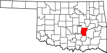 | |
| Towns | ||
| Footnotes | ‡This populated place also has portions in an adjacent county or counties | |