Horningsea Park, New South Wales
| Horningsea Park Sydney, New South Wales | |||||||||||||||
|---|---|---|---|---|---|---|---|---|---|---|---|---|---|---|---|
 Trash and Treasure markets | |||||||||||||||
|
Horningsea Park | |||||||||||||||
| Coordinates | 33°56′38″S 150°50′38″E / 33.94389°S 150.84389°ECoordinates: 33°56′38″S 150°50′38″E / 33.94389°S 150.84389°E | ||||||||||||||
| Established | 1996 | ||||||||||||||
| Postcode(s) | 2171 | ||||||||||||||
| Location | 39 km (24 mi) south-west of Sydney | ||||||||||||||
| LGA(s) | City of Liverpool | ||||||||||||||
| State electorate(s) | Liverpool | ||||||||||||||
| Federal Division(s) | Werriwa | ||||||||||||||
| |||||||||||||||
Horningsea Park is a suburb of Sydney, in the state of New South Wales, Australia. Horningsea Park is located 39 kilometres south-west of the Sydney central business district, in the local government area of the City of Liverpool and is part of the Greater Western Sydney region.
History
In 1819, Joshua John Moore a British grazier was granted 500 acres (2.0 km2) in what was then known as Cabramatta. He named his property "Horningsea" after his birthplace, the village of Horningsea in Cambridgeshire, England. In the 1830s, he built a grand house which still stands to this day in Horningsea Park Drive and is listed on the Register of the National Estate. The house was at some stage home to Count Strzelecki, the Polish-born explorer who named Mount Kosciuszko.[1] It was purchased around 1855 by Vaiben Solomon (1802–1860), and it was around this time it was first called Horningsea Park.[2] Vaiben and his family lived there and ran the farm until 1872.
The suburb was part of neighbouring Hoxton Park and largely farmland until 1996 when Long Homes subdivided the area for housing and Liverpool Council named it after Moore's estate.[3]
Horningsea Park has a number of heritage-listed sites, including:
- Camden Valley Way: Horningsea Park[4]
Commercial area
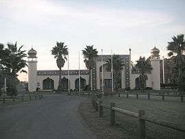
Carnes Hill Marketplace is a large shopping centre at the northern edge of the suburb. At the southern edge are the Trash and Treasure markets, a familiar landmark to passers by on Camden Valley Way.
Schools
There are two schools in Horningsea Park. The Holy Spirit Primary School is a Catholic school behind the Carnes Hill Marketplace. John Edmondson High School is a state high school on Horningsea Park Drive.
Transport
Cowpasture Road and Camden Valley Way are the main roads in and out of Horningsea Park, the latter providing connection to Liverpool and Camden. Horningsea Park is the terminus for four Busabout bus services to Liverpool, two via Cowpastures Road and Hoxton Park, and two via Camden Valley Way, Prestons and Lurnea.[5] In 2015, railway stations opened in the neighbouring suburbs of Edmondson Park and Leppington.
Notable residents
- Joshua John Moore (1790–1864), grazier whose house Horningsea Park gave the suburb its name.[6]
- Paweł Edmund Strzelecki (1797–1873), explorer who named Mount Kosciuszko.[7]
- Vaiben Solomon (c1800 - 1860) arrived NSW 1817, ex convict and early Australian pioneer, businessman and philanthropist, involved in the building of the first Sydney synagogue.
References
- ↑ "Horningsea Park (Place ID 3296)". Australian Heritage Database. Department of the Environment. Retrieved 2008-04-21.
- ↑ "Advertising". The Sydney Morning Herald. National Library of Australia. 2 April 1856. p. 1. Retrieved 15 January 2016.
- ↑ "Horningsea Park". Geographical Names Register (GNR) of NSW. Geographical Names Board of New South Wales. Retrieved 14 June 2009.
- ↑ "Horningsea Park, New South Wales State Heritage Register (NSW SHR) Number H00255". New South Wales State Heritage Register. Office of Environment and Heritage. Retrieved 18 May 2018.
- ↑ "Busabout Network Map". Busabout. Archived from the original on 2008-07-21. Retrieved 2008-04-19.
- ↑ "Moore, Joshua John (1790 - 1864)". Australian Dictionary of Biography Online. Retrieved 2008-04-21.
- ↑ "Strzelecki, Sir Paul Edmund de (Count Strzelecki) (1797 - 1873)". Australian Dictionary of Biography Online. Retrieved 2008-04-21.
| Wikimedia Commons has media related to Horningsea Park, New South Wales. |