Camden, New South Wales
| Camden Sydney, New South Wales | |||||||||||||||
|---|---|---|---|---|---|---|---|---|---|---|---|---|---|---|---|
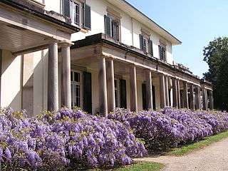
.jpg) Argyle Street, Camden | |||||||||||||||
|
Camden | |||||||||||||||
| Coordinates | 34°03′16″S 150°41′45″E / 34.05444°S 150.69583°ECoordinates: 34°03′16″S 150°41′45″E / 34.05444°S 150.69583°E | ||||||||||||||
| Population | 3,230 (2016 census)[1] | ||||||||||||||
| Established | 1840 | ||||||||||||||
| Postcode(s) | 2570 | ||||||||||||||
| Location | 65 km (40 mi) south-west of Sydney CBD | ||||||||||||||
| LGA(s) | Camden Council | ||||||||||||||
| Region | Macarthur | ||||||||||||||
| State electorate(s) | Camden | ||||||||||||||
| Federal Division(s) | Hume | ||||||||||||||
| |||||||||||||||
Camden is a historic town, south-west of Sydney, New South Wales, located 65 kilometres from the Sydney central business district. Camden is the administrative centre for the local government area of Camden Council and is a part of the Macarthur region.
History
Indigenous people
The area now known as Camden was originally at the northern edge of land belonging to the Gandangara people of the Southern Highlands who called it Benkennie meaning 'dry land'. North of the Nepean River were the Muringong, southernmost of the Darug people while to the east were the Tharawal people. They lived in extended family groups of 20–40 members, hunting kangaroos, possums and eels and gathering yams and other seasonal fruit and vegetables from the local area. They were described as 'short, stocky, strong and superbly built' and generally considered peaceful. However, as British settlers encroached on their land and reduced their food sources, they turned to armed resistance which ended in 1816 after many of their number were massacred.[2]
European settlement
Explorers first visited the area in 1795 and named it 'Cowpastures' after a herd of cattle that had disappeared was discovered there. In February 1805, Governor King instructed (apparently reluctantly) a surveyor to measure 5,000 acres (2,000 ha) for John Macarthur at Cowpastures, where Macarthur had been promised land by the Secretary of State for War and the Colonies, Lord Camden. Macarthur named his property Camden Park in honour of his sponsor.[3]
As Macarthur's wool industry thrived, local citizens began pushing for the establishment of a town in the area to support the industry. Surveyor-General Major Thomas Mitchell suggested Macarthur surrender 320 acres (130 ha) of his land for the purpose to which he refused. Following his death in 1834, his children decided to subdivide the land and the first lots in the new town of Camden went on sale in 1840. Camden Post Office opened on 1 May 1841, the day after the nearby Elderslie office (open from 1839) closed.[4] By 1883, the population had grown to over 300 and a movement began to establish a local council which held its first meeting in 1889.
Heritage listings
Camden has the following heritage-listed sites:
- 135 Argyle Street: Camden Post Office[5]
- Aerodrome Road, Cobbitty: Macquarie Grove[6]
- Exeter Street: Nant Gwylan and Garden[7]
Transport
Between 1882 and 1962 Camden was connected to Campbelltown and Sydney by the Camden railway line. Camden is served by Camden Airport, which is mostly used by trainee pilots for flying schools, the Australian Air League, and other forms of general aviation.
Climate
Camden has a humid subtropical climate (Köppen climate classification: Cfa).
| Climate data for Camden Airport | |||||||||||||
|---|---|---|---|---|---|---|---|---|---|---|---|---|---|
| Month | Jan | Feb | Mar | Apr | May | Jun | Jul | Aug | Sep | Oct | Nov | Dec | Year |
| Record high °C (°F) | 46.4 (115.5) |
45.6 (114.1) |
41.0 (105.8) |
38.5 (101.3) |
29.5 (85.1) |
24.9 (76.8) |
27.0 (80.6) |
30.2 (86.4) |
36.5 (97.7) |
40.5 (104.9) |
42.6 (108.7) |
43.1 (109.6) |
46.4 (115.5) |
| Average high °C (°F) | 29.7 (85.5) |
28.7 (83.7) |
26.8 (80.2) |
23.9 (75) |
20.7 (69.3) |
17.7 (63.9) |
17.4 (63.3) |
19.1 (66.4) |
22.0 (71.6) |
24.4 (75.9) |
26.3 (79.3) |
28.6 (83.5) |
23.8 (74.8) |
| Daily mean °C (°F) | 23.3 (73.9) |
22.7 (72.9) |
20.8 (69.4) |
17.5 (63.5) |
13.8 (56.8) |
11.1 (52) |
10.1 (50.2) |
11.5 (52.7) |
14.4 (57.9) |
17.2 (63) |
19.6 (67.3) |
21.9 (71.4) |
17 (62.6) |
| Average low °C (°F) | 16.9 (62.4) |
16.8 (62.2) |
14.9 (58.8) |
11.1 (52) |
7.0 (44.6) |
4.6 (40.3) |
2.9 (37.2) |
3.9 (39) |
6.8 (44.2) |
10.0 (50) |
13.0 (55.4) |
15.3 (59.5) |
10.3 (50.5) |
| Record low °C (°F) | 7.9 (46.2) |
7.2 (45) |
5.9 (42.6) |
−0.7 (30.7) |
−2.2 (28) |
−5.4 (22.3) |
−6.0 (21.2) |
−4.0 (24.8) |
−1.8 (28.8) |
1.3 (34.3) |
3.8 (38.8) |
5.7 (42.3) |
−6.0 (21.2) |
| Average precipitation mm (inches) | 79.8 (3.142) |
97.3 (3.831) |
89.6 (3.528) |
67.1 (2.642) |
53.0 (2.087) |
66.6 (2.622) |
35.5 (1.398) |
40.7 (1.602) |
38.3 (1.508) |
60.7 (2.39) |
75.1 (2.957) |
56.4 (2.22) |
788.0 (31.024) |
| Average precipitation days (≥ 0.2 mm) | 10.3 | 11.0 | 10.6 | 9.4 | 8.5 | 9.0 | 8.1 | 7.6 | 7.9 | 9.6 | 10.3 | 9.2 | 111.5 |
| Average afternoon relative humidity (%) | 49 | 52 | 52 | 52 | 52 | 53 | 50 | 43 | 44 | 47 | 50 | 46 | 49 |
| Source: [8] | |||||||||||||
Education
Camden is the location of research facilities for the veterinary and agricultural schools of the University of Sydney. The local government area has three public high schools, Camden High School, Elderslie High School and Elizabeth Macarthur High School, as well as eight Catholic and three Anglican schools.
Culture
The Camden Show is an annual event which combines amusement park attractions with the elements of a state fair. Camden is served by three local radio stations, 2MCR, Vintage FM and C91.3FM. Local newspapers are the Camden Advertiser,[9] the District Reporter and the Macarthur Chronicle.
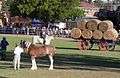 Camden Show 2011, main arena.
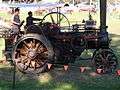 Traction engine, Camden Show
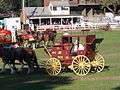 Camden Show 2011, Cobb & Co. coach
People
Demographics
According to the 2016 census, there were 3,230 residents in Camden. In Camden, 80.0% of people were born in Australia. The most common other countries of birth were England 4.5%, New Zealand 1.6%, Scotland 0.9%, Ireland 0.8% and Germany 0.6%. 87.8% of people only spoke English at home. Other languages spoken at home included Spanish 0.6%, German 0.5%, Croatian 0.5%, Mandarin 0.4% and Italian 0.4%. The most common responses for religion in Camden were Catholic 30.7%, Anglican 26.4% and No Religion 19.9%.[1]
Politics
Camden lies within the local government area of Camden Council. The council consists of nine councillors; three for each of the three wards; North Ward (Bringelly, Rossmore, Leppington, Cobbitty, Oran Park, Catherine Field, Harrington Park, Kirkham), Central Ward (Mount Annan, Currans Hill, Smeaton Grange, Narellan Vale) and South Ward (Ellis Lane, Narellan, Grasmere, Camden, Elderslie, Spring Farm, Bickley Vale, Cawdor, Camden South). Lara Symkowiak was elected mayor in 2012.
The southern part of the Camden LGA including Camden town center is contained within the federal electorate of Hume while the northern end of the LGA (north of Narellan Road) is within the federal electorate of Macarthur. The state seat of Camden covers all of the Camden LGA, and parts of the City of Campbelltown and the City of Liverpool.
The state member for Camden is Chris Patterson, first elected in 2011. The federal member for Macarthur is Mike Freelander, first elected in 2016 and the federal member for Hume is Angus Taylor, first elected in 2013. Both Angus Taylor and Chris Patterson are members of the Liberal Party of Australia while Mike Freelander is a member of the Australian Labor Party.
Planning issues
On 27 May 2008 Camden Council rejected plans from the Quranic Society to build a 1,200-student Islamic school in the nearby suburb of Cawdor on planning grounds. The site was 2.5 kilometres (1.6 mi) south of the centre of Camden adjacent to the Camden General Cemetery and 800 metres (2,600 ft) north of the then recently relocated Camden High School. The issue received national[10] and international media coverage.[11] The proposal was opposed from within the local community, many expressing fear about the presence of Muslims in an area where relatively few Muslims live.[12] There were angry, racially based comments by a number of residents in Camden.[13] The Christian Democratic Party (CDP) opposed the proposal. Speaking at a public meeting in December 2007, CDP leader Fred Nile (present alongside Robert Balzola) said he opposed the school "because Islam opposed Christianity". A spokesman for the Quranic Society said it was "absurd" to claim that Muslims are anti-Christian.[14]
In making its decision several council members, including Mayor Chris Patterson, said the school was inappropriate for the semi-rural area of Camden and likely to cause parking, traffic and other problems.[15] Australian Prime Minister Kevin Rudd indicated before the council decision that he wouldn't support the school on planning grounds.[16] The Quranic Society said it will appeal the Council's decision in the Land and Environment Court of New South Wales.
In September 2008, a proposal to build a private Catholic school received media attention for not provoking the same sort of outcry as the previous proposal. News authority failed to note this school had already been located in Camden (Cobbity) for several years and was a special needs school. Some residents who were not supportive of the Islamic school now welcomed the Catholic school proposal. The Catholic school proposal is set in a different location, where it has been argued that such a development would be suitable.[17]
On 2 June 2009, The Land and Environment Court passed down the decision to reject the appeal by the Quranic Society, with the court stating that the "development application was not suitable for the rural nature of the land."[18]
Notable residents
- Steven Bradbury, short track speed skater who won Australia's first Winter Olympics gold medal
- Rob Hirst, drummer with the band Midnight Oil
- John Macarthur, father of the Australian wool industry
- Mat Mladin, world motorcycle champion
- Professor Graeme Clark, inventor of the Bionic Ear
- Hugh McCrae, Australian poet, biographer, illustrator
- James Francis Dwyer (1874–1952), author [19]
- Francis Arthur Macarthur-Onslow (1875–1938), grazier and businessman[20]
- James William Macarthur-Onslow (1867–1946), soldier, grazier and politician [21]
- Joan Mary Woodhill, (1912–1990), dietition[22]
- Roy Darrell Stuckey, (1900–1985), town clerk[23]
- Chloe Esposito, modern pentathlon competitor who won the gold medal in the 2016 Rio olympics
References
- 1 2 Australian Bureau of Statistics (27 June 2017). "Camden(State Suburb)". 2016 Census QuickStats. Retrieved 2017-10-16.

- ↑ "The History of Camden". Camden Historical Society. Archived from the original on 31 August 2007. Retrieved 14 June 2007.
- ↑ "The History of Camden". Camden Council. Archived from the original on 3 April 2007. Retrieved 10 June 2007.
- ↑ Premier Postal History. "Post Office List". Archived from the original on 19 August 2008. Retrieved 11 April 2008.
- ↑ "Camden Post Office (Place ID 106176)". Australian Heritage Database. Department of the Environment. Retrieved 22 September 2018.
- ↑ "Macquarie Grove, New South Wales State Heritage Register (NSW SHR) Number H00493". New South Wales State Heritage Register. Office of Environment and Heritage. Retrieved 18 May 2018.
- ↑ "Nant Gwylan and Garden, New South Wales State Heritage Register (NSW SHR) Number H00243". New South Wales State Heritage Register. Office of Environment and Heritage. Retrieved 18 May 2018.
- ↑ "Climate statistics for Camden Airport AWS". Bureau of Meteorology. Archived from the original on 28 September 2018. Retrieved 28 September 2018.
- ↑ "camdenadvertiser.com.au". camdenadvertiser.com.au. Archived from the original on 3 September 2018. Retrieved 3 September 2013.
- ↑ Camden locals oppose proposed Islamic school Archived 7 June 2008 at the Wayback Machine.; Politicians, locals oppose Islamic school Archived 26 December 2007 at the Wayback Machine.; Backlash over new Islamic school Archived 30 April 2008 at the Wayback Machine.; Cops block mass Muslim protest Archived 23 December 2007 at the Wayback Machine.; Camden Council rejects Islamic school Archived 30 May 2008 at the Wayback Machine.; Anti-Islamic school Camden 'not racist' Archived 29 May 2008 at the Wayback Machine.
- ↑ Town moves against Islamic school Archived 30 May 2008 at the Wayback Machine.; Australia Muslim school rejected Archived 30 May 2008 at the Wayback Machine.; Australia Muslim school rejected Archived 28 May 2008 at the Wayback Machine..
- ↑ Residents uneasy amid opposition to Muslim school Archived 28 May 2008 at the Wayback Machine.; pigs heads staked at Islamic-school-site Archived 6 August 2008 at the Wayback Machine.
- ↑ "The Islamic school furore in Australia. Camden, Sydney". Youtube.com. Archived from the original on 17 April 2016. Retrieved 3 September 2013.
- ↑ "Nile party behind anti-Muslim school rally". Smh.com.au. 21 December 2007. Archived from the original on 30 April 2008. Retrieved 3 September 2013.
- ↑ Dart, Jonathon (28 May 2008). "Islamic school rejected". The Sydney Morning Herald. Fairfax. Archived from the original on 30 May 2008. Retrieved 28 May 2008. ; Lyons, John (28 May 2008). "Camden Council votes down Islamic school". The Australian. News.com.au. Archived from the original on 28 May 2008. Retrieved 31 May 2008.
- ↑ "Rudd opposed to Islamic school". Archived from the original on 29 May 2008. Retrieved 2 June 2008.
- ↑ "smh.com.au". smh.com.au. 9 September 2008. Archived from the original on 9 September 2008. Retrieved 3 September 2013.
- ↑ "Court rejects Sydney Islamic school – ABC News (Australian Broadcasting Corporation)". Abc.net.au. 2 June 2009. Archived from the original on 14 July 2009. Retrieved 3 September 2013.
- ↑ Stewart, Ken (1981). "Dwyer, James Francis (1874–1954)". Australian Dictionary of Biography. Ken Stewart. Archived from the original on 28 December 2014.
- ↑ Walsh, G.P (1986). "Macarthur-Onslow, Francis Arthur (1875–1938)". Australian Dictionary of Biography. G.P Walsh. Archived from the original on 27 March 2015.
- ↑ Walsh, G.P. (1986). "Macarthur-Onslow, James William (1867–1946)". Australian Dictionary of Biography. Archived from the original on 2 April 2015. Retrieved 30 March 2015.
- ↑ Brown, Dianna (2012). "Woodhill, Joan Mary". Australian Dictionary of Biography. Archived from the original on 2 April 2015.
- ↑ Knight, Kenneth W. (2012). "Stuckey, Roy Darrell (1900–1985)". Australian Dictionary of Biography. Archived from the original on 4 April 2015. Retrieved 30 March 2015.
External links
| Wikimedia Commons has media related to Camden, New South Wales. |
- Ian Willis (2008). "Camden". Dictionary of Sydney. Retrieved 25 September 2015. [CC-By-SA]
- Camden Council website
- Camden Show Society website
- Camden Advertiser website
- Minutes of the Camden Council meeting of 27 May 2008, when the Quaranic School application was discussed