Ontario Highway 10
| ||||
|---|---|---|---|---|
| Route information | ||||
| Length | 137.3 km[1] (85.3 mi) | |||
| History |
Established September 1848[2] Designated February 26, 1920[3] | |||
| Major junctions | ||||
| South end |
Northern terminus of | |||
|
| ||||
| North end |
| |||
| Location | ||||
| Major cities | Owen Sound, Brampton | |||
| Towns | Markdale, Shelburne, Orangeville, Caledon | |||
| Highway system | ||||
| ||||

King's Highway 10, commonly referred to as Highway 10 is a provincially maintained highway in the Canadian province of Ontario. The highway connects the northern end of Highway 410 with the city of Owen Sound on the southern shores of Georgian Bay, passing through the towns of Orangeville and Shelburne as well as several smaller villages along the way. It historically followed the Toronto–Sydenham Road, part of which later became Hurontario Street, as well as Prince of Wales Road. [4]
The highway was established in 1920 as one of the original provincial highways. It was extended south by 1937 to Highway 2 in Port Credit. That same year, it became the site of the first interchange in Canada at The Middle Road. Since the late 1990s, the southern end has been truncated to its current terminus north of the Brampton–Caledon border.
Route description
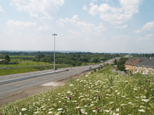


Highway 10 follows a route originally carved through the virgin forests of Upper Canada in 1848. Its route has remained largely unchanged since that time, and the highway still divides many of the towns it serves, with the exception of Orangeville. It acts as the meridian for the Regional Municipality of Peel; parallel sidelines are divided into East and West in several cases by the highway.
Beginning at its southern end in Caledon, Highway 10, following the Hurontario Street alignment, passes to the west of Valleywood, a suburban community on the fringe of the Greater Toronto Area. The highway presses northwest and rises gently over the Niagara Escarpment, a World Biosphere Reserve. Immediately to the west are the Forks of the Credit, a deep glacial ravine and provincial park regarded for its scenery. The highway passes between several large quarries and enters Caledon Village. Continuing, it reaches Orangeville at Highway 9. The highway passes to the east of Orangeville on a bypass, switching between the Hurontario St. and Prince of Wales Rd. alignments, avoiding the business district. At the north end of the bypass, the highway curves and proceeds directly north towards the village of Primrose at Highway 89.
Highway 10 turns west, becoming concurrent with Highway 89 for a short distance, into the town of Shelburne. The concurrency ends in the centre of Shelburne, as Highway 10 splits and turns north and then resumes its northwesterly course. From Shelburne to Owen Sound, the road follows the northernmost part of the former Toronto–Sydenham Road, a colonization road that predates the division of the land in this area. As such, the road follows a diagonal path to the survey grid. It briefly merges with Ontario Highway 6 in Owen Sound before it ends, while Highway 6 goes on to Tobermory.
History
Historically, Highway 10 follows the 19th-century stagecoach route known as the Toronto–Sydenham Road (the southern half of which later became absorbed into Hurontario Street), which travelled north from Dundas Street (later Highway 5) in Cooksville through Brampton, Orangeville and Shelburne to Owen Sound. It was first designated as a provincial highway on February 26, 1920 when the newly formed Department of Highways assumed the road. It was later extended south when the provincial government assumed the remaining stretch to Lakeshore Road (Highway 2) in Port Credit, on the north shore of Lake Ontario.[5] At that point, the total length of the highway was 166 km.
The highway formerly turned west onto Highway 9 and ran concurrently with it through downtown Orangeville along Broadway, then turned north to follow First Street (the Prince of Wales Road alignment). In 1968, the bypass around Orangeville was completed, bypassing a short section of the Hurontario Street alignment, which is today a dead end providing access to a hotel.[6]

In 1998, due to the combination of increasing urbanization and the presence of the parallel Highway 410 through most of the corridor, the provincial government repealed the connecting link agreement for the southernmost 31 km of the highway running through Brampton and Mississauga, which was already effectively under the control of their respective municipal governments. However, the street is still often colloquially referred to by the former highway number in these cities. In 2009, Highway 410 was connected to Highway 10 about 500 metres north of Highway 10's southernmost terminus at the border of Brampton. The 500-metre "orphaned" segment is now discontinuous, and while still technically part of the highway, is only linked to the rest of the highway via a connecting road, and is signed only as "Hurontario Street" rather than with both the street name and highway number.
Also in 2009, a major project to widen two-lane sections of the southern portions of the highway was completed, and the highway is now four lanes wide from Highway 410 north to Camilla. From Shelburne north to Owen Sound, it remains a two-lane highway with several passing lanes in hillier regions.
During winter, the northern stretches of the highway that pass through the snowbelt region of Grey County are subject to poor visibility and road closings during windy conditions or winter storms.
Major intersections
The following table lists the major junctions along Highway 10, as noted by the Ministry of Transportation of Ontario.[1]
| Division | Location | km[1] | mi | Destinations | Notes | |
|---|---|---|---|---|---|---|
| Peel | Mississauga | −28.9 | −18.0 | Southern terminus of Highway 10 prior to 1998, under a connecting link agreement through Mississauga and Brampton Highway 2's connecting link agreement was also repealed in 1998 | ||
| −26.9 | −16.7 | |||||
| −25.0 | −15.5 | Highway 5's connecting link agreement was repealed in 1998 | ||||
| −22.9 | −14.2 | Burnhamthorpe Road | ||||
| −21.8 | −13.5 | |||||
| −20.8 | −12.9 | Eglinton Avenue | ||||
| −17.2 | −10.7 | |||||
| Brampton | −13.5 | −8.4 | ||||
| −11.6 | −7.2 | |||||
| −8.5 | −5.3 | Queen Street | ||||
| −5.4 | −3.4 | Highway 7 was downloaded to the Region of Peel in 1998. Currently Regional Road 107. | ||||
| −1.0 | −0.62 | End of former Mississauga-Brampton connecting link agreement | ||||
| Caledon | 0.0 | 0.0 | Highway 10 now officially begins just south of where Highway 410 ends | |||
| 5.2 | 3.2 | |||||
| 14.5 | 9.0 | Forks of the Credit Road | ||||
| 18.9 | 11.7 | Formerly Highway 24; south end of former Highway 24 concurrency. | ||||
| Peel–Dufferin boundary | Orangeville | 28.3 | 17.6 | Highway 10 departs the Hurontario Street alignment | ||
| Dufferin | 28.9 | 18.0 | County road serving as a Highway 9 bypass of Orangeville that links discontinuous sections of that highway | |||
| 29.4 | 18.3 | Broadway / Buena Vista Drive | Former route of Highway 9 | |||
| Biggles | 32.2 | 20.0 | County Road 7 east (Hockley Road) – Loretto County Road 16 west (5th Sideroad) | |||
| Camilla | 38.3 | 23.8 | County Road 8 east (Mono Centre Road) – Mono Centre | |||
| Primrose | 48.6 | 30.2 | Beginning of Highway 89 concurrency (and former triple concurrency with Highway 24) | |||
| Shelburne | 52.6 | 32.7 | County Road 124 north – Collingwood | Formerly Highway 24; end of former triple concurrency | ||
| 53.9 | 33.5 | End of Highway 89 concurrency | ||||
| Dufferin–Grey boundary | Dundalk | 72.7 | 45.2 | County Road 9 west County Road 9 east – Creemore | ||
| Grey | Chatsworth | 124.5 | 77.4 | Beginning of Highway 6 concurrency | ||
| Owen Sound | 137.3 | 85.3 | End of Highway 6 concurrency; Highway 6 continues west concurrent with Highway 21 | |||
1.000 mi = 1.609 km; 1.000 km = 0.621 mi
| ||||||
See also
References
| Wikimedia Commons has media related to Ontario Highway 10. |
- Sources
- 1 2 3 Ministry of Transportation of Ontario (2010). "Annual Average Daily Traffic (AADT) counts". Government of Ontario. Retrieved March 20, 2016.
- ↑ Shragge 1984, p. 40.
- ↑ Shragge 1984, p. 74.
- ↑ "Heritage Walking Tour Brochure (PDF)". History of Orangeville (Page 7). Town of Orangeville. Retrieved September 28, 2018.
- ↑ Shragge 1948, p. 74.
- ↑ "Google Maps view of Hwy. 10 aligned with First St. at the north end of the bypass".
- Bibliography
- Shragge, John; Bagnato, Sharon (1984). From Footpaths to Freeways. Ontario Ministry of Transportation and Communications, Historical Committee. ISBN 0-7743-9388-2.

