Hemlock, Tillamook County, Oregon
| Hemlock | |
|---|---|
| Unincorporated community | |
 Hemlock Location within the state of Oregon  Hemlock Hemlock (the US) | |
| Coordinates: 45°18′56″N 123°50′12″W / 45.31556°N 123.83667°WCoordinates: 45°18′56″N 123°50′12″W / 45.31556°N 123.83667°W | |
| Country | United States |
| State | Oregon |
| County | Tillamook |
| Elevation | 210 ft (60 m) |
| Time zone | UTC-8 (Pacific (PST)) |
| • Summer (DST) | UTC-7 (PDT) |
| GNIS feature ID | 1143472[1] |
| Coordinates and elevation from Geographic Names Information System[1] | |
Hemlock is an unincorporated community in Tillamook County, in the U.S. state of Oregon.[1] It lies along U.S. Route 101 about 3 miles (5 km) north of Beaver.[2] Beaver Creek, a tributary of the Nestucca River, flows through Hemlock.[2]
According to Oregon Geographic Names, the community was named for the western hemlock tree, "which grows in great abundance in the Coast Range."[3] The post office in Hemlock operated from 1906 to 1921.[3]
References
- 1 2 3 "Hemlock". Geographic Names Information System. United States Geological Survey. November 28, 1980. Retrieved December 16, 2016.
- 1 2 Oregon Atlas & Gazetteer (7th ed.). Yarmouth, Maine: DeLorme. 2008. p. 26. ISBN 0-89933-347-8.
- 1 2 McArthur, Lewis A.; Lewis L. McArthur (2003) [1928]. Oregon Geographic Names (7th ed.). Portland, Oregon: Oregon Historical Society Press. p. 461. ISBN 0-87595-277-1.
Municipalities and communities of Tillamook County, Oregon, United States | ||
|---|---|---|
| Cities | 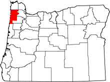 | |
| CDPs | ||
| Unincorporated communities | ||
This article is issued from
Wikipedia.
The text is licensed under Creative Commons - Attribution - Sharealike.
Additional terms may apply for the media files.