Bayside Gardens, Oregon
| Bayside Gardens, Oregon | |
|---|---|
| Census-designated place (CDP) | |
 Bayside Gardens, Oregon  Bayside Gardens, Oregon | |
| Coordinates: 45°42′52″N 123°54′59″W / 45.71444°N 123.91639°WCoordinates: 45°42′52″N 123°54′59″W / 45.71444°N 123.91639°W | |
| Country | United States |
| State | Oregon |
| County | Tillamook |
| Elevation | 39 ft (12 m) |
| Population (2010) | |
| • Total | 880 |
| Time zone | UTC-8 (Pacific (PST)) |
| • Summer (DST) | UTC-7 (PDT) |
| Area code(s) | 503 |
| GNIS feature ID | 2611715[1] |
| Coordinates and elevation from Geographic Names Information System[1] | |
Bayside Gardens is an unincorporated community in Tillamook County, Oregon, United States.[1] It lies along Route 101 between Manzanita and Nehalem and borders Nehalem Bay.[2] For statistical purposes, the United States Census Bureau has defined Bayside Gardens as a census-designated place (CDP).[1] The census definition of the area may not precisely correspond to local understanding of the area with the same name. The population of the CDP was 880 at the 2010 census.[3]
References
- 1 2 3 4 "Bayside Gardens". Geographic Names Information System. United States Geological Survey. April 14, 2010. Retrieved December 21, 2016.
- ↑ Oregon Atlas & Gazetteer (7th ed.). Yarmouth, Maine: DeLorme. 2008. p. 20. ISBN 0-89933-347-8.
- ↑ "Table Viewer". American FactFinder. U.S. Census Bureau. 2010. Retrieved December 21, 2016.
Municipalities and communities of Tillamook County, Oregon, United States | ||
|---|---|---|
| Cities | 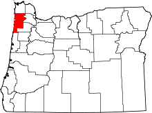 | |
| CDPs | ||
| Unincorporated communities | ||
This article is issued from
Wikipedia.
The text is licensed under Creative Commons - Attribution - Sharealike.
Additional terms may apply for the media files.