Hazon, Israel
| Hazon חָזוֹן | |
|---|---|
 Hazon  Hazon | |
| Coordinates: 32°54′21.96″N 35°23′37.32″E / 32.9061000°N 35.3937000°ECoordinates: 32°54′21.96″N 35°23′37.32″E / 32.9061000°N 35.3937000°E | |
| District | Northern |
| Council | Merom HaGalil |
| Affiliation | Hapoel HaMizrachi |
| Founded | 1969 |
| Founded by | Moshavniks from Galilee |
| Population (2017)[1] | 327 |
| Website | www.mizra.org.il |
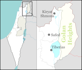
Hazon (Hebrew: חָזוֹן) is a moshav in the Upper Galilee in northern Israel. Located nine kilometers east of Carmiel,[2] it falls under the jurisdiction of Merom HaGalil Regional Council. In 2017 it had a population of 327.[1]
History
The village was founded in 1969 by moshavniks from the Galilee, taking its name from the slopes of Mount Hazon, where it is located. Southeast of the moshav lie the ruins of Hazor, which has remnants from the Iudaea Province era.[2] It was established on the land of the depopulated Palestinian village of Al-Mansura.[3]
References
- 1 2 "List of localities, in Alphabetical order" (PDF). Israel Central Bureau of Statistics. Retrieved August 26, 2018.
- 1 2 Mapa's concise gazetteer of Israel (in Hebrew). Yuval El'azari (ed.). Tel-Aviv: Mapa Publishing. 2005. p. 178. ISBN 965-7184-34-7.
- ↑ Khalidi, W. (1992). All That Remains: The Palestinian Villages Occupied and Depopulated by Israel in 1948. Washington D.C.: Institute for Palestine Studies. p. 533. ISBN 0-88728-224-5.
This article is issued from
Wikipedia.
The text is licensed under Creative Commons - Attribution - Sharealike.
Additional terms may apply for the media files.