Havelock Island
| Native name: हॅवलॉक द्वीप Nickname: Sir Henry Havelock Island [1] | |
|---|---|
 Havelock Island Location of Havelock Island  Havelock Island Havelock Island (India) | |
| Geography | |
| Location | Bay of Bengal |
| Coordinates | 11°58′N 93°00′E / 11.96°N 93.00°ECoordinates: 11°58′N 93°00′E / 11.96°N 93.00°E |
| Archipelago | Andaman Islands |
| Adjacent bodies of water | Indian Ocean |
| Total islands | 1 |
| Major islands |
|
| Area | 92.2 km2 (35.6 sq mi)[2] |
| Length | 18 km (11.2 mi) |
| Width | 8 km (5 mi) |
| Coastline | 58.5 km (36.35 mi) |
| Highest elevation | 167 m (548 ft) |
| Highest point | Yulutang |
| Administration | |
| District | South Andaman |
| Island group | Andaman Islands |
| Island sub-group | Ritchie's Archipelago |
| Tehsil | Port Blair Tehsil |
| Largest settlement | Govinda Nagar |
| Demographics | |
| Population | 6,351 (2011) |
| Pop. density | 68.5 /km2 (177.4 /sq mi) |
| Ethnic groups | Bengali |
| Additional information | |
| Time zone | |
| PIN | 744211[3] |
| Telephone code | 031928 [4] |
| Official website |
www |
| Literacy | 84.4% |
| Avg. summer temperature | 30.2 °C (86.4 °F) |
| Avg. winter temperature | 23.0 °C (73.4 °F) |
| Sex ratio | 1.2♂/♀ |
| Census code | 35.639.0004 |
| Official languages | Hindi, English |
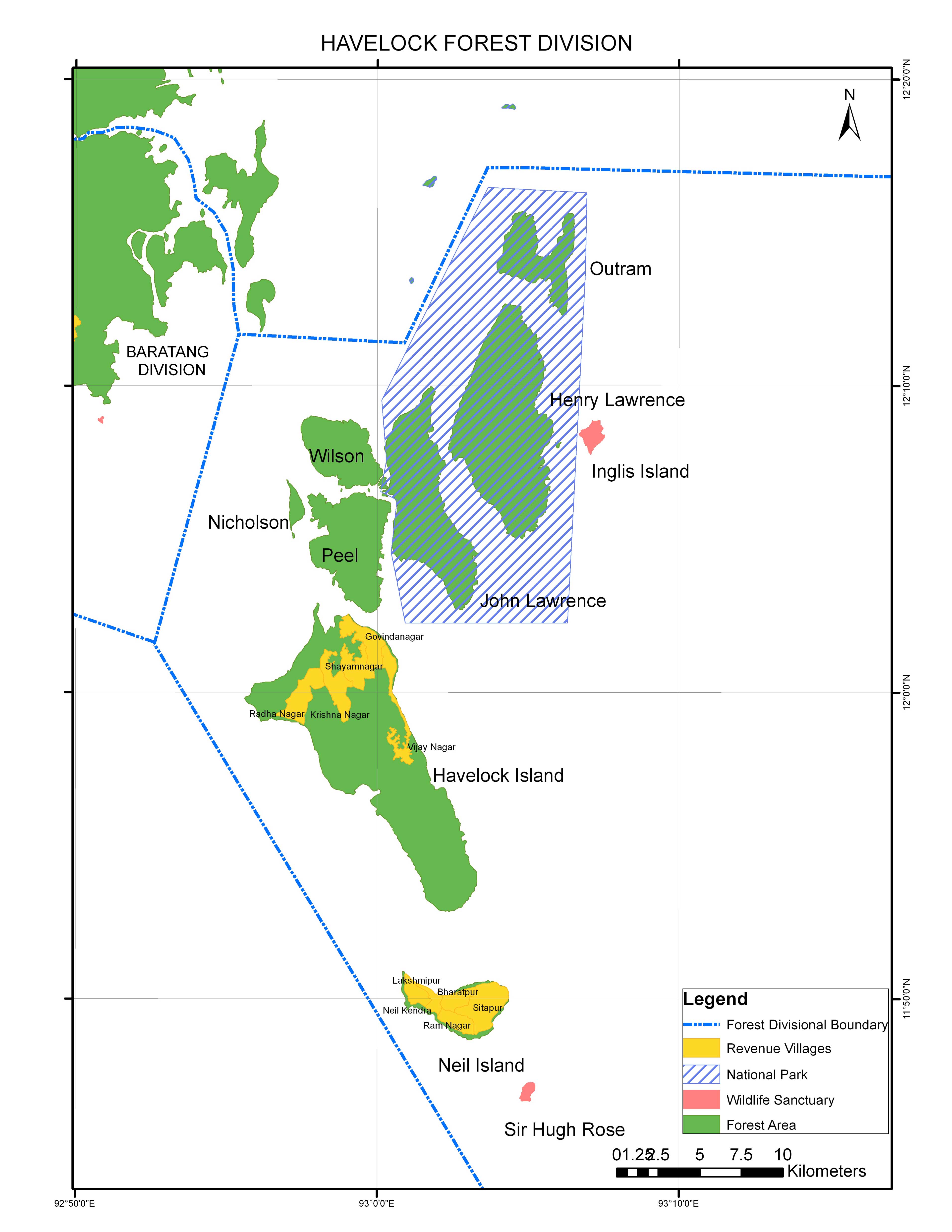
Havelock Island (Hindi: हॅवलॉक द्वीप) is the largest of the islands that comprise a chain of islands to the east of Great Andaman in the Andaman Islands. It belongs to the South Andaman administrative district, part of the Indian union territory of Andaman and Nicobar Islands.[5] The island is 41 km (25 mi) northeast of the capital city, Port Blair.
Etymology
Havelock Island is named after a British general, Sir Henry Havelock, who served in India.[6]
History
Havelock is one of the few places that the administration of the Andaman and Nicobar Islands union territory of India has permitted and encouraged development of tourism, with a focus on promoting eco-tourism.
Havelock Island avoided much of the devastation by the 2004 Indian Ocean earthquake and its resulting tsunami and there were no documented casualties.
There is a lighthouse at the northern point of the island, near Govinda Nagar, established in 2005. [7]
Geography
The island belongs to the Ritchie's Archipelago and is located between Peel Island and Neill Island.
Administration
Politically, Havelock Island is part of Port Blair taluk.[8]
Demographics
The island's current population of 6,351 consists of mainly Bengali settlers. Many of these settlers have Bangladeshi origin as these people were given settlement by the Indian government after the 1971 war between India and Pakistan.
The six villages are:
- Govinda Nagar 2,940
- Vejoy Nagar (inc. Kalapathar) 1,099
- Shyam Nagar 856
- Krishna Nagar 719
- Radha Nagar 637
- Road between Shyam Nagar and Krishna Nagar 100[9]
Beaches
Radhanagar Beach on the western coast, also known as Number 7 Beach, is one of the most popular beaches on Havelock and was named "Best Beach in Asia" by Time in 2004.[10] Other notable beaches include Elephant Beach on the northwest coast and Vijay Nagar Beach (No. 5), Beach No. 3 and Beach No. 1 on the east coast. Kalapathar is another famous beach.[11]
Transportation
The island can be reached from Port Blair by government-operated ferries and private cruises.[12] There are also helicopter services.[13]
A local bus connects the jetty and villages on an hourly circuit.[14]
Gallery
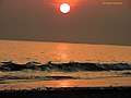 Radha Nagar Beach sunset view
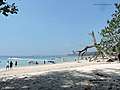 Elephant Beach, Havelock Island
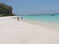 Kalapathar Beach
 Prominent horticulture produce of Havelock
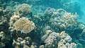 Coral reef Elephant Beach
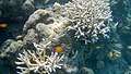 Coral reef Elephant Beach
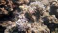 Coral reef Elephant Beach
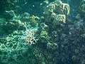 Coral reef Elephant Beach
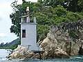 Havelock Light House
References
- ↑
- ↑ area info
-Official site - ↑ "A&N Islands - Pincodes". 22 September 2016. Archived from the original on 23 March 2014. Retrieved 22 September 2016.
- ↑ "STD Codes of Andaman and Nicobar". allcodesindia.in. Retrieved 23 September 2016.
- ↑ "Village Code Directory: Andaman & Nicobar Islands" (PDF). Census of India. Retrieved 16 January 2011.
- ↑ Llewellyn-Jones, Rosie (2007). The Great Uprising in India, 1857-58: Untold Stories, Indian and British. Boydell & Brewer. p. 168. ISBN 978-1-84383-304-8.
- ↑ "Narcondam Island". Directorate General of Lighthouses and Lightships. Retrieved 18 October 2016.
- ↑ "DEMOGRAPHIC – A&N ISLANDS" (PDF). andssw1.and.nic.in. Retrieved 23 September 2016.
- ↑ Map
- ↑ "Archived copy". Archived from the original on 23 January 2009. Retrieved 19 January 2009.
- ↑ beaches map
- CNN
- Another beach poll - ↑ A & N Administration. "Ferry Program for Neil, Havelock & Rangat". Retrieved 15 October 2013.
- Sanjib Kumar Roy. "Makruzz Ferry services to Neil Island via Havelock". Andaman Sheekha. Retrieved 15 October 2013.
- Coastal Cruise Archived 13 February 2015 at the Wayback Machine. - ↑ A & N Administration. "Helicopter Inter Island Schedule". Retrieved 15 October 2013.
- ↑ bus
External links
| Wikimedia Commons has media related to Havelock Island. |