Hartwell, Georgia
| Hartwell, Georgia | |
|---|---|
| City | |
 Buildings on Howell Street in 2018 | |
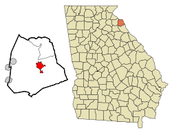 Location in Hart County and the state of Georgia | |
| Coordinates: 34°21′10″N 82°55′52″W / 34.35278°N 82.93111°WCoordinates: 34°21′10″N 82°55′52″W / 34.35278°N 82.93111°W | |
| Country | United States |
| State | Georgia |
| County | Hart |
| Area | |
| • Total | 5.11 sq mi (13.23 km2) |
| • Land | 5.09 sq mi (13.18 km2) |
| • Water | 0.02 sq mi (0.04 km2) |
| Elevation | 801 ft (244 m) |
| Population (2010) | |
| • Total | 4,469 |
| • Estimate (2016)[1] | 4,505 |
| • Density | 878/sq mi (339.0/km2) |
| Time zone | UTC-5 (Eastern (EST)) |
| • Summer (DST) | UTC-4 (EDT) |
| ZIP code | 30643 |
| Area code(s) | 706 |
| FIPS code | 13-37144[2] |
| GNIS feature ID | 0331924[3] |
| Website |
www |
Hartwell is a city in Hart County, Georgia, United States. The population was 4,469 at the 2010 census.[4] The city is the county seat of Hart County.[5]
History
Hartwell was founded in 1854 as seat of the newly formed Hart County. It was incorporated as a town in 1856 and as a city in 1904. The town was named for Revolutionary War figure Nancy Morgan Hart.[6]
Geography
Hartwell is located in central Hart County at 34°21′10″N 82°55′52″W / 34.35278°N 82.93111°W (34.352738, -82.931161).[7] It sits 4 miles (6 km) southwest of Lake Hartwell, which acquired its name from the city. Hartwell is in the Piedmont region of Georgia, or the Upland South, and lies 30 miles (48 km) southeast of the foothills of the Appalachian Mountains at Toccoa.
U.S. Route 29 passes through the center of Hartwell, leading east 7 miles (11 km) to the South Carolina border at Hartwell Dam on the Savannah River, and southwest 12 miles (19 km) to Royston. Anderson, South Carolina, is 23 miles (37 km) to the northeast via US 29, and Athens, Georgia, is 43 miles (69 km) to the southwest. Georgia State Route 51 also passes through Hartwell, leading north 7 miles (11 km) to Reed Creek and west 9 miles (14 km) to Bowersville.
According to the United States Census Bureau, Hartwell has a total area of 5.1 square miles (13.2 km2), of which 0.02 square miles (0.04 km2), or 0.32%, are water.[4]
Demographics
| Historical population | |||
|---|---|---|---|
| Census | Pop. | %± | |
| 1870 | 154 | — | |
| 1880 | 443 | 187.7% | |
| 1900 | 1,672 | — | |
| 1910 | 2,007 | 20.0% | |
| 1920 | 2,323 | 15.7% | |
| 1930 | 2,048 | −11.8% | |
| 1940 | 2,372 | 15.8% | |
| 1950 | 2,964 | 25.0% | |
| 1960 | 4,599 | 55.2% | |
| 1970 | 4,865 | 5.8% | |
| 1980 | 4,855 | −0.2% | |
| 1990 | 4,555 | −6.2% | |
| 2000 | 4,188 | −8.1% | |
| 2010 | 4,469 | 6.7% | |
| Est. 2016 | 4,505 | [1] | 0.8% |
| U.S. Decennial Census[8] | |||
As of the census[2] of 2010, there were 4,469 people. There were 2,266 housing units. The racial makeup of the city was 61.33% White, 34.53% African American, 0.13% Native American, 0.62% Asian, 0% Pacific Islander, 0.33% from other races, and 1.77% from two or more races. Hispanic or Latino of any race were 3.07% of the population.
The median income for a household in the city was $29,128 and the median income for a family was $45,909. The per capita income for the city was $18,937. About 15.4% of families and 23.1% of the population were below the poverty line, including 21.5% of those under age 18 and 20.6% of those age 65 or over.
Climate
| Monthly normal and record high and low temperatures[9] | |||||
|---|---|---|---|---|---|
| Mon. | Avg. High |
Avg. Low |
Avg. | Rec. High |
Rec. Low |
| Jan | 53 °F | 31 °F | 41 °F | 81 °F | -5 °F |
| Feb | 58 °F | 35 °F | 47 °F | 80 °F | 4 °F |
| Mar | 65 °F | 40 °F | 53 °F | 88 °F | 5 °F |
| Apr | 73 °F | 49 °F | 61 °F | 94 °F | 24 °F |
| May | 81 °F | 58 °F | 70 °F | 100 °F | 33 °F |
| Jun | 88 °F | 67 °F | 78 °F | 106 °F | 42 °F |
| Jul | 91 °F | 71 °F | 81 °F | 108 °F | 53 °F |
| Aug | 90 °F | 70 °F | 80 °F | 106 °F | 52 °F |
| Sep | 83 °F | 63 °F | 73 °F | 102 °F | 34 °F |
| Oct | 74 °F | 51 °F | 63 °F | 98 °F | 25 °F |
| Nov | 65 °F | 41 °F | 53 °F | 88 °F | 11 °F |
| Dec | 55 °F | 33 °F | 44 °F | 80 °F | 2 °F |
Hartwell is located in the humid subtropical climate zone of the Southeastern United States. It is in the Piedmont Plateau region, along the eastern side of the Appalachian Mountains, at an elevation just above 800 feet (240 m). Due to some of the highest of elevations in the Appalachians being between Hartwell and Canada, this allows for slightly warmer conditions than areas further south such as Atlanta. One exception to this rule is called the "wedge" or cold air damming. This is due to a large high pressure system in eastern Canada driving colder drier air down against the eastern side of the Appalachian Mountain range. When this phenomenon is joined by gulf moisture, it frequently causes ice storms or freezing rain in the region. This same geographical feature can also cause frequent drought.
Hartwell averages 51.96 inches (1,320 mm) of precipitation annually. The average snowfall is 2 inches (51 mm), although more can fall, and the city is just as likely to have no measurable snowfall in any given year. The 1993 Storm of the Century brought 6 inches (150 mm) of snow to the area.
Education
Hart County School District
The Hart County School District holds pre-school to grade twelve, and consists of three elementary schools, a middle school, a high school, and an academy school.[10] The district has 230 full-time teachers and over 3,564 students.[11]
- Hartwell Elementary School
- North Hart Elementary School
- South Hart Elementary School
- Hart County Middle School
- Hart County High School
- Hart County Academy
Notable people
- Donald Burdick, retired United States Army major general and director of the Army National Guard
- Mike Hubbard, Former Speaker of the Alabama House of Representatives and now convicted fellon, is a Hartwell native
References
- 1 2 "Population and Housing Unit Estimates". Retrieved June 9, 2017.
- 1 2 "American FactFinder". United States Census Bureau. Retrieved 2008-01-31.
- ↑ "US Board on Geographic Names". United States Geological Survey. 2007-10-25. Retrieved 2008-01-31.
- 1 2 "Geographic Identifiers: 2010 Demographic Profile Data (G001): Hartwell city, Georgia". American Factfinder. U.S. Census Bureau. Retrieved May 18, 2017.
- ↑ "Find a County". National Association of Counties. Retrieved 2011-06-07.
- ↑ Hellmann, Paul T. (May 13, 2013). Historical Gazetteer of the United States. Routledge. p. 232. Retrieved 30 November 2013.
- ↑ "US Gazetteer files: 2010, 2000, and 1990". United States Census Bureau. 2011-02-12. Retrieved 2011-04-23.
- ↑ "Census of Population and Housing". Census.gov. Retrieved June 4, 2015.
- ↑ The Weather Channel. Retrieved on 2007-07-23.
- ↑ Georgia Board of Education, Retrieved June 19, 2010.
- ↑ School Stats, Retrieved June 19, 2010.
External links
Municipalities and communities of Hart County, Georgia, United States | ||
|---|---|---|
| City | 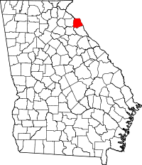 | |
| Town | ||
| CDPs | ||
| Unincorporated community | ||
| Footnotes | ‡This populated place also has portions in an adjacent county or counties | |