Harrisville, Michigan
| Harrisville | |
|---|---|
| City | |
 Intersection of US-23 and the terminus of M-72 | |
 Location within the state of Michigan | |
| Coordinates: 44°39′28″N 83°17′41″W / 44.65778°N 83.29472°W | |
| Country | United States |
| State | Michigan |
| County | Alcona |
| Area[1] | |
| • Total | 0.61 sq mi (1.58 km2) |
| • Land | 0.61 sq mi (1.58 km2) |
| • Water | 0 sq mi (0 km2) |
| Elevation | 623 ft (190 m) |
| Population (2010)[2] | |
| • Total | 493 |
| • Estimate (2016)[3] | 469 |
| • Density | 810/sq mi (310/km2) |
| Time zone | UTC-5 (EST) |
| • Summer (DST) | UTC-4 (EDT) |
| ZIP code | 48740 |
| Area code(s) | 989 |
| FIPS code | 26-36860[4] |
| GNIS feature ID | 0627866[5] |
Harrisville is a city in the U.S. state of Michigan and the county seat of Alcona County.[6] The population was 493 at the 2010 census, making Harrisville the sixth-smallest city by population in the state of Michigan. The city is surrounded by Harrisville Township, but is administratively autonomous. Located on Lake Huron, it is an official Michigan Department of Natural Resources Harbor of Refuge.[7]
History
The place was first known as Davison's Mill after Crosier Davison, who in partnership with Simeon Holden, had purchased land and water power rights here in 1854. Benjamin Harris and his sons, Levi and Henry, of West Bloomfield, New York bought out the partners. A post office established on September 16, 1857 was named Harrisville, with Levi as the first postmaster.[8]
The Harris sold out to Weston, (George L.) Colwell & Company, who had H.G. Rothwell plat the community in 1870.[8] Harrisville was incorporated as a village in 1887[8] and as a city in 1905.[9]
Geography
According to the United States Census Bureau, the city has a total area of 0.61 square miles (1.58 km2), all land.[1] It is considered to be part of Northern Michigan.
The city is on the western shore of Lake Huron and has a harbor for recreational boaters. The harbor is a center for salmon and trout fishing.[10] It is also a designated "Harbor of Refuge" on Lake Huron by the US Coast Guard.
The town also boasts Harrisville State Park, which includes a wooded campground along the beach.
Sturgeon Point Light Station, a lighthouse and museum, is a few miles to the north, and is open to the public.
Harrisville is on the edge of Huron National Forest, which offers outdoor recreational opportunities such as hunting, swimming, cross-country skiing and trout fishing. The forest contains 330 miles (530 km) of hiking trails. The Huron and Manistee National Forests were separately designated, but were combined in 1945 for administrative purposes.
The Lake Huron beaches in and around Harrisville (including two state parks) have been recognized as being among the "top ten in Michigan." "Old-fashioned lake vacations abound on this pretty stretch of Lake Huron."[11]
Harrisville is situated along the Lake State Railway, formerly the Detroit and Mackinac Railway (D&M). The D&M passenger depot is made of stone, which makes it one of two along the railway (the other being in Standish).[12] It is privately maintained by local citizens as part of the municipality's historical legacy.[13]
Demographics
| Historical population | |||
|---|---|---|---|
| Census | Pop. | %± | |
| 1880 | 549 | — | |
| 1890 | 987 | 79.8% | |
| 1900 | 403 | −59.2% | |
| 1910 | 444 | 10.2% | |
| 1920 | 460 | 3.6% | |
| 1930 | 438 | −4.8% | |
| 1940 | 437 | −0.2% | |
| 1950 | 485 | 11.0% | |
| 1960 | 487 | 0.4% | |
| 1970 | 541 | 11.1% | |
| 1980 | 559 | 3.3% | |
| 1990 | 470 | −15.9% | |
| 2000 | 514 | 9.4% | |
| 2010 | 493 | −4.1% | |
| Est. 2016 | 469 | [3] | −4.9% |
| Source: Census Bureau. Census 1960- 2000, 2010. | |||
2010 census
As of the census[2] of 2010, there were 493 people, 231 households, and 130 families residing in the city. The population density was 808.2 inhabitants per square mile (312.0/km2). There were 329 housing units at an average density of 539.3 per square mile (208.2/km2). The racial makeup of the city was 96.6% White, 0.6% African American, 1.0% Native American, 0.2% Asian, 0.6% from other races, and 1.0% from two or more races. Hispanic or Latino of any race were 2.4% of the population.
There were 231 households of which 18.2% had children under the age of 18 living with them, 42.4% were married couples living together, 11.7% had a female householder with no husband present, 2.2% had a male householder with no wife present, and 43.7% were non-families. 38.5% of all households were made up of individuals and 20.3% had someone living alone who was 65 years of age or older. The average household size was 1.96 and the average family size was 2.55.
The median age in the city was 51.6 years. 16.4% of residents were under the age of 18; 5% were between the ages of 18 and 24; 20.2% were from 25 to 44; 29% were from 45 to 64; and 29.6% were 65 years of age or older. The gender makeup of the city was 45.0% male and 55.0% female.
2000 census
As of the census[4] of 2000, there were 514 people, 239 households, and 131 families residing in the city. The population density was 831.2 per square mile (320.1/km²). There were 327 housing units at an average density of 528.8 per square mile (203.6/km²). The racial makeup of the city was 94.94% White, 2.14% African American, 0.39% Native American, 0.97% Asian, and 1.56% from two or more races. Hispanic or Latino of any race were 0.97% of the population.
There were 239 households out of which 18.4% had children under the age of 18 living with them, 44.4% were married couples living together, 8.4% had a female householder with no husband present, and 44.8% were non-families. 41.4% of all households were made up of individuals and 22.6% had someone living alone who was 65 years of age or older. The average household size was 1.92 and the average family size was 2.57.
In the city, the population was spread out with 16.0% under the age of 18, 7.4% from 18 to 24, 21.6% from 25 to 44, 25.9% from 45 to 64, and 29.2% who were 65 years of age or older. The median age was 48 years. For every 100 females, there were 96.2 males. For every 100 females age 18 and over, there were 93.7 males.
The median income for a household in the city was $27,500, and the median income for a family was $34,286. Males had a median income of $23,625 versus $21,875 for females. The per capita income for the city was $16,983. About 9.3% of families and 13.6% of the population were below the poverty line, including 20.8% of those under age 18 and 6.5% of those age 65 or over.
Transportation
Major highways


Bus
- Indian Trails provides daily intercity bus service between St. Ignace and Bay City, Michigan.[16]
Airport
Harrisville City Airport is 2200 feet (671 m) in length; it is located on Walker Road.[17] A larger public airport that serves the area and has nearly all weather capability is Oscoda-Wurtsmith Airport.
Local events

Harrisville is also home to the famous Glenview Clydesdales.


Government
- Mayor John Dobis (R)[18]
- Clerk Barbara Pierce (R)[18]
- Treasurer Thomas Keerl (R)[18]
- Alderman Ward I Paul T. Dwyer, (R)[18]
- Alderman Ward II Joan Crick (D)[18]
- Alderman Ward II James Kaiser (D)[18]
- Alderman Ward III Noel Lemere (D)[18]
- Alderman Ward III Barbara Pierce (D)[18]
(information as of May 2012)
Notable residents
- Casey Makela, the author of bestselling books on soap making,[19] and owner of the Killmaster Soap & Woolen Works,[20] lives in Harrisville.
- Harrisville was the birthplace, home town and burial place of Baseball Hall of Famer Hazen Shirley "Kiki" Cuyler, and he is memorialized on a section of M-72 and in a local baseball field. A local bar that he owned still bears his name.[21]
Media
Newspapers
- The Alcona County Review], located in Harrisville, is the newspaper of record, and has served the community since 1877.
- The Alpena News is the daily newspaper of record for much of northeastern lower peninsula of Michigan.
- Daily editions of the Detroit Free Press and The Detroit News are also available throughout the area.
Radio
Further reading
- "Bibliography on Alcona County". Clarke Historical Library, Central Michigan University. Retrieved January 17, 2013. (including Harrisville)]
- "History of Alcona County". History of the Lake Huron shore. With illustrations and biographical sketches of some of its prominent men and pioneers. Ann Arbor, Mich.: University of Michigan Library. 2005 [1883]. pp. 255–274. Retrieved 2007-04-11.
- Powers, Perry Francis (2005) [1912]. "Alcona County". A history of northern Michigan and its people. Ann Arbor, Mich.: University of Michigan Library. pp. 498–505. Retrieved 2007-04-11.
References
- 1 2 "US Gazetteer files 2010". United States Census Bureau. Archived from the original on 2012-01-24. Retrieved 2012-11-25.
- 1 2 "American FactFinder". United States Census Bureau. Retrieved 2012-11-25.
- 1 2 "Population and Housing Unit Estimates". Retrieved June 9, 2017.
- 1 2 "American FactFinder". United States Census Bureau. Retrieved 2008-01-31.
- ↑ "US Board on Geographic Names". United States Geological Survey. 2007-10-25. Retrieved 2008-01-31.
- ↑ "Find a County". National Association of Counties. Retrieved 2011-06-07.
- ↑ "DNR - Harbors". michigan.gov.
- 1 2 3 Romig 1986, pp. 254.
- ↑ "The 18 tiniest cities in Michigan". Flint Journal. Mlive Media Group. December 4, 2016. p. 15. Retrieved December 5, 2016.
- ↑ "Facts To Consider Before You Sell Gold". hvharbor.com.
- ↑ Detroit Free Press, May 26, 2007
- ↑ "How Harrisville got a Stone Depot". michiganrailroads.com. Archived from the original on 2016-03-24.
- ↑ Detroit and Mackinac Railway Harrisville station.
- ↑ "Photos of ends of M-72". state-ends.com. Archived from the original on 2007-12-09.
- ↑ History of Michigan highways.
- ↑ "BAY CITY-ALPENA-CHEBOYGAN-ST. IGNACE" (PDF). Indian Trails. March 19, 2013. Archived from the original (PDF) on July 24, 2013. Retrieved 2013-04-03.
- ↑ Harrisville City Airport map
- 1 2 3 4 5 6 7 8 "list of elected officials". Alcona County Review. Retrieved May 1, 2012.
- ↑ "2002 Shows," Michigan Magazine, Accessed December 9, 2007.
- ↑ Killmaster (named for lumberman John Killmaster, its founder who is buried in Harrisville) is a ghost town in Alcona County. See Gustin Township, Michigan.
- ↑ "Kiki Cuyler". Baseball reference.com. Retrieved May 7, 2012.
Sources
- Romig, Walter (October 1, 1986) [1973]. Michigan Place Names: The History of the Founding and the Naming of More Than Five Thousand Past and Present Michigan Communities. Great Lakes Books Series (Paperback). Detroit, Michigan: Wayne State University Press. ISBN 081431838X. ISBN 978-0814318386.
| Wikimedia Commons has media related to Harrisville, Michigan. |
Municipalities and communities of Alcona County, Michigan, United States | ||
|---|---|---|
| City | 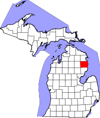 | |
| Village | ||
| Townships | ||
| Unincorporated communities | ||
Coordinates: 44°39′23″N 83°17′41″W / 44.65639°N 83.29472°W